Russian Shahed drone tracked transiting across northern Ukraine toward Rivne Oblast
What happened
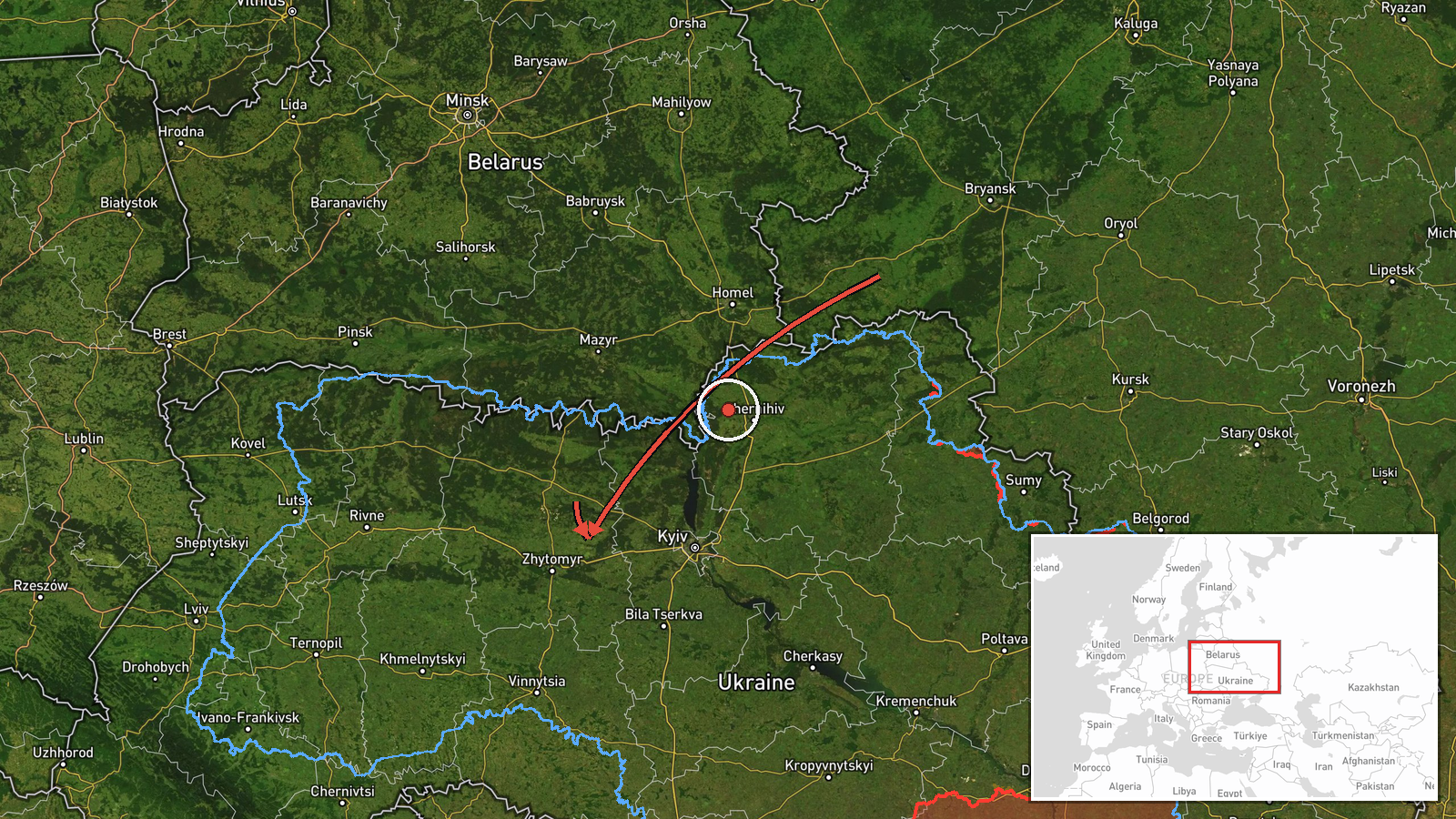
Ukrainian air monitoring reported a Russian jet-powered Shahed (Geran-3) drone in flight over northern Zhytomyr Oblast on the morning of October 15, 2026, traveling southeastward toward northern Rivne Oblast. The Geran-3 variant represents an advanced cruise drone variant. The observation was logged by the Kyiv-based air defense coordination channel @kpszsu at 01:52 UTC. The drone's trajectory and intended target remain unclear from available reporting.
Context and assessment
This transit occurred amid a broader wave of Russian drone activity across northern and central Ukraine on October 15, with simultaneous reports of Shahed variants heading toward Makariv, Borodianka, and Ivankiv, as well as ballistic missile activity toward Bila Tserkva. The corridor from Zhytomyr through Rivne represents a persistent Russian air approach route toward western Ukrainian population centers and infrastructure. Rivne Oblast, hosting both civilian and strategic assets, has been a recurring target category. The concentration of near-simultaneous drone and missile transits suggests a coordinated strike operation, consistent with recent Russian air campaign patterns.
Sources and confidence
Reported by Ukrainian military air monitoring (@kpszsu Telegram), a primary source for real-time air defense tracking. Single-source reporting limits independent verification; confidence scored at 8.0 reflects the source's institutional reliability and consistency with parallel activity reports. Confirmation would strengthen confidence; alternative independent tracking data or impact reports would raise assessment.
Location
Northern Zhytomyr Oblast, approximately 50.26°N, 28.68°E, representing the drone's observed position during transit. The region lies north of Kyiv, characterized by mixed terrain. The reported southeastern vector places the drone on approach toward Rivne Oblast's northern territories, a distance of roughly 80–100 kilometers northwestward.
Related events nearby
- Ukrainian air monitoring: 1 Russian jet-powered Shahed (Geran-3) drone heading toward Makariv.2026-10-15 01:53 UTC · Drone Transit · Makariv, Ukraine
- Ukrainian air monitoring: 1 Russian jet-powered Shahed (Geran-3) drone heading toward Borodianka.2026-10-15 01:53 UTC · Drone Transit · Borodianka, Ukraine
- Ukrainian air monitoring: 2+ Russian jet-powered Shahed (Geran-3) drones heading toward Ivankiv.2026-10-15 01:54 UTC · Drone Transit · Ivankiv, Ukraine
- Ukrainian air monitoring: 1 Russian Shahed-type drone over Vasylkiv.2026-10-14 07:11 UTC · Drone Transit · Vasylkiv, Ukraine
- Ukrainian air monitoring: 1 Russian jet-powered Shahed (Geran-3) drone from Vinnytsia Oblast toward Voronovyts2026-10-15 02:16 UTC · Drone Transit · Voronovytsya, Ukraine
▶ View this event on the live map

Intel Mapper aggregates open-source reports from monitored Telegram and X channels, geolocates them, cross-checks duplicates across sources and assigns a confidence score. Entries are updated as new confirmations arrive. Read how we verify events.