Russian Geran-3 drone transits toward Ivankiv in sustained overnight strike wave
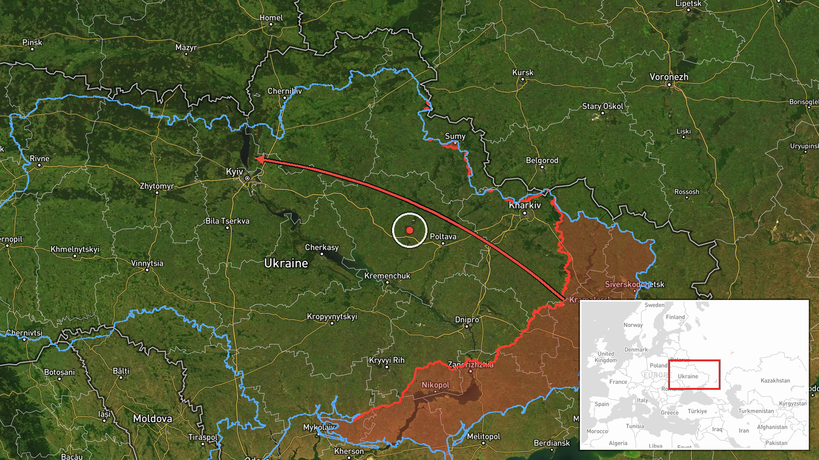
What happened
Ukrainian air monitoring detected one Russian jet-powered Shahed (Geran-3) drone passing through Pivnichnyi and heading toward Ivankiv at 04:51 UTC on October 15, 2026. The report was issued by the Ukrainian Kyiv regional military administration (@kpszsu). This sighting was part of a broader pattern of similar drone transits across the Kyiv region between 01:52 and 04:55 UTC, with multiple Geran-3 aircraft tracked heading toward Ivankiv, Dymer, Borodianka, and Krasiatychi.
Context and assessment
Ivankiv lies approximately 80 kilometers northwest of Kyiv and has served as a strategically sensitive area given its proximity to the capital and transport corridors. The Geran-3 is a long-range cruise drone capable of striking targets at considerable distance. The concentration of multiple Geran-3 transits across a roughly three-hour window targeting multiple towns in the northwestern Kyiv region suggests a coordinated overnight strike operation. Such patterns typically indicate Russian efforts to target infrastructure, military facilities, or logistics hubs that support Ukrainian defensive operations around the capital. The repeated focus on towns in this corridor may reflect attempts to disrupt supply lines or strike administrative and military installations in settlements serving as command or supply nodes.
Sources and confidence
Reported solely by the Kyiv regional military administration Telegram channel (@kpszsu), which regularly publishes air monitoring data. The confidence score of 8.0 reflects the official Ukrainian source and consistency with the wider pattern of six related drone transits reported over the same timeframe, though single-source reporting and lack of independent verification limit absolute certainty. Corroboration from multiple monitoring channels or confirmed impact reporting would strengthen confidence.
Location
Ivankiv is located at approximately 50.94°N, 29.90°E in the Kyiv Oblast, roughly 80 kilometers northwest of central Kyiv. The settlement sits along the Teteriv River valley in relatively open terrain, with forest-covered areas to the north and east. The precision is assessed at settlement level based on Ukrainian air monitoring coordinates.
Related events nearby
- Ukrainian air monitoring: 1 Russian jet-powered Shahed (Geran-3) drone heading toward Ivankiv.2026-10-15 05:16 UTC · Drone Transit · Ivankiv, Ukraine
- Ukrainian air monitoring: 2+ Russian jet-powered Shahed (Geran-3) drones heading toward Ivankiv.2026-10-15 01:54 UTC · Drone Transit · Ivankiv, Ukraine
- Ukrainian air monitoring: 1 Russian jet-powered Shahed (Geran-3) drone heading toward Krasiatychi.2026-10-15 03:36 UTC · Drone Transit · Krasiatychi, Ukraine
- Ukrainian air monitoring: 1 Russian jet-powered Shahed (Geran-3) drone passing Pivnichnyi, heading toward Dyme2026-10-15 01:52 UTC · Drone Transit · Dymer, Ukraine
- Ukrainian air monitoring: 1 Russian jet-powered Shahed (Geran-3) drone heading toward Borodianka.2026-10-15 04:55 UTC · Drone Transit · Borodianka, Ukraine
▶ View this event on the live map

Intel Mapper aggregates open-source reports from monitored Telegram and X channels, geolocates them, cross-checks duplicates across sources and assigns a confidence score. Entries are updated as new confirmations arrive. Read how we verify events.