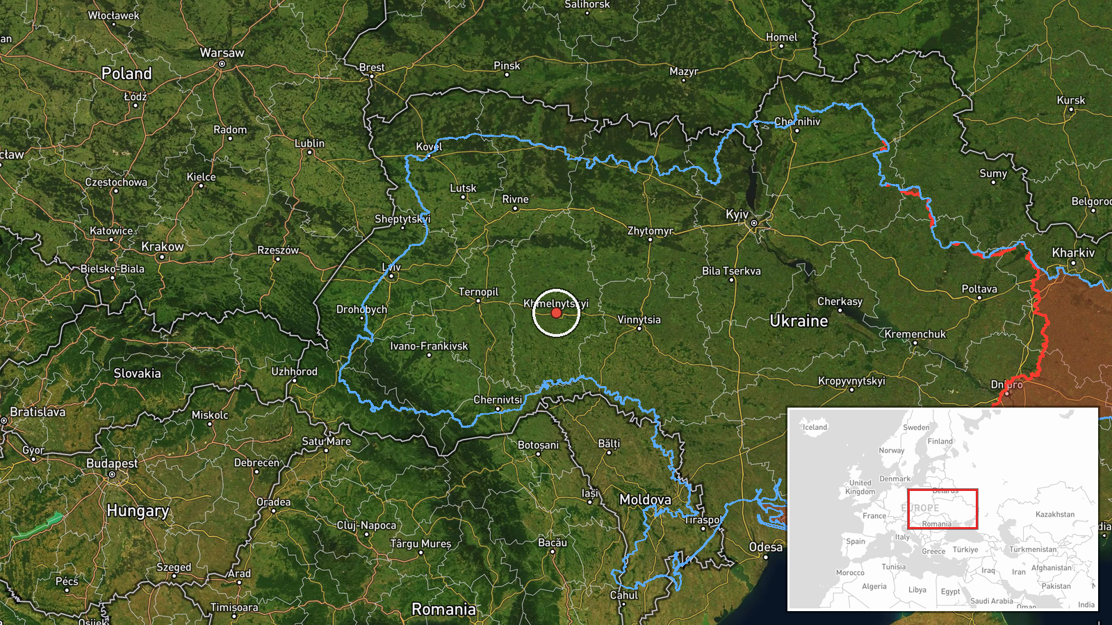
Russian Geran-3 drone tracked toward Khmelnytskyi Oblast in western Ukraine
What happened
Ukrainian air monitoring systems detected one Russian jet-powered Shahed-type drone (Geran-3) transiting toward Khmelnytskyi Oblast on October 15 at 17:30 UTC. The drone was tracked from Vinnytsia Oblast, crossing into the target region. The report was issued by the Ukrainian air command (@kpszsu) via Telegram. No immediate strike confirmation was provided in the source material.
Context and assessment
Khmelnytskyi Oblast, located in western Ukraine roughly 350 kilometers from Russian territory, has faced repeated drone incursions throughout 2026. Related detections on the same day show at least five separate Geran-3 sorties directed at the region between 09:49 and 17:30 UTC, suggesting a concentrated campaign. The Geran-3 is a jet-powered variant with extended range and payload capacity compared to earlier Shahed models. The frequency of launches toward this region may indicate targeting of critical infrastructure, military logistics nodes, or industrial facilities. The pattern of multiple daily strikes reflects ongoing Russian efforts to degrade Ukrainian defensive capacity and civilian morale in western oblasts.
Sources and confidence
Report sourced exclusively from Telegram channel @kpszsu (Ukrainian air command). Single-source reporting limits confidence despite corroboration from five related drone detections the same day. Confidence score of 8.0 reflects Ukrainian official monitoring system credibility but lack of independent verification. Cross-confirmation from independent air defense or intelligence channels would raise confidence; absence of strike outcome reporting lowers it slightly.
Location
Khmelnytskyi Oblast, western Ukraine, determined by Ukrainian air monitoring reports. Region spans approximately 20,600 square kilometers in the historical Galicia area. Nearby features include the city of Khmelnytskyi (regional center, population ~270,000), the Pivdennyi checkpoint area, and transit routes from central Ukraine toward Polish border. Approximate coordinate precision reflects oblast-level reporting rather than specific target identification.
Related events nearby
- Ukrainian air monitoring: 1 Russian Shahed-type drone passing Pivdennyi, heading toward Khmelnytskyi Oblast.2026-10-15 16:59 UTC · Drone Transit · Khmelnytskyi Oblast, Ukraine
- Ukrainian air monitoring: 1 Russian jet-powered Shahed (Geran-3) drone heading toward Khmelnytskyi.2026-10-15 16:04 UTC · Drone Transit · Khmelnytskyi, Ukraine
- Ukrainian air monitoring: 1 Russian jet-powered Shahed (Geran-3) drone heading toward Khmelnytskyi Oblast.2026-10-15 12:27 UTC · Drone Transit · Khmelnytskyi Oblast, Ukraine
- Ukrainian air monitoring: 1 Russian jet-powered Shahed (Geran-3) drone heading toward Khmelnytskyi Oblast.2026-10-15 12:10 UTC · Drone Transit · Khmelnytskyi Oblast, Ukraine
- Ukrainian air monitoring: 1 Russian jet-powered Shahed (Geran-3) drone from Vinnytsia Oblast toward Khmelnytsk2026-10-15 09:49 UTC · Drone Transit · Khmelnytskyi Oblast, Ukraine
▶ View this event on the live map

Intel Mapper aggregates open-source reports from monitored Telegram and X channels, geolocates them, cross-checks duplicates across sources and assigns a confidence score. Entries are updated as new confirmations arrive. Read how we verify events.