Russian Geran-3 drone tracked heading toward Kryve Ozero in southern Ukraine
What happened
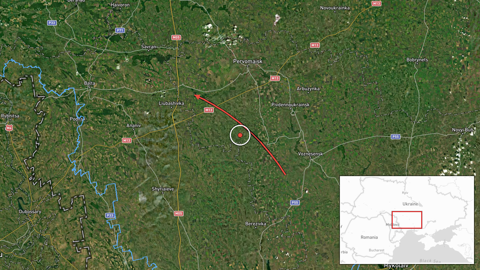
Ukrainian air monitoring reported one Russian jet-powered Shahed (Geran-3) drone transiting from Mykolaiv Oblast in the direction of Kryve Ozero on the afternoon of October 15. The report was issued by the official Kyiv Post Special Forces unit Telegram channel. Geran-3 drones are air-launched cruise missiles derived from Soviet-era designs, equipped with jet engines for extended range. The report indicates tracking rather than interception or impact.
Context and assessment
Kryve Ozero lies in southern Mykolaiv Oblast near the administrative border with Kherson Oblast, an area that has faced sustained Russian drone and missile operations since 2022. The October 15 sighting occurred amid a broader pattern of Russian jet-powered Shahed activity across central and southern Ukraine that day, with separate reports of similar drones transiting Podilsk, Ladyzhyn, and the Vinnytsia-Cherkasy border region. A larger wave of thirty Shahed-type drones was also tracked toward Pivdennoukrainsk the previous evening. This concentration of drone flights may reflect efforts to probe Ukrainian air defenses or conduct strikes across multiple regions simultaneously.
Sources and confidence
Reported by Kyiv Post Special Forces (@kpszsu) Telegram channel, the official air monitoring feed for Ukrainian military air defense coordination. Single-source report with high location confidence. Confidence score of 8.0 reflects official Ukrainian military sourcing and precise geolocation data, though the absence of independent corroboration and lack of confirmed outcome information prevents higher certainty. Confirmation of interception, impact, or drone fate would strengthen confidence.
Location
Kryve Ozero is a settlement in Mykolaiv Oblast, southern Ukraine, situated approximately 80 kilometers inland from the Black Sea coast. The location lies near the regional boundary with Kherson Oblast. Geolocation precision is set at settlement level with high confidence based on official Ukrainian monitoring data and known settlement coordinates.
Related events nearby
- Ukrainian air monitoring reports 1 Russian jet-powered Shahed (Geran-3) drone transiting at the Vinnytsia-Cher2026-10-15 09:13 UTC · Drone Transit · Vinnytsia-Cherkasy Oblast Border, Ukraine
- Ukrainian air monitoring: 30 Russian Shahed-type drones heading toward Pivdennoukrainsk.2026-10-14 19:50 UTC · Drone Transit · Pivdennoukrainsk, Ukraine
- Ukrainian air monitoring: 1 Russian jet-powered Shahed (Geran-3) drone over Podilsk.2026-10-15 15:32 UTC · Drone Transit · Podilsk, Ukraine
- Ukrainian air monitoring: 2+ Russian jet-powered Shahed (Geran-3) drones passing Podilsk, heading northwest.2026-10-15 11:33 UTC · Drone Transit · Podilsk, Ukraine
- Ukrainian air monitoring: 1 Russian jet-powered Shahed (Geran-3) drone over Ladyzhyn.2026-10-15 09:05 UTC · Drone Transit · Ladyzhyn, Ukraine
▶ View this event on the live map

Intel Mapper aggregates open-source reports from monitored Telegram and X channels, geolocates them, cross-checks duplicates across sources and assigns a confidence score. Entries are updated as new confirmations arrive. Read how we verify events.