Russian Geran-3 drone tracked transiting Vinnytsia-Cherkasy border northward
What happened
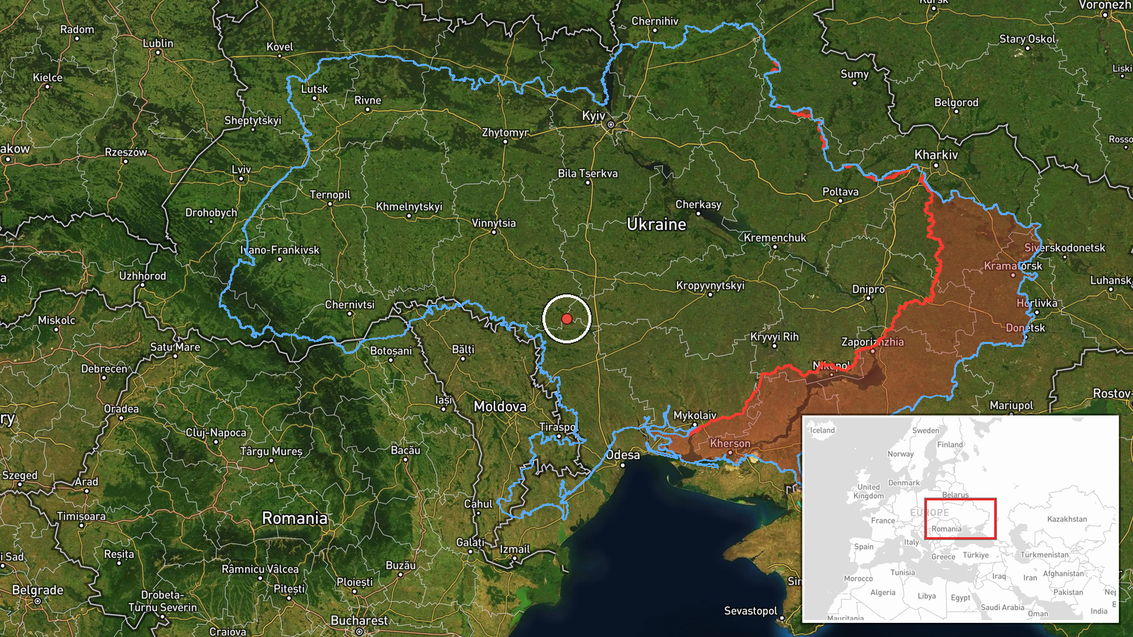
Ukrainian air monitoring reportedly detected one Russian jet-powered Shahed (Geran-3) drone at the border between Vinnytsia and Cherkasy oblasts on October 15 at 09:13 UTC, moving on a northward heading into central Ukraine. The report came via the official Telegram channel of Ukraine's air defense command. The sighting occurred amid a broader pattern of Russian drone activity across central and southern Ukraine that morning.
Context and assessment
The Vinnytsia-Cherkasy border region sits in central Ukraine, roughly 200 kilometers southwest of Kyiv. Geran-3 drones—jet-powered variants with extended range—have become a recurring feature of Russian strikes targeting infrastructure and military positions in central Ukraine. Related reports from the same morning show similar drones transiting through Vinnytsia Oblast toward settlements including Tulchyn, Illintsi, and Voronovytsya, suggesting a coordinated multi-vector operation. This pattern is consistent with Russian attempts to penetrate Ukrainian air defenses via dispersed launch corridors and varied flight paths, potentially aiming at distant targets in central or northern Ukraine.
Sources and confidence
Reported solely by the official Telegram channel of Ukraine's Cyberspace Protection Command (@kpszsu), a primary monitoring source but lacking independent cross-confirmation. Confidence of 8.0 reflects the established credibility of the channel and consistency with related same-day sightings, though single-source reporting and regional-level location precision limit certainty. Confirmation by second independent sources or recovery of debris would strengthen confidence.
Location
The reported position is at the administrative border between Vinnytsia and Cherkasy oblasts in central Ukraine, determined by Ukrainian air monitoring to regional precision. Ladyzhyn, a city approximately 30 kilometers southwest, reported drone activity minutes earlier. The area lies in a region of sparse population and mixed agricultural and industrial land, typical of central Ukrainian terrain between the Dnieper River and western approaches to Kyiv.
Related events nearby
- Ukrainian air monitoring: 1 Russian jet-powered Shahed (Geran-3) drone over Ladyzhyn.2026-10-15 09:05 UTC · Drone Transit · Ladyzhyn, Ukraine
- Ukrainian air monitoring: 1 Russian jet-powered Shahed (Geran-3) drone from Vinnytsia Oblast toward Tulchyn.2026-10-15 09:29 UTC · Drone Transit · Tulchyn, Ukraine
- Ukrainian air monitoring: 1 Russian jet-powered Shahed (Geran-3) drone from Vinnytsia Oblast toward Illintsi.2026-10-15 02:09 UTC · Drone Transit · Illintsi, Ukraine
- Ukrainian air monitoring: 30 Russian Shahed-type drones heading toward Pivdennoukrainsk.2026-10-14 19:50 UTC · Drone Transit · Pivdennoukrainsk, Ukraine
- Ukrainian air monitoring: 1 Russian jet-powered Shahed (Geran-3) drone from Vinnytsia Oblast toward Voronovyts2026-10-15 02:16 UTC · Drone Transit · Voronovytsya, Ukraine
▶ View this event on the live map

Intel Mapper aggregates open-source reports from monitored Telegram and X channels, geolocates them, cross-checks duplicates across sources and assigns a confidence score. Entries are updated as new confirmations arrive. Read how we verify events.