Single jet-powered Shahed (Geran-3) drone reported heading toward Ivano-Frankivsk, Ukraine
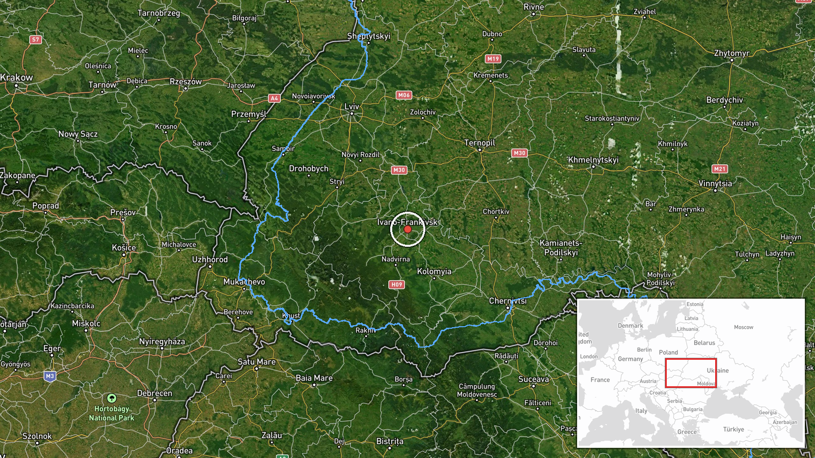
What happened
Ukrainian air monitoring reported on Telegram that one Russian jet-powered Shahed, identified as a Geran-3, was moving on a course toward Ivano-Frankivsk, a city in western Ukraine. The alert was posted at 01:04 UTC on 16 October 2026. The original Ukrainian-language message describes the object as a jet-type unmanned aerial vehicle approaching from the east. The report is a transit warning, not a confirmation of impact, and it does not describe any damage, casualties, or interception. The information comes from a single channel, the Telegram account @kpszsu, and has not been independently corroborated at the time of writing.
Context and assessment
Ivano-Frankivsk sits in the Carpathian foothills in the west of Ukraine, a region that has been reached by long-range drones throughout the war and that hosts energy, transport, and industrial infrastructure. The alert fits a sequence visible on the same night. An earlier warning at 16:58 UTC on 15 October described a single Geran-3 leaving Rivne Oblast toward Lopatyn, and a warning at 01:08 UTC on 16 October described another single drone heading toward Chortkiv, a town in Ternopil Oblast about 100 kilometres to the east. Taken together, the reports suggest a sequence of individual drones moving across western Ukraine rather than a single mass salvo. Operationally, this pattern is consistent with dispersed long-range strikes designed to stretch air defence and early-warning coverage, or with routes intended to test corridors toward western targets. Because the reports describe only heading and not target, the intended objective cannot be determined from the data available.
Sources and confidence
The report rests on one Telegram channel, @kpszsu, which has published air-monitoring alerts in the past. The related Chortkiv and Lopatyn entries appear to come from the same type of monitoring feed, but they do not independently confirm this specific track. The confidence score of 8.0 reflects a clear, specific, and time-stamped alert with a precise weapon description, offset by the single-source basis. Confidence would rise with corroboration from official Ukrainian air force statements, regional military administration posts, or local media, or with a reported impact or interception. It would fall if the track is withdrawn, the drone is reclassified, or later reports conflict with the stated heading.
Location
The location is recorded at settlement level, with Ivano-Frankivsk's city centre as the coordinate reference, and the location confidence is rated high. The alert names the city as the direction of travel rather than a specific facility. Ivano-Frankivsk lies on the Bystrytsia River in the Prykarpattia region at the foot of the Carpathians, roughly 700 kilometres west of Kyiv. Its surroundings include forested hills, the Dnipro basin, and major regional road and rail links.
Related events nearby
- Ukrainian air monitoring: 1 Russian jet-powered Shahed (Geran-3) drone heading toward Chortkiv.2026-10-16 01:08 UTC · Drone Transit · Chortkiv, Ukraine
- Ukrainian air monitoring: 2+ Russian jet-powered Shahed (Geran-3) drones heading toward Ternopil Oblast.2026-10-16 02:18 UTC · Drone Transit · Ternopil Oblast, Ukraine
- Ukrainian air monitoring: 1 Russian jet-powered Shahed (Geran-3) drone from Rivne Oblast toward Lopatyn.2026-10-15 16:58 UTC · Drone Transit · Lopatyn, Ukraine
▶ View this event on the live map

Intel Mapper aggregates open-source reports from monitored Telegram and X channels, geolocates them, cross-checks duplicates across sources and assigns a confidence score. Entries are updated as new confirmations arrive. Read how we verify events.