Ukrainian Air Force reports one jet-powered Geran-3 drone over southern Rivne Oblast
What happened
On 16 October 2026 at 01:05 UTC, a Telegram channel that relays Ukrainian air monitoring reported one Russian jet-powered Shahed (Geran-3) drone south of Rivne, Ukraine. The original post is brief and reads in translation as a jet-type UAV south of Rivne, heading west. The report does not describe impacts, damage, or casualties. It is one entry in a run of similar transit alerts logged across Rivne and neighboring oblasts between 07:47 and 01:05 UTC on 15 to 16 October. The attribution to Russia rests on the monitoring report's description of the drone type and the broader pattern of Shahed-family launches.
Context and assessment
Rivne Oblast lies in northwestern Ukraine, close to the Belarusian border and the Polish frontier beyond it. It is not a front-line area, but long-range drones crossing it from the east or north are a recurring feature of Russian strike campaigns against western and central Ukraine. The related events show a sustained pattern on the same day. Drones were reported passing Olevsk and heading toward Rivne Oblast at 07:47, arriving from Khmelnytskyi Oblast at 09:48, and appearing over Rivne Oblast at 17:19. Overnight, several more were reported heading toward the oblast and passing Vinnytsia-area locations, with another from Zhytomyr Oblast at 01:05. The sequence suggests a multi-wave pattern of small groups crossing the region rather than a single isolated incursion. The heading west in the current report may indicate a route toward western Ukraine or a flight path beyond it, but the data does not confirm a target. Operationally, such transits are often read as either attacks aimed at distant objectives or drones being moved and routed through the area, and the report alone cannot distinguish between these.
Sources and confidence
The report comes from a single Telegram channel, @kpszsu, which is widely associated with the Ukrainian Air Force's air monitoring. No independent outlet, official statement, or second channel appears in the dataset for this specific drone, so cross-confirmation is absent. The confidence score of 8.0 reflects the channel's established role and the consistency of the surrounding series of similar alerts, but it is held below the top of the scale because the single-source status and the absence of any follow-up. Confidence would rise with corroboration from additional monitoring channels, regional military administration statements, or reports of debris or impacts. It would fall if the channel later corrected or withdrew the alert, or if the track could not be matched to the wider sequence.
Location
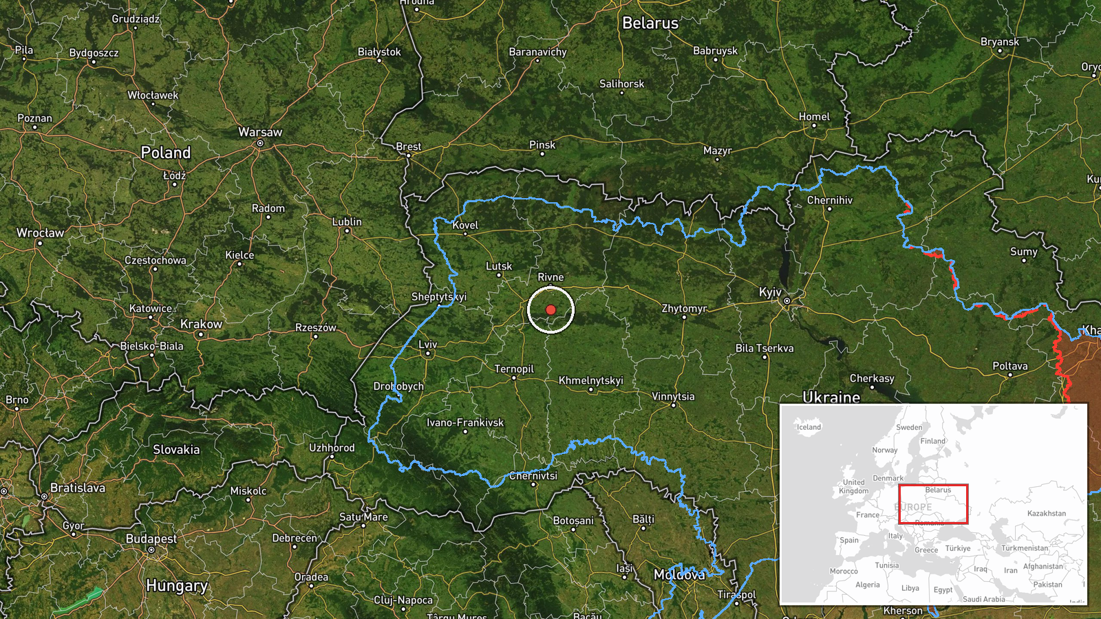
The coordinates, 50.34973 N and 26.25 E, are a regional-level approximation tied to the phrase south of Rivne rather than to a specific settlement, facility, or confirmed flight position. The location is therefore marked as low precision in the dataset. The point lies in the southern part of Rivne Oblast, a region of flat to gently rolling terrain associated with the Polissia lowlands, where forests, wetlands, and river valleys are common. Rivne city itself is roughly thirty kilometers north of the marked point.
Related events nearby
- Ukrainian air monitoring: 2+ Russian jet-powered Shahed (Geran-3) drones heading toward Rivne Oblast.2026-10-16 01:47 UTC · Drone Transit · Rivne Oblast, Ukraine
- Ukrainian air monitoring: 1 Russian jet-powered Shahed (Geran-3) drone over Rivne Oblast.2026-10-16 01:42 UTC · Drone Transit · Rivne Oblast, Ukraine
- Ukrainian air monitoring: 1 Russian jet-powered Shahed (Geran-3) drone from Zhytomyr Oblast toward Rivne Oblas2026-10-16 01:05 UTC · Drone Transit · Rivne Oblast, Ukraine
- Ukrainian air monitoring: 1 Russian jet-powered Shahed (Geran-3) drone heading toward Rivne Oblast; 2+ Russian2026-10-16 01:04 UTC · Drone Transit · Rivne Oblast, Ukraine
- Ukrainian air monitoring: 1 Russian jet-powered Shahed (Geran-3) drone over Rivne Oblast.2026-10-15 17:19 UTC · Drone Transit · Rivne Oblast, Ukraine
▶ View this event on the live map

Intel Mapper aggregates open-source reports from monitored Telegram and X channels, geolocates them, cross-checks duplicates across sources and assigns a confidence score. Entries are updated as new confirmations arrive. Read how we verify events.