Single jet-powered Shahed-type drone reported transiting Vinnytsia Oblast on a northern course
What happened
Ukrainian air monitoring, relayed through the Telegram channel @kpszsu, reported a single jet-powered drone north of Haisyn in Vinnytsia Oblast at about 04:03 UTC on 16 October 2026, travelling on a northerly course. The original Ukrainian wording, 'Реактивний БпЛА на півночі від Гайсина на Вінниччині, курс північний', describes a reactive unmanned aerial vehicle moving north. The event is classified as Drone Transit because the report describes passage through the area rather than an impact. It does not mention damage, casualties, or intercepts. The system identifies the drone as a Russian Geran-3, a jet-powered variant of the Shahed family, and only one channel is listed as the source.
Context and assessment
Vinnytsia Oblast lies in west-central Ukraine, between the southern Odesa and Kirovohrad regions and the northern approaches toward Zhytomyr and Kyiv. It has repeatedly appeared in recent reporting as a corridor for long-range drones moving north. The related entries show that pattern across roughly 24 hours. A single drone from Kirovohrad Oblast was reported heading toward Vinnytsia at 08:58 UTC on 15 October, another from Odesa Oblast at 17:01 the same day, and drones were tracked over western Kirovohrad and southern Zhytomyr in the early hours of 16 October. At 04:14, about eleven minutes after this report, a count of two or more jet-powered drones over Vinnytsia was posted. Taken together, the sequence suggests repeated inbound tracks crossing the oblast from several starting points. Operationally, the jet-powered Geran-3 is generally described as faster than piston-engined Shahed models, which could shorten warning windows for local air defence. The pattern could reflect route testing, pressure through repeated transits, or routine long-range movement. The available data cannot distinguish between these explanations, and none of the entries records a strike.
Sources and confidence
The report comes from one Telegram channel, @kpszsu, and the supplied data contains no second outlet confirming this specific track. The five related entries are also labelled as Ukrainian air monitoring, so they reinforce the regional pattern but do not independently verify this drone. The score of 8.0 is low, which reflects single-source reporting, the absence of cross-confirmation, and transit-only wording with no reported impact. Confidence would rise if other air monitoring or regional military administration channels confirmed a jet-powered drone on this track. It would fall if the entry were corrected, reclassified, or attributed to a different drone type.
Location
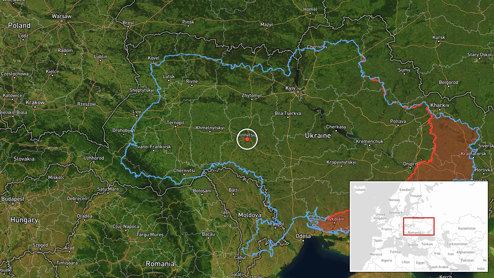
The location is recorded at oblast level as Vinnytsia Oblast, with region-level precision and low location confidence. The mapped coordinates (49.23, 28.47) are an approximate placeholder rather than a settlement point. The report names the area north of Haisyn, a town in the south of the oblast, but the mapped point does not match Haisyn's position. The oblast is largely agricultural and is crossed by the Southern Bug River, with rural terrain across much of its area.
Related events nearby
- Ukrainian air monitoring: 2+ Russian jet-powered Shahed (Geran-3) drones over Vinnytsia Oblast.2026-10-16 04:14 UTC · Drone Transit · Vinnytsia Oblast, Ukraine
- Ukrainian air monitoring: 1 Russian jet-powered Shahed (Geran-3) drone from Odesa Oblast toward Vinnytsia Obla2026-10-15 17:01 UTC · Drone Transit · Vinnytsia Oblast, Ukraine
- Ukrainian air monitoring: 1 Russian jet-powered Shahed (Geran-3) drone from Kirovohrad Oblast toward Vinnytsia2026-10-15 08:58 UTC · Drone Transit · Vinnytsia Oblast, Ukraine
- Ukrainian air monitoring: jet-powered Shahed (Geran-3) drones tracked over western Kirovohrad Oblast, heading 2026-10-16 01:16 UTC · Drone Transit · Vinnytsia, Ukraine
- Ukrainian air monitoring: one Russian Shahed-type drone tracked in southern Zhytomyr Oblast, heading toward Vi2026-10-16 01:06 UTC · Drone Transit · Vinnytsia, Ukraine
▶ View this event on the live map

Intel Mapper aggregates open-source reports from monitored Telegram and X channels, geolocates them, cross-checks duplicates across sources and assigns a confidence score. Entries are updated as new confirmations arrive. Read how we verify events.