Two or more Russian Geran-3 jet-powered drones tracked over Vinnytsia Oblast, Ukraine
What happened
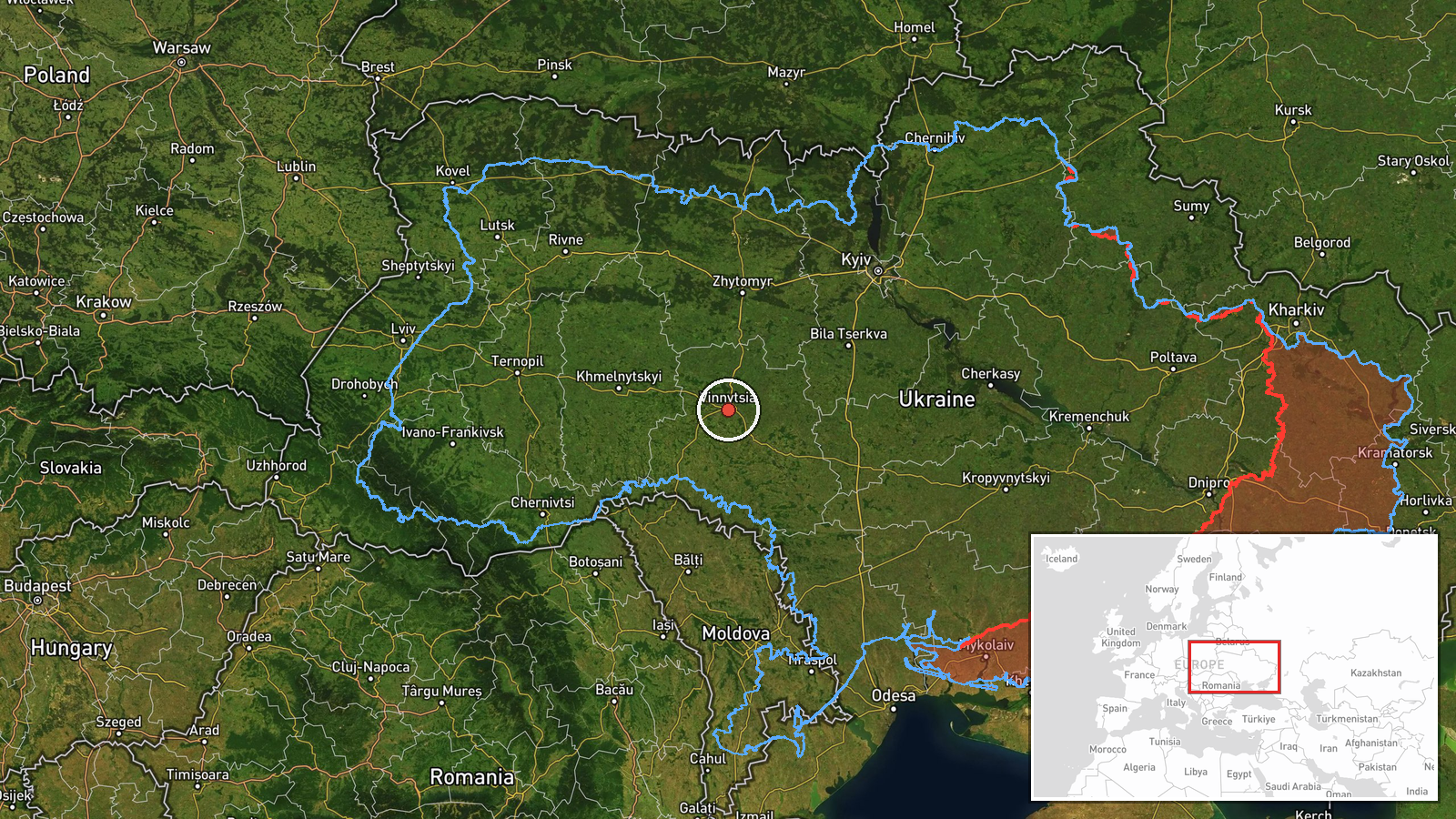
Ukraine's air monitoring channel, reported on Telegram as @kpszsu, posted on 16 October 2026 at 04:14 UTC that two or more jet-powered Shahed (Geran-3) drones were over Vinnytsia Oblast in west-central Ukraine. The original Ukrainian post described jet-powered UAVs in the region, placed north of Vinnytsia city, in the east and in the west of the oblast, with a heading toward the west. The summary's count of two or more reflects these multiple positions rather than a confirmed total. The report mentions no impacts, casualties or damage. It is classified as a Drone Transit, meaning the drones were tracked passing through the area rather than reported striking a target. Because the post gives positions and direction only, the exact number, altitude and final destination of the drones remain unconfirmed.
Context and assessment
Vinnytsia Oblast lies on the main western approaches from central and southern Ukraine, so Shahed-type drones crossing it are a recurring feature of long-range strike routing. The Geran-3 is the jet-powered variant of the Shahed design, faster than the piston-engined original and harder to intercept with slow air defence, which is why its tracking is treated as operationally significant. The related events show a pattern over roughly nineteen hours. On 15 October, single drones were logged moving from Kirovohrad Oblast at 08:58 and from Odesa Oblast at 17:01, both toward Vinnytsia. Early on 16 October, a drone was tracked in southern Zhytomyr Oblast heading toward Vinnytsia at 01:06, followed by drones over western Kirovohrad at 01:16. A single drone was then logged passing the oblast heading north at 04:03. The sequence suggests repeated transits from several directions rather than one continuous attack. Operationally, this may indicate drones routed through or around the oblast on different corridors, though the data does not establish whether Vinnytsia itself was a target.
Sources and confidence
The event rests on one channel, the Telegram account @kpszsu, and the source count is one. The related entries carry the same style of air-monitoring reporting and are consistent with one another, but the data does not show independent cross-confirmation from separate outlets, official statements or sensor data. The confidence score of 8.0 is high for a single channel, likely reflecting the channel's established role in air-threat reporting and the internal consistency of the timeline, while the event is not marked as corrected. Confidence would rise with corroboration from other monitoring bodies, Air Force statements, regional military administration notices or physical evidence. It would fall if later posts revised the number or direction of the drones, or if the report were withdrawn or contradicted.
Location
The coordinates, 49.23 north and 28.47 east, are approximate and correspond to the wider oblast rather than a settlement or facility, so the location precision is set to region and confidence is low. Vinnytsia Oblast sits in west-central Ukraine within the historical Podillia region. Its landscape is mainly rolling agricultural plain with forest patches, and the Southern Bug River runs through the area, passing Vinnytsia city. The oblast's wide extent explains why the post used directional terms rather than a fixed point.
Related events nearby
- Ukrainian air monitoring: 1 Russian jet-powered Shahed (Geran-3) drone passing Vinnytsia Oblast, heading north2026-10-16 04:03 UTC · Drone Transit · Vinnytsia Oblast, Ukraine
- Ukrainian air monitoring: 1 Russian jet-powered Shahed (Geran-3) drone from Odesa Oblast toward Vinnytsia Obla2026-10-15 17:01 UTC · Drone Transit · Vinnytsia Oblast, Ukraine
- Ukrainian air monitoring: 1 Russian jet-powered Shahed (Geran-3) drone from Kirovohrad Oblast toward Vinnytsia2026-10-15 08:58 UTC · Drone Transit · Vinnytsia Oblast, Ukraine
- Ukrainian air monitoring: jet-powered Shahed (Geran-3) drones tracked over western Kirovohrad Oblast, heading 2026-10-16 01:16 UTC · Drone Transit · Vinnytsia, Ukraine
- Ukrainian air monitoring: one Russian Shahed-type drone tracked in southern Zhytomyr Oblast, heading toward Vi2026-10-16 01:06 UTC · Drone Transit · Vinnytsia, Ukraine
▶ View this event on the live map

Intel Mapper aggregates open-source reports from monitored Telegram and X channels, geolocates them, cross-checks duplicates across sources and assigns a confidence score. Entries are updated as new confirmations arrive. Read how we verify events.