Air monitoring reports 2+ jet-powered Shahed drones over Zhytomyr Oblast, heading west
What happened
At about 05:32 UTC on 16 October 2026, the Telegram channel @kpszsu, which carries Ukrainian air monitoring alerts, reported two or more Russian jet-powered Shahed-type drones, labeled Geran-3, moving on a westward course through the northern parts of Kyiv and Zhytomyr regions. The original Ukrainian-language post refers to jet-powered unmanned aerial vehicles in the north of Kyiv and Zhytomyr oblasts heading west. The English summary's wording, over Zhytomyr Oblast, is a condensed reading of that phrasing. The report does not mention impacts, damage, casualties, or interceptions. It is a transit notice issued while drones are tracked through airspace, not a confirmation of a strike. Attribution to Russia and the Geran-3 designation come from the channel's own labeling and have not been independently verified here.
Context and assessment
Zhytomyr Oblast lies on a main corridor between northern Ukraine and the western regions, and the city of Zhytomyr sits on routes that drones have repeatedly used toward Rivne, Vinnytsia and areas near Kyiv. The related events show a sustained pattern over roughly 24 hours. On 15 October at 12:10 UTC, one or more jet-powered drones were reported transiting northern Zhytomyr Oblast toward Rivne Oblast. Early on 16 October, a 02:56 report described two or more drones heading toward Zhytomyr Oblast. At 03:56, a single drone was reported in northern Vinnytsia Oblast moving toward Zhytomyr. At 04:02, a Shahed-type drone was reported from Zhytomyr Oblast toward Berdychiv, and at 04:53 another was heading toward Zhytomyr city. The sequence suggests a repeated track through the same northern belt, with individual drones entering, crossing and leaving the region over several hours. Operationally, this may indicate that the region is being used as a transit lane, possibly to reach western targets or to stretch air defense coverage, although open monitoring alone cannot establish intent. The jet-powered variant is generally faster than the older piston-engined Shahed, which would shorten warning times for ground observers.
Sources and confidence
The report comes from a single Telegram channel, @kpszsu, and no other outlet is cited in the data. The related events come from the same channel and use similar wording, which shows continuity but not independent confirmation. The confidence score of 8.0 reflects the channel's consistent reporting in this series and the internal coherence of the sequence, but it stays below the maximum because there is only one source and the location is regional. Confidence would rise with matching statements from official Ukrainian air force or regional military administration channels, or from independent flight trackers. It would fall if corrections alter the drone count or direction.
Location
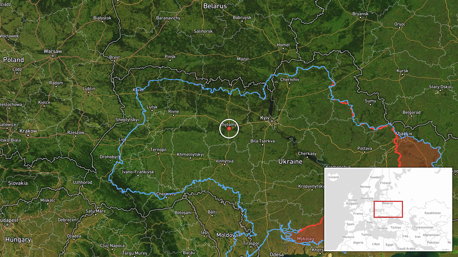
The marker at 50.25 N, 28.66 E sits in the city of Zhytomyr. Its geographic precision is recorded as region and its location confidence as low, so it represents the oblast rather than a confirmed point. The report places drones across northern Kyiv and Zhytomyr regions, an area of farmland, forest and river valleys, including basins of the Teteriv and Irpin rivers. Treat the pin as approximate.
Related events nearby
- Ukrainian air monitoring: 1 Russian jet-powered Shahed (Geran-3) drone heading toward Zhytomyr.2026-10-16 04:53 UTC · Drone Transit · Zhytomyr, Ukraine
- Ukrainian air monitoring: one Russian jet-powered Shahed (Geran-3) drone in northern Vinnytsia Oblast, heading2026-10-16 03:56 UTC · Drone Transit · Zhytomyr Oblast, Ukraine
- Ukrainian air monitoring: 2+ Russian jet-powered Shahed (Geran-3) drones heading toward Zhytomyr Oblast.2026-10-16 02:56 UTC · Drone Transit · Zhytomyr Oblast, Ukraine
- Ukrainian air monitoring reports 1+ Russian jet-powered Shahed (Geran-3) drone(s) transiting northern Zhytomyr2026-10-15 12:10 UTC · Drone Transit · Zhytomyr Oblast, Ukraine
- Ukrainian air monitoring: 1 Russian Shahed-type drone from Zhytomyr Oblast toward Berdychiv.2026-10-16 04:02 UTC · Drone Transit · Berdychiv, Ukraine
▶ View this event on the live map

Intel Mapper aggregates open-source reports from monitored Telegram and X channels, geolocates them, cross-checks duplicates across sources and assigns a confidence score. Entries are updated as new confirmations arrive. Read how we verify events.