Ukrainian air monitoring reports drone group heading toward Zlatopil in Kharkiv Oblast
What happened
Ukrainian air monitoring, relayed through the Telegram channel @kpszsu, reported on 16 October 2026 at 10:15 UTC groups of unmanned aerial vehicles in Kharkiv Oblast moving toward Zlatopil. The original Ukrainian post, translated roughly, reads 'Kharkiv region: UAV groups heading toward Zlatopil,' and does not state a number or drone type. The English summary attached to the event adds that three or more Russian Shahed-type drones were involved, a figure and classification that go beyond the wording of the original post. The report describes a track in progress, not a confirmed impact, and no damage or casualties are described in the available data.
Context and assessment
Zlatopil sits within a drone corridor that shows several related events in the preceding day and a half. On 15 October at 13:49 UTC a Banderol mini cruise missile was reported moving from Kharkiv Oblast toward Lozova. Single Shahed-type drones were logged heading toward Kharkiv at 16:17 on 15 October and at 06:24 on 16 October, and toward Lozova at 08:55 on 16 October. A jet-powered Geran-3 drone was also reported toward Kharkiv at 08:50 UTC on 16 October. Taken together, the pattern suggests sustained, repeated long-range strike activity across the northeastern front region rather than a single isolated launch. Shahed-type drones are typically low-cost, slow loitering munitions, and groups heading toward one settlement may be intended to saturate air defenses, strike local infrastructure or logistics, or act as decoys for other weapons. The data does not identify an intended target, and a transit report only shows direction of travel. Whether this group was intercepted, diverted, or caused damage would require separate reporting, so readers should treat intent as unknown rather than assume a particular target set.
Sources and confidence
The report rests on a single channel, the Telegram account @kpszsu, which carries Ukrainian air monitoring alerts. No other outlet in the data set reportedly confirms this group, so cross-confirmation is absent. The confidence score of 8.0 reflects a credible monitoring source, a high-precision location, and a clear, time-stamped original post. It is held below the maximum because the report is single-sourced and the original text gives no drone count or type. Confidence would rise with corroboration from a second independent monitoring source, interception or impact statements from regional authorities, or imagery. It would fall if later updates contradicted the direction or type of drones.
Location
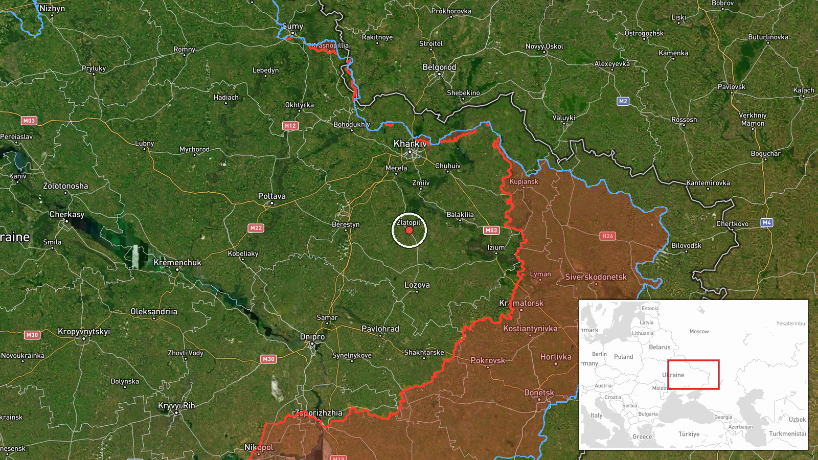
Location was assigned at settlement level for Zlatopil, Ukraine, with high confidence, using coordinates of roughly 49.376 N, 36.218 E. The point marks the settlement rather than a specific facility, and the report does not name one. The settlement lies in Kharkiv Oblast in north-eastern Ukraine, in a largely flat, agricultural landscape of fields and scattered tree belts typical of the region. No specific nearby landmarks are named in the source data.
Related events nearby
- Ukrainian air monitoring: 1 Russian Shahed-type drone heading toward Lozova.2026-10-16 08:55 UTC · Drone Transit · Lozova, Ukraine
- Ukrainian air monitoring: 1 Russian Banderol mini cruise missile from Kharkiv Oblast toward Lozova.2026-10-15 13:49 UTC · Cruise Missile · Lozova, Ukraine
- Ukrainian air monitoring: 1 Russian jet-powered Shahed (Geran-3) drone heading toward Kharkiv.2026-10-16 08:50 UTC · Drone Transit · Kharkiv, Ukraine
- Ukrainian air monitoring: 1 Russian Shahed-type drone heading toward Kharkiv.2026-10-16 06:24 UTC · Drone Transit · Kharkiv, Ukraine
- Ukrainian air monitoring: 1 Russian Shahed-type drone heading toward Kharkiv.2026-10-15 16:17 UTC · Drone Transit · Kharkiv, Ukraine
▶ View this event on the live map

Intel Mapper aggregates open-source reports from monitored Telegram and X channels, geolocates them, cross-checks duplicates across sources and assigns a confidence score. Entries are updated as new confirmations arrive. Read how we verify events.