Single Shahed-type drone reported moving from Kyiv Oblast toward Zhytomyr Oblast, Ukraine
What happened
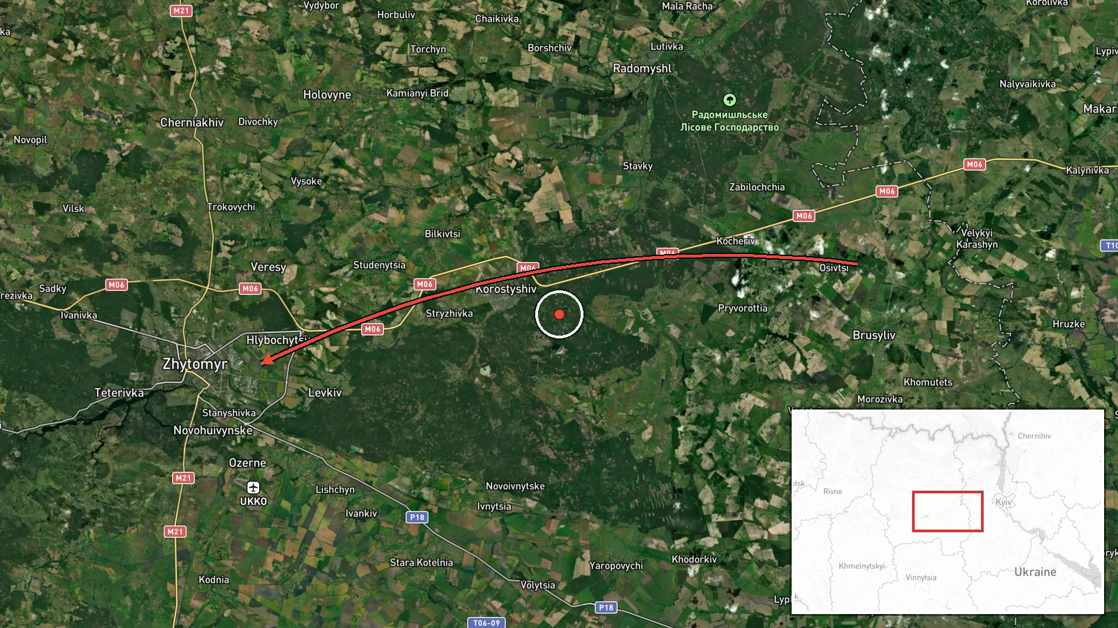
Ukrainian air monitoring reported on Telegram channel @kpszsu, at about 10:26 UTC on 16 October 2026, that one Russian Shahed-type drone was flying from Kyiv Oblast toward Zhytomyr Oblast. The original post, written in Ukrainian, describes a UAV (БпЛА) passing near Pisківка, which is a settlement in the Kyiv Oblast area, on a course toward Zhytomyr region. The wording is a transit notice rather than a report of impact, and it names no damage, casualties or intercepts. The event is attributed to Russia on the basis of the drone type and the monitoring channel's framing. The map point is a regional centroid for Zhytomyr Oblast, not a precise position of the drone.
Context and assessment
Zhytomyr Oblast lies in northwestern Ukraine, on the route between the Kyiv region and the western regions, and its city of Zhytomyr has repeatedly appeared in recent air-alert traffic. The related events show a sustained pattern on the same axis over the preceding day: single and small groups of jet-powered Geran-3 drones were logged from northern Vinnytsia and northern Kyiv oblasts toward Zhytomyr Oblast, and a group of two or more was reported over the oblast at 05:32 UTC. Taken together, the entries suggest repeated probing or transit flights across this corridor rather than a single isolated launch. Operationally, drones moving through the region in succession may be aimed at infrastructure further west, or may be used to stretch air defence and draw radar and interceptor attention. Such inferences remain uncertain, because transit reports do not reveal the drones' intended targets, and the pattern could also reflect the routing of drones aimed elsewhere.
Sources and confidence
The report rests on one Telegram channel, @kpszsu, which is the official Ukrainian air-force monitoring account. It has no independent cross-confirmation in the data provided, so the confidence score of 8.0 reflects the channel's authority and the consistency of its recent reports rather than multiple sources. Confidence would rise with corroboration from regional military administrations, local officials, or open-source monitors tracking the same flight path. It would fall if subsequent reports revised the route, the drone count, or the drone type, or if no later sightings in the area followed.
Location
The location was set at the Zhytomyr Oblast regional level, with the marker placed at approximate coordinates of 50.25 N, 28.66 E, and the precision is marked as region with low location confidence. The original post mentions Pisківка, which indicates the drone's approximate passage area in Kyiv Oblast, but it does not specify the drone's final position within Zhytomyr Oblast. The region is largely flat to gently rolling terrain of the Polissia transition zone, with forests, wetlands and river valleys, including the Teteriv and Irpin basins to the east and north.
Related events nearby
- Ukrainian air monitoring: 1 Russian jet-powered Shahed (Geran-3) drone over Zhytomyr.2026-10-16 08:10 UTC · Drone Transit · Zhytomyr, Ukraine
- Ukrainian air monitoring: 2+ Russian jet-powered Shahed (Geran-3) drones over Zhytomyr Oblast.2026-10-16 05:32 UTC · Drone Transit · Zhytomyr Oblast, Ukraine
- Ukrainian air monitoring: 1 Russian jet-powered Shahed (Geran-3) drone heading toward Zhytomyr.2026-10-16 04:53 UTC · Drone Transit · Zhytomyr, Ukraine
- Ukrainian air monitoring: 1 Russian jet-powered Shahed (Geran-3) drone from northern Vinnytsia Oblast toward Z2026-10-16 03:56 UTC · Drone Transit · Zhytomyr Oblast, Ukraine
- Ukrainian air monitoring: 1 Russian Shahed-type drone from Zhytomyr Oblast toward Berdychiv.2026-10-16 04:02 UTC · Drone Transit · Berdychiv, Ukraine
▶ View this event on the live map

Intel Mapper aggregates open-source reports from monitored Telegram and X channels, geolocates them, cross-checks duplicates across sources and assigns a confidence score. Entries are updated as new confirmations arrive. Read how we verify events.