Telegram monitor reports 3+ Russian Shahed-type drones heading toward Poltava Oblast
What happened
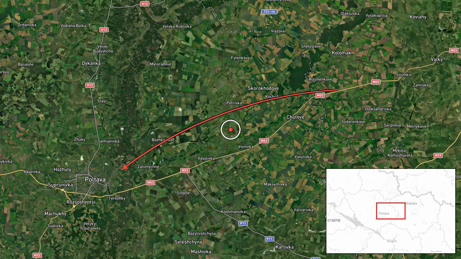
A Ukrainian air monitoring account on Telegram, @kpszsu, reported on 16 October 2026 at 10:37 UTC that at least three Russian Shahed-type drones were moving toward Poltava Oblast in central Ukraine. The summary places the origin in Kharkiv Oblast, but the original Ukrainian-language post describes groups of drones along the border of Dnipropetrovsk and Kharkiv oblasts heading toward Poltava. That wording points to a transit corridor rather than a single launch point. The post names no settlement, target, or impact and reports only direction of travel. It is a transit notice, not a strike report.
Context and assessment
Poltava Oblast lies on routes that long-range drones often use to move from northeastern and southeastern Ukraine deeper toward the west, so repeated sightings there are not unusual. The related reports show a dense sequence within about 24 hours. On 15 October a Banderol mini cruise missile was logged heading toward Poltava Oblast, and a second was reported from southern Poltava toward Bilyky. That afternoon a Geran-3 jet-powered Shahed passed Kobelyaky heading west. Early on 16 October two or more Geran-3 drones passed northern Poltava heading west, and at 03:24 another Geran-3 was reported from southern Sumy Oblast toward Poltava. The pattern suggests a sustained stream of drones and missiles crossing the oblast's airspace, mostly westward. Operationally, this may indicate routing through a corridor rather than a focus on one place, though the reports do not establish intent. The traffic could reflect strikes planned elsewhere or attempts to draw air defences. Later reports of impacts or air-defence activity would help test that reading.
Sources and confidence
Only one channel, the Telegram account @kpszsu, is listed, and no independent outlet has cross-confirmed the report. The confidence score of 8.0 reflects a specialized monitoring source posting a time-stamped, specific message, offset by single-source status and the lack of corroborating tracks or impact data. Confidence would rise if other monitoring channels, official air-force statements, or regional officials confirmed the route and drone count. It would fall if later reporting contradicted the direction of travel or the origin, particularly given the mismatch between the summary's Kharkiv origin and the original's border wording.
Location
Location is region-level with low confidence. The coordinates are an approximate center point for Poltava Oblast, not a settlement or facility, and no origin point is recorded. Poltava Oblast is in central-eastern Ukraine, bordered by Kharkiv Oblast to the northeast and Dnipropetrovsk Oblast to the south. The terrain is largely flat agricultural steppe and forest-steppe, drained by rivers including the Vorskla.
Related events nearby
- Ukrainian air monitoring: 3+ Russian Shahed-type drones heading toward Poltava Oblast.2026-10-16 11:43 UTC · Drone Transit · Poltava Oblast, Ukraine
- Ukrainian air monitoring: 1 Russian jet-powered Shahed (Geran-3) drone from southern Sumy Oblast toward Poltav2026-10-16 03:24 UTC · Drone Transit · Poltava Oblast, Ukraine
- Ukrainian air monitoring: 1 Russian Banderol mini cruise missile heading toward Poltava Oblast.2026-10-15 12:05 UTC · Cruise Missile · Poltava Oblast, Ukraine
- Ukrainian air monitoring: 1 Russian Banderol mini cruise missile from southern Poltava Oblast toward Bilyky.2026-10-15 12:08 UTC · Cruise Missile · Bilyky, Ukraine
- Ukrainian air monitoring: 1 Russian jet-powered Shahed (Geran-3) drone passing Kobelyaky, heading west.2026-10-15 16:01 UTC · Drone Transit · Kobelyaky, Ukraine
▶ View this event on the live map

Intel Mapper aggregates open-source reports from monitored Telegram and X channels, geolocates them, cross-checks duplicates across sources and assigns a confidence score. Entries are updated as new confirmations arrive. Read how we verify events.