Ukrainian air monitoring reports 3+ Shahed-type drones moving west toward Poltava Oblast
What happened
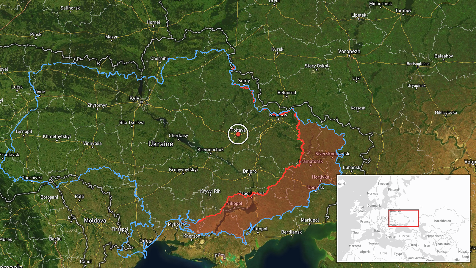
Ukrainian air monitoring, as relayed by the Telegram channel @kpszsu, reported on 16 October 2026 at 11:43 UTC that three or more Russian Shahed-type strike drones were heading toward Poltava Oblast in central Ukraine. The original Ukrainian-language post describes 'groups of strike UAVs' moving on a western course from eastern Kharkiv Oblast toward the Poltava region. The report names no settlement, target, or impact, and gives no drone count beyond 'three or more.' The event is classified as a drone transit, meaning it concerns movement through the airspace rather than a confirmed strike. The item rests on a single channel, and the data provided contains no independent confirmation.
Context and assessment
Poltava Oblast sits in central Ukraine, on routes that connect the east and northeast with western and central regions, and it contains transport corridors and energy infrastructure. Drones crossing it on a westward course can therefore be read as transit toward other areas rather than as a sign of a specific local target. The related reports fit that reading. Earlier on 16 October, at 03:24 UTC, a jet-powered Geran-3 was reported moving from southern Sumy Oblast toward Poltava Oblast. At 10:37 UTC, three or more Shahed-type drones were reported moving from Kharkiv Oblast toward Poltava Oblast. On 15 October, a Banderol mini cruise missile was reported heading toward Poltava Oblast at 12:05 UTC, and another was reported moving from southern Poltava Oblast toward Bilyky at 12:08 UTC. At 16:01 UTC that day, a Geran-3 was reported passing Kobelyaky heading west. Taken together, these reports suggest a sustained pattern of tracks crossing the oblast over roughly 32 hours, from several axes and with mixed weapon types. Operationally, this may indicate that the oblast is being used as a corridor, or that the launches are being tracked along a single approach. The data does not establish intent.
Sources and confidence
The report comes from one Telegram channel, @kpszsu, and no other outlet in the data corroborates it. The confidence score of 8.0 reflects that the alert is consistent with several same-day reports on the same Kharkiv-to-Poltava axis, and that the wording is specific about direction and minimum drone count. It is held below the top of the scale because the source count is one and no official or independent tracking confirmation is attached. Confidence would rise with corroboration from an official air force statement, a regional military administration, or independent flight-tracking data. It would fall if the track were revised, if later reports showed the drones turning away from the oblast, or if the channel's earlier alerts proved inaccurate.
Location
The location is approximate and set at region level, not at a settlement. The coordinates, 49.59 N and 34.55 E, mark an oblast-wide point near the city of Poltava rather than a specific place on the drones' route. The oblast is largely flat to gently rolling steppe, cut by river valleys, including the Vorskla River that runs past Poltava city. The low location confidence reflects that the report gives direction of travel but no position at the time of the alert.
Related events nearby
- Ukrainian air monitoring: 1 Russian Banderol mini cruise missile heading toward Poltava.2026-10-17 11:26 UTC · Cruise Missile · Poltava, Ukraine
- Ukrainian air monitoring: 1 Russian jet-powered Shahed (Geran-3) drone passing Poltava Oblast, heading northwe2026-10-17 08:17 UTC · Drone Transit · Poltava Oblast, Ukraine
- Ukrainian air monitoring: 1 Russian jet-powered Shahed (Geran-3) drone from Dnipropetrovsk Oblast toward Polta2026-10-17 08:05 UTC · Drone Transit · Poltava Oblast, Ukraine
- Ukrainian air monitoring: 1 Russian jet-powered Shahed (Geran-3) drone heading toward Kobelyaky.2026-10-17 03:36 UTC · Drone Transit · Kobelyaky, Ukraine
- Ukrainian air monitoring reports a Russian Shahed-type drone heading toward Velyki Sorochyntsi and Myrhorod in2026-10-17 11:24 UTC · Drone Transit · Velyki Sorochyntsi, Ukraine
▶ View this event on the live map

Intel Mapper aggregates open-source reports from monitored Telegram and X channels, geolocates them, cross-checks duplicates across sources and assigns a confidence score. Entries are updated as new confirmations arrive. Read how we verify events.