Single Russian jet-powered Shahed drone reported transiting Dnipropetrovsk toward Poltava Oblast
What happened
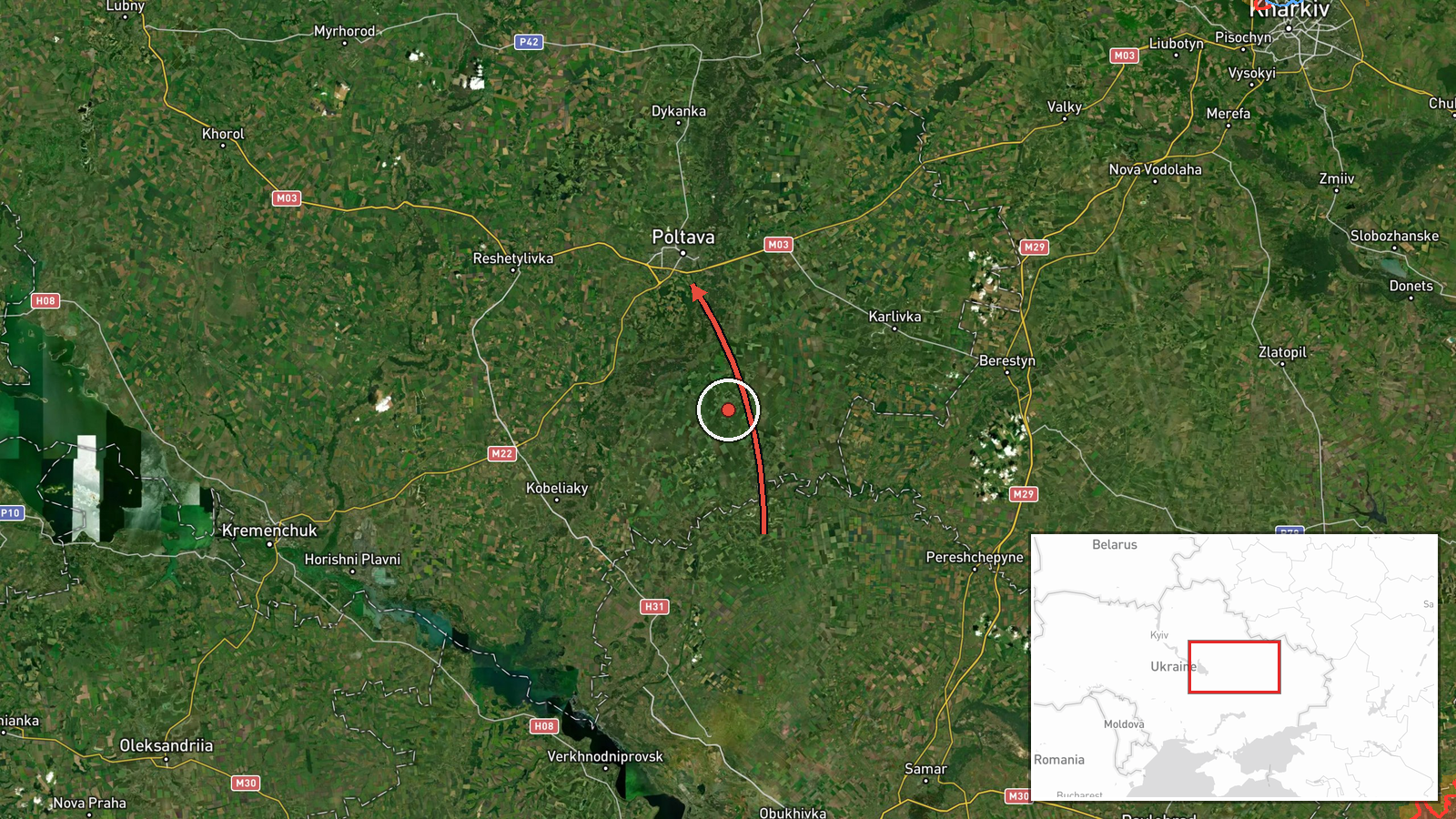
Ukrainian air monitoring reported on 17 October 2026 at 08:05 UTC a single Russian jet-powered Shahed-type drone, identified in the report as a Geran-3, passing near Mahdalynivka in Dnipropetrovsk Oblast and moving toward Poltava Oblast. The original Ukrainian-language post, published by the Telegram channel @kpszsu, describes a jet-powered UAV flying past the village on its way into Poltava region. It does not describe any impact, casualties, or damage, and the event is classified as a drone transit rather than a strike. Because the report names a village but the map pin sits at regional level, the precise track is approximate.
Context and assessment
Poltava and Dnipropetrovsk Oblasts lie on a central Ukrainian corridor that Russian long-range drones have repeatedly crossed on routes between the northeast and the south and west, so transits here are a routine part of the wider air campaign. The Geran-3 jet-powered variant is faster than the older piston-engined Geran-2 and is generally associated with harder-to-intercept flights. The related reports show a sequence on 16 and 17 October. Groups of three or more Shahed-type drones were reported moving from Kharkiv Oblast toward Poltava Oblast at 10:37 and 11:43 UTC on 16 October. Early on 17 October, a single drone was reported passing northern Dnipropetrovsk Oblast heading west at 01:23 UTC, followed at 03:36 UTC by a single Geran-3 heading toward Kobelyaky in Poltava Oblast, and at 08:17 UTC by a single Geran-3 passing Poltava Oblast heading northwest. The later reports may describe the same airframe, but the data does not confirm that. Operationally, single-drone transits of this kind may reflect reconnaissance, probing of air defence coverage, or flights aimed at targets farther along the route, though none of these readings can be confirmed from this report alone.
Sources and confidence
The event rests on one channel, the official Telegram account @kpszsu, which carries Ukrainian Air Force monitoring updates and is therefore reportedly an authoritative military source for airborne threat tracking. No independent outlet, regional administration, or second monitoring channel is recorded in the data as confirming this specific transit. The confidence score of 8.0 reflects the official origin of the post, the specific named route, and the consistency with the surrounding related reports, while the single-source basis and the lack of corroboration keep it below the top of the range. Confidence would rise with an independent tracking source or a regional statement referencing the same drone, and would fall if the originating channel issued a correction or if the related reports were found to describe a different sequence.
Location
The location is taken from the named village of Mahdalynivka in Dnipropetrovsk Oblast, as stated in the original Ukrainian text, while the destination is given only as Poltava Oblast. The coordinates attached to the event are a regional-level point for Poltava Oblast, not a settlement pin, which is why location confidence is marked low. The surrounding terrain is flat steppe and farmland between the Dnipro and Vorskla river basins, with scattered settlements, rail lines, and road networks that give the drone route few physical obstacles.
Related events nearby
- Ukrainian air monitoring: 1 Russian jet-powered Shahed (Geran-3) drone passing Poltava Oblast, heading northwe2026-10-17 08:17 UTC · Drone Transit · Poltava Oblast, Ukraine
- Ukrainian air monitoring: 3+ Russian Shahed-type drones heading toward Poltava Oblast.2026-10-16 11:43 UTC · Drone Transit · Poltava Oblast, Ukraine
- Ukrainian air monitoring: 3+ Russian Shahed-type drones from Kharkiv Oblast toward Poltava Oblast.2026-10-16 10:37 UTC · Drone Transit · Poltava Oblast, Ukraine
- Ukrainian air monitoring: 1 Russian jet-powered Shahed (Geran-3) drone heading toward Kobelyaky.2026-10-17 03:36 UTC · Drone Transit · Kobelyaky, Ukraine
- Ukrainian air monitoring: 1 Russian Shahed-type drone passing northern Dnipropetrovsk Oblast, heading west.2026-10-17 01:23 UTC · Drone Transit · northern Dnipropetrovsk Oblast, Ukraine
▶ View this event on the live map

Intel Mapper aggregates open-source reports from monitored Telegram and X channels, geolocates them, cross-checks duplicates across sources and assigns a confidence score. Entries are updated as new confirmations arrive. Read how we verify events.