Single Shahed-type drone reported heading west across northern Dnipropetrovsk Oblast
What happened
Ukrainian air monitoring reported on Telegram that one Russian Shahed-type drone was passing through northern Dnipropetrovsk Oblast on a westward course. The original post, from the channel @kpszsu, reads in Ukrainian roughly as "UAV in the north of Dnipropetrovshchyna, western course," which is a brief alert with no further detail. It does not describe impacts, damage, casualties, or the drone's eventual fate. The event is timestamped 2026-10-17 01:23 UTC. The report identifies the drone only by type and direction, and it does not name a specific settlement, so the route should be read as an approximate track rather than a confirmed position.
Context and assessment
The location sits in the northern part of an oblast that has been under repeated pressure in recent days. Within roughly 24 hours before this alert, the same monitoring feed logged a drone from Kherson Oblast heading toward Dnipropetrovsk Oblast, a guided glide bomb (KAB) heading toward the oblast, a jet-powered Geran-3 heading toward Dnipro, and several jet-powered drones heading toward the Kamianske district. A separate alert described Geran-3 drones passing through northern Chernihiv Oblast, indicating activity across a broad arc of the north and centre. The westward heading here may reflect a transit route, a path toward targets further west, or a decoy or reconnaissance track. Single-drone entries like this one often represent one element of larger, staggered salvos, but the data alone cannot establish whether this drone was part of a coordinated group or a stand-alone flight.
Sources and confidence
The event rests on a single Telegram channel, @kpszsu, which is the official Ukrainian Air Force monitoring feed and is generally regarded as a primary source for airspace alerts. No independent outlet, second channel, or official statement in the data cross-confirms the track. The confidence score of 8.0 reflects a credible primary source with a short, unambiguous message, offset by the absence of any second report and the lack of a precise location. Confidence would rise if a separate monitoring channel, regional military administration, or later alert confirmed the drone's track or its fate. It would fall if subsequent updates contradicted the heading or identified the object as something other than a drone.
Location
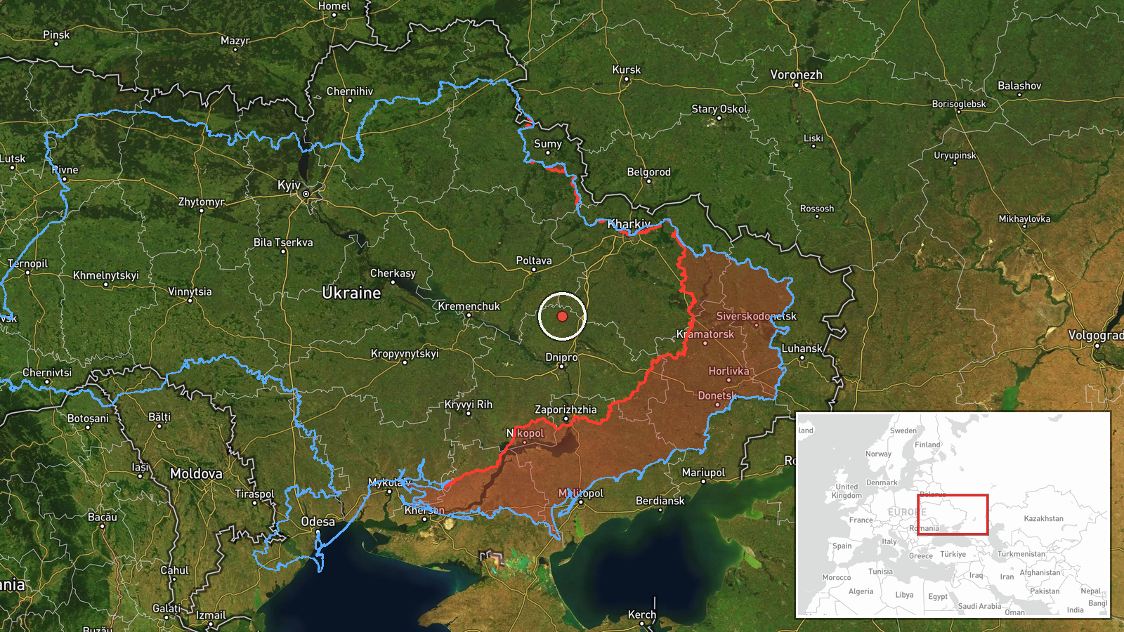
The coordinates were assigned at regional precision, centred on approximately 49.05 N, 35.05 E in northern Dnipropetrovsk Oblast, because the alert names only the oblast's northern area. No settlement or facility is identified. The area is largely agricultural steppe with river valleys and reservoirs, and the Dnipro River corridor runs through the broader oblast. The point should be treated as an approximate reference rather than a precise drone position.
Related events nearby
- Ukrainian air monitoring: 1 Russian Shahed-type drone heading toward Dnipro; 2+ Russian jet-powered Shahed (Ge2026-10-17 00:57 UTC · Drone Transit · Dnipro, Ukraine
- Ukrainian air monitoring: 1 Russian Shahed-type drone from Kherson Oblast toward Dnipropetrovsk Oblast.2026-10-16 14:31 UTC · Drone Transit · Dnipropetrovsk Oblast, Ukraine
- Ukrainian air monitoring: 1 Russian guided glide bomb (KAB) heading toward Dnipropetrovsk Oblast.2026-10-16 07:00 UTC · Airstrike · Dnipropetrovsk Oblast, Ukraine
- Ukrainian air monitoring: 1 Russian jet-powered Shahed (Geran-3) drone heading toward Dnipro; 1 Russian jet-po2026-10-16 02:29 UTC · Drone Transit · Dnipro, Ukraine
- Ukrainian air monitoring: 1 Russian ballistic missile heading toward Kamyanske.2026-10-17 01:42 UTC · Ballistic Missile · Kamyanske, Ukraine
▶ View this event on the live map

Intel Mapper aggregates open-source reports from monitored Telegram and X channels, geolocates them, cross-checks duplicates across sources and assigns a confidence score. Entries are updated as new confirmations arrive. Read how we verify events.