Ukrainian air monitoring reports one ballistic missile inbound toward Kamianske area
What happened
Ukrainian air monitoring reported on 17 October 2026 at 01:42 UTC that one Russian ballistic missile was heading toward Kamianske, a city in Dnipropetrovsk Oblast in central-eastern Ukraine. The original Ukrainian-language post, roughly translated as 'Ballistic on Kamianske/Dnipro,' named both Kamianske and the city of Dnipro, while the structured summary centres on Kamianske. The report is an early warning of an inbound launch rather than confirmation of impact, and it does not state a target, damage, or casualties. The alert was posted on Telegram by the channel @kpszsu and has not yet been matched by a second independent report in the data available. Because the warning concerns a flight in progress, details such as interception, impact point, or damage would need separate reporting to confirm.
Context and assessment
This alert sits within a dense sequence of Russian air activity over the Dnipro corridor during the preceding day. Earlier on 16 October, monitoring channels logged a Shahed-type drone moving from Kherson Oblast toward Dnipropetrovsk Oblast, a guided glide bomb heading toward the same oblast, and a jet-powered Geran-3 heading toward Dnipro. Shortly before the missile alert, a further Shahed-type drone was tracked toward Dnipro, with additional Geran-3 drones passing through northern Chernihiv Oblast. Kamianske district also received a separate drone transit warning on the afternoon of 16 October. Taken together, the pattern shows repeated, overlapping approaches toward the same industrial and urban area over roughly 24 hours. Ballistic missiles are a different class of threat from drones and glide bombs. They travel faster and on steeper trajectories, leaving less time for warning and interception, and they are typically reserved for larger or higher-value targets. Operationally, a mixed sequence of drones followed by a ballistic launch is consistent with an attempt to stretch and saturate air defences, though the data alone cannot establish intent or coordination. Dnipro is a major industrial and logistics hub, which helps explain why the surrounding area draws repeated attention.
Sources and confidence
All information in this entry comes from a single Telegram channel, @kpszsu, which is associated with Ukrainian air monitoring and early warnings. No second independent channel, wire service, or official impact statement appears in the available data, so the report stands uncorroborated. The confidence score of 8.0 reflects a clear, specific, and timestamped warning from a channel with an established role in air alerts, offset by the absence of cross-confirmation and the fact that the alert describes an intercepted or incoming flight rather than a verified impact. Confidence would rise with a second independent source, local authority statements on the alert, or reports of an explosion or interception near Kamianske. It would fall if the alert were updated, withdrawn, or contradicted by later official accounts.
Location
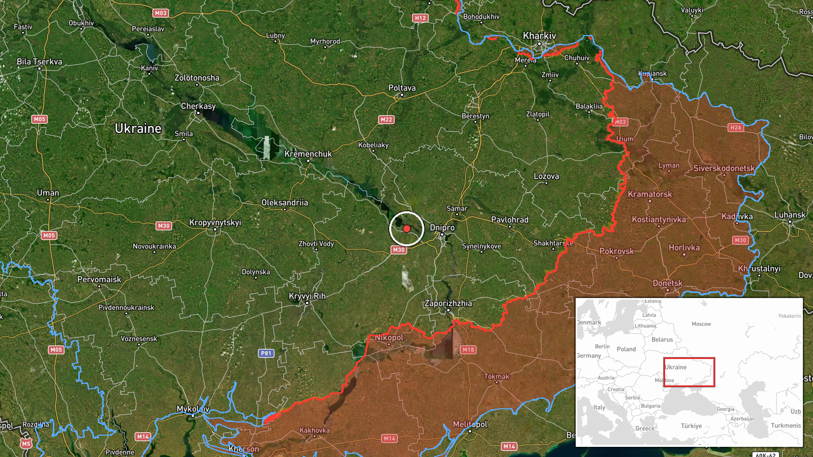
The location is recorded at settlement level, with high location confidence. The coordinates (48.517, 34.606) fall within the city of Kamianske, which is the place named in the summary. Kamianske lies in Dnipropetrovsk Oblast along the Dnipro River, close to the regional city of Dnipro. The area is largely flat steppe terrain shaped by the river valley, and it hosts heavy industry and transport links. The city's position near Dnipro explains why the original post named both places.
Related events nearby
- Ukrainian air monitoring: 2+ Russian jet-powered Shahed (Geran-3) drones heading toward Kamianske district.2026-10-16 14:34 UTC · Drone Transit · Kamianske district, Ukraine
- Ukrainian air monitoring: 1 Russian Shahed-type drone heading toward Dnipro; 2+ Russian jet-powered Shahed (Ge2026-10-17 00:57 UTC · Drone Transit · Dnipro, Ukraine
- Ukrainian air monitoring: 1 Russian Shahed-type drone from Kherson Oblast toward Dnipropetrovsk Oblast.2026-10-16 14:31 UTC · Drone Transit · Dnipropetrovsk Oblast, Ukraine
- Ukrainian air monitoring: 1 Russian guided glide bomb (KAB) heading toward Dnipropetrovsk Oblast.2026-10-16 07:00 UTC · Airstrike · Dnipropetrovsk Oblast, Ukraine
- Ukrainian air monitoring: 1 Russian jet-powered Shahed (Geran-3) drone heading toward Dnipro; 1 Russian jet-po2026-10-16 02:29 UTC · Drone Transit · Dnipro, Ukraine
▶ View this event on the live map

Intel Mapper aggregates open-source reports from monitored Telegram and X channels, geolocates them, cross-checks duplicates across sources and assigns a confidence score. Entries are updated as new confirmations arrive. Read how we verify events.