Ukrainian air monitoring reports a Russian Banderol cruise missile heading toward Poltava
What happened
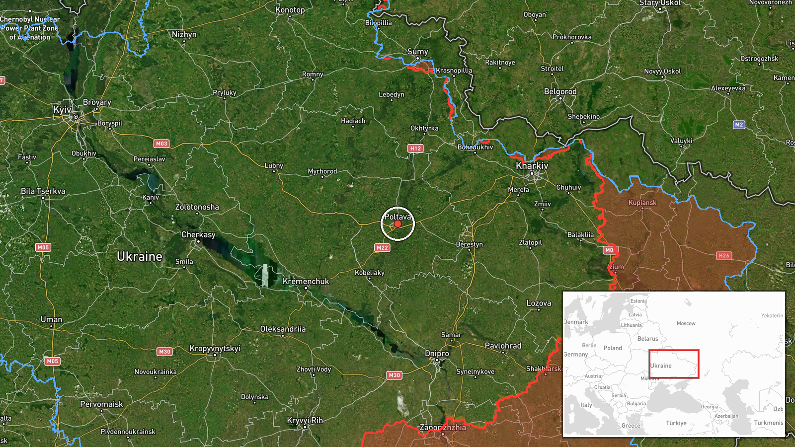
Ukrainian air monitoring reported at about 11:26 UTC on 17 October 2026 that one Russian Banderol mini cruise missile was heading toward Poltava from the northeast. The report was posted on the Telegram channel @kpszsu, which carries Ukrainian air-force monitoring updates. The original Ukrainian wording, a rocket symbol followed by the phrase that a Banderol is moving toward Poltava from the northeast, describes an inbound track rather than an impact. The report does not mention damage, casualties, or interception, so the event is recorded as a warning of a single missile. The reported target is Poltava city, the regional center of Poltava Oblast.
Context and assessment
Poltava is the regional capital of Poltava Oblast in central-eastern Ukraine, which makes it a significant administrative and urban target. The related events show a dense sequence of tracks across the same oblast over roughly 27 hours. On 16 October, monitoring reported three or more Shahed-type drones heading toward Poltava Oblast. Early on 17 October, a jet-powered Geran-3 drone was reported heading toward Kobelyaky. At 08:05 another Geran-3 was reported moving from Dnipropetrovsk Oblast toward Poltava Oblast, and at 08:17 one was reported passing through the oblast heading northwest. At 11:24, a Shahed-type drone was reported heading toward Velyki Sorochyntsi and Myrhorod, both in Poltava Oblast, two minutes before the missile warning. Taken together, the pattern suggests multiple aerial systems tracked in overlapping directions across one region. The mix of drone and cruise missile tracks may indicate successive approaches or an effort to stretch air defenses along several axes, although the monitoring reports alone cannot establish intent. Because these are monitoring warnings rather than impact reports, they document threat movement, not outcomes.
Sources and confidence
Only one channel, Telegram @kpszsu, carried this report, so there is no cross-confirmation at this time. The confidence score of 8.0 out of 10 reflects a channel that identifies the weapon type, direction, and target clearly, but the absence of a second independent report keeps it below the top range. Confirmation from other monitoring feeds, an official Ukrainian air force statement, or local reports of alerts or impacts in Poltava would raise confidence. A correction, a change in the reported target, or silence from other sources after the warning would lower it. The event is currently marked as uncorrected.
Location
The coordinates, 49.59 N and 34.55 E, match the city of Poltava at settlement precision, and the location confidence is recorded as high. Poltava lies in central-eastern Ukraine on the Vorskla River and serves as the administrative center of Poltava Oblast. The other places named in the related events, Kobelyaky, Velyki Sorochyntsi, and Myrhorod, are all in the same oblast. The surrounding terrain is largely flat and agricultural.
Related events nearby
- Ukrainian air monitoring: 1 Russian jet-powered Shahed (Geran-3) drone passing Poltava Oblast, heading northwe2026-10-17 08:17 UTC · Drone Transit · Poltava Oblast, Ukraine
- Ukrainian air monitoring: 1 Russian jet-powered Shahed (Geran-3) drone from Dnipropetrovsk Oblast toward Polta2026-10-17 08:05 UTC · Drone Transit · Poltava Oblast, Ukraine
- Ukrainian air monitoring: 1 Russian jet-powered Shahed (Geran-3) drone heading toward Kobelyaky.2026-10-17 03:36 UTC · Drone Transit · Kobelyaky, Ukraine
- Ukrainian air monitoring reports a Russian Shahed-type drone heading toward Velyki Sorochyntsi and Myrhorod in2026-10-17 11:24 UTC · Drone Transit · Velyki Sorochyntsi, Ukraine
- Ukrainian air monitoring: 2+ Russian jet-powered Shahed (Geran-3) drones passing Kozelshchyna, heading northwe2026-10-17 11:55 UTC · Drone Transit · Kozelshchyna, Ukraine
▶ View this event on the live map

Intel Mapper aggregates open-source reports from monitored Telegram and X channels, geolocates them, cross-checks duplicates across sources and assigns a confidence score. Entries are updated as new confirmations arrive. Read how we verify events.