Single Shahed-type drone reported heading toward Kremenchuk amid repeated overnight transits
What happened
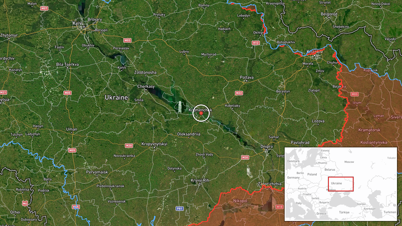
Ukrainian air monitoring reported on Telegram via the channel @kpszsu that one Russian Shahed-type drone was heading toward Kremenchuk in central Ukraine at about 11:09 UTC on 16 October 2026. The original post is brief and describes strike drones ("Ударні БпЛА") approaching Kremenchuk from the south and the northeast, though the summary counts one drone. The report does not describe any impact, damage, casualties or interception. Because it is a single-channel alert issued during an active air-threat period, the reported course and count should be read as provisional. Later updates would be needed to confirm what, if anything, the drone reached.
Context and assessment
Kremenchuk sits on the Dnipro River in Poltava Oblast and hosts a large hydroelectric dam, a major industrial complex and rail and road links that matter for logistics across central Ukraine. Those features make it a recurring focus for air-threat warnings. The related reports show a clear pattern on 15 and 16 October 2026. Earlier that day, a jet-powered Geran-3 drone was logged passing Kobelyaky, a town to the northeast, heading west. In the early hours of 16 October, at least two Geran-3 drones were reported heading toward Kremenchuk, and later reports described two or more drones passing south of the city heading west. By mid-morning the count rose to three or more Shahed-type drones heading toward the city, and the present alert is the latest in that sequence. Taken together, the series suggests a sustained effort to probe or saturate air defenses in the Kremenchuk area rather than a single isolated flight. Approaches from both the south and northeast could indicate attempts to reach the city from different corridors, though the data alone cannot establish intent or target. Operationally, repeated transits of this kind can strain interceptor allocation and warning systems even when individual drones are shot down or lost.
Sources and confidence
The event rests on one Telegram channel, @kpszsu, which is linked to the Ukrainian Air Force's public monitoring. No second independent outlet appears in the data, so cross-confirmation is absent. The confidence score of 8.0 out of 10 reflects the official-linked origin of the channel, the specific geographic wording and the consistency with a series of related alerts that day, but it is held below the maximum because there is no independent corroboration and no impact reporting. The score would rise with confirmation from a second monitoring source, radar or interception reports, or official statements on the outcome. It would fall if later updates contradicted the count or heading, or if the alert were revised or withdrawn.
Location
The location is recorded at settlement precision for Kremenchuk, Ukraine, at roughly 49.07 N, 33.42 E, with high location confidence. The coordinates correspond to the city itself rather than a specific facility, so no individual site is identified. Kremenchuk lies on the wide Dnipro reservoir in the forest-steppe belt of central Ukraine, with the river, dam and reservoir shaping the surrounding terrain. Kobelyaky, referenced in a related report, lies to the northeast, while the southern approach named in the original post crosses open steppe and river valleys.
Related events nearby
- Ukrainian air monitoring: 3+ Russian Shahed-type drones heading toward Kremenchuk.2026-10-16 10:52 UTC · Drone Transit · Kremenchuk, Ukraine
- Ukrainian air monitoring: 3+ Russian Shahed-type drones heading toward Kremenchuk.2026-10-16 10:18 UTC · Drone Transit · Kremenchuk, Ukraine
- Ukrainian air monitoring: 2+ Russian jet-powered Shahed (Geran-3) drones heading toward Kremenchuk.2026-10-16 01:08 UTC · Drone Transit · Kremenchuk, Ukraine
- Ukrainian air monitoring: 2+ Russian jet-powered Shahed (Geran-3) drones passing south of Kremenchuk, heading 2026-10-16 04:45 UTC · Drone Transit · south of Kremenchuk, Ukraine
- Ukrainian air monitoring: 1 Russian jet-powered Shahed (Geran-3) drone passing Kobelyaky, heading west.2026-10-15 16:01 UTC · Drone Transit · Kobelyaky, Ukraine
▶ View this event on the live map

Intel Mapper aggregates open-source reports from monitored Telegram and X channels, geolocates them, cross-checks duplicates across sources and assigns a confidence score. Entries are updated as new confirmations arrive. Read how we verify events.