Ukrainian air monitoring reports at least two jet-powered Shahed drones heading toward Kremenchuk
What happened
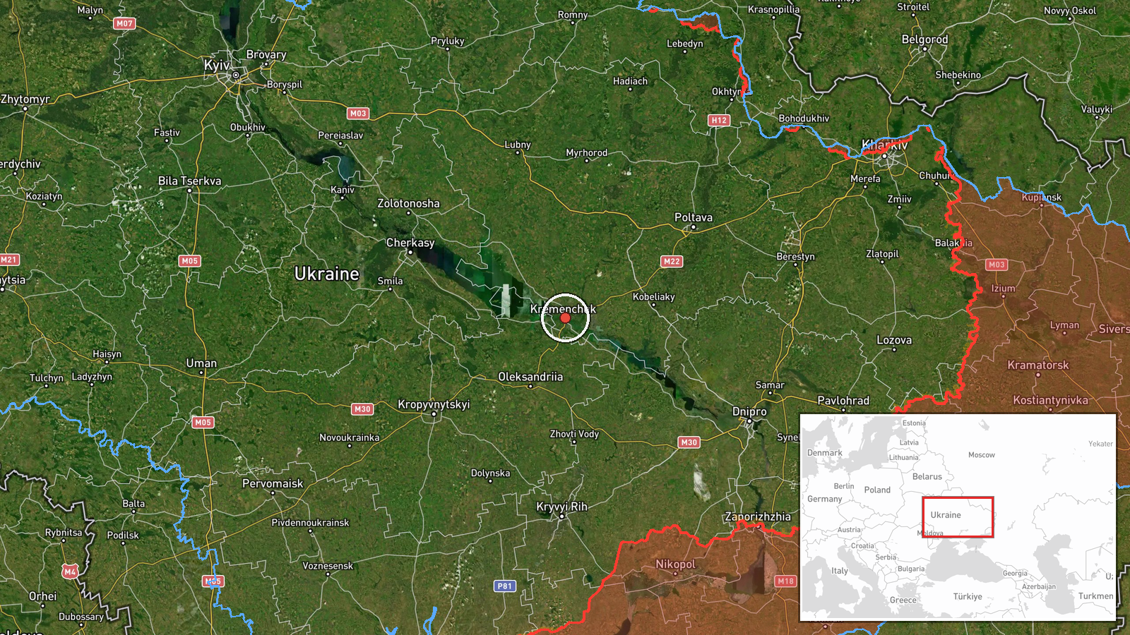
Ukrainian air monitoring reported at least two Russian jet-powered Shahed drones, designated Geran-3, moving toward Kremenchuk in central Ukraine. The report was posted on Telegram by the channel @kpszsu and describes the drones as approaching from the east. The event is timestamped 16 October 2026 at 01:08 UTC. The original Ukrainian-language post reads roughly as 'Jet-powered UAVs toward Kremenchuk from the east,' and it gives no firm count beyond the summary's 'two or more' phrasing. The source material describes no explosion, impact, or damage, and it does not say whether the drones were intercepted, lost track of, or continued past the city. The event is classified as a drone transit, not a confirmed strike.
Context and assessment
Kremenchuk is a major industrial city on the Dnipro River, with a large reservoir, road and rail links, and industrial facilities that have been targeted in past phases of the war. The event fits a sequence of activity in the same region earlier on 15 October 2026. Single Geran-3 transits were logged near Kalynopil, Bilyky, and Kobelyaky, and two Banderol mini cruise missiles were reported over or heading toward Poltava Oblast at 12:05 and 12:08 UTC. Taken together, these reports suggest a multi-axis pattern across central Ukraine rather than an isolated flight. Repeated transits through the same corridor may indicate reconnaissance, a probing or saturation effort against air defenses, or an attempt to strike infrastructure in the region. The jet-powered variant flies faster than the piston-engined Shahed, which would generally shorten warning times for ground observers. These are interpretations of the pattern, not established intent, and the event data alone does not show which target, if any, was planned.
Sources and confidence
The event rests on one Telegram channel, @kpszsu, which the data identifies as the source for this report. It is not cross-confirmed by a second independent channel, official statement, or local report in the provided data. The confidence score of 8.0 is relatively high because the report is specific about drone type, direction, and destination, and it fits the surrounding air-monitoring reports from the same day. It is held below the maximum because the claim comes from a single post with no independent corroboration. Confidence would rise with confirmation from additional monitoring sources, regional officials, or visible interception or impact reports. It would fall if later reports contradict the drone count, the direction, or the destination.
Location
The location is recorded at settlement level, with coordinates of 49.07 N and 33.42 E approximating the center of Kremenchuk rather than any specific facility. The location confidence is high because the report names the city directly. Kremenchuk lies on the Dnipro River in Poltava Oblast, near the large Kremenchuk Reservoir. The nearby settlements named in related reports, including Kobelyaky, Bilyky, and Kalynopil, are in the same general area of central Ukraine.
Related events nearby
- Ukrainian air monitoring: 1 Russian jet-powered Shahed (Geran-3) drone passing Kobelyaky, heading west.2026-10-15 16:01 UTC · Drone Transit · Kobelyaky, Ukraine
- Ukrainian air monitoring: 1 Russian jet-powered Shahed (Geran-3) drone from Poltava Oblast toward Bilyky.2026-10-15 08:49 UTC · Drone Transit · Bilyky, Ukraine
- Ukrainian air monitoring tracks jet-powered Shahed (Geran-3) drones over western and northern Poltava Oblast, 2026-10-16 01:34 UTC · Drone Transit · Western Poltava Oblast, Ukraine
- Ukrainian air monitoring: 1 Russian Banderol mini cruise missile over Poltava Oblast.2026-10-15 12:08 UTC · Cruise Missile · Poltava Oblast, Ukraine
- Ukrainian air monitoring: 1 Russian Banderol mini cruise missile heading toward Poltava Oblast.2026-10-15 12:05 UTC · Cruise Missile · Poltava Oblast, Ukraine
▶ View this event on the live map

Intel Mapper aggregates open-source reports from monitored Telegram and X channels, geolocates them, cross-checks duplicates across sources and assigns a confidence score. Entries are updated as new confirmations arrive. Read how we verify events.