Jet-powered Shahed drones reported south of Kremenchuk, heading west, per Ukrainian monitoring
What happened
Ukrainian air monitoring reported at least two Russian jet-powered Shahed drones, designated Geran-3, operating south of Kremenchuk in central Ukraine and heading west. The report was posted at 04:45 UTC on 16 October 2026 on the Telegram channel @kpszsu. The original Ukrainian wording describes the drones as 'реактивні БпЛА' (jet UAVs) south of Kremenchuk on a westward course. The English summary says 'over Kremenchuk,' which is looser than the source's 'south of.' The report does not mention impacts, casualties, or any strike. It describes only aerial movement tracked by monitoring, so the event is best read as a transit observation rather than a confirmed attack.
Context and assessment
Kremenchuk is a Dnipro River city with a large industrial base, including a refinery, and a major road and rail crossing, which is why drone tracks near it draw attention. The event sits within a sequence of Geran-3 reports across central Ukraine on 15 and 16 October. Earlier entries placed a single drone passing Bilyky and Kobelyaky in Poltava Oblast, and a group of drones heading toward Kremenchuk at 01:08 UTC. Later entries tracked drones over western and northern Poltava Oblast and northern Kirovohrad Oblast, all heading west, with one reported in northern Vinnytsia Oblast. Taken together, the pattern suggests a multi-drone flight path moving westward through the region rather than a set of unrelated local incidents. Operationally, this may indicate routing toward targets farther west, or drones being redirected or dispersed. Such an interpretation is inferred from the track pattern alone and cannot be confirmed from the monitoring data, which does not identify intended targets.
Sources and confidence
The event rests on one Telegram channel, @kpszsu, which is generally understood to be the Ukrainian Air Force's official account. No second independent source is listed for this entry. The confidence score of 8.0 reflects the channel's institutional role and the specificity of the report, offset by the single-source basis and the lack of corroboration from other outlets. Confidence would rise with a second channel or with corroborating reports from regional military administrations or defense ministry statements. It would fall if the event were corrected, if the 'south of' versus 'over' wording were resolved against the original text, or if later monitoring placed the drones on a different track.
Location
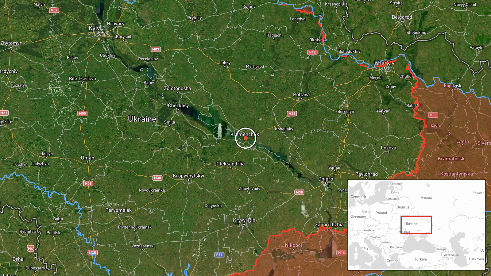
The location is recorded at settlement level for Kremenchuk, with high location confidence and coordinates at approximately 49.07 N, 33.42 E. The original report's phrase 'south of Kremenchuk' means the drones were probably outside the city proper, so the marker reflects the nearest settlement rather than the exact track. Kremenchuk sits on the Dnipro River in Poltava Oblast, in central Ukraine. The Kremenchuk Reservoir, a large stretch of the Dnipro, runs through the area and is a notable nearby feature.
Related events nearby
- Ukrainian air monitoring: 2+ Russian jet-powered Shahed (Geran-3) drones heading toward Kremenchuk.2026-10-16 01:08 UTC · Drone Transit · Kremenchuk, Ukraine
- Ukrainian air monitoring: 1 Russian jet-powered Shahed (Geran-3) drone passing Kobelyaky, heading west.2026-10-15 16:01 UTC · Drone Transit · Kobelyaky, Ukraine
- Ukrainian air monitoring: 1 Russian jet-powered Shahed (Geran-3) drone from Poltava Oblast toward Bilyky.2026-10-15 08:49 UTC · Drone Transit · Bilyky, Ukraine
- Ukrainian air monitoring tracks jet-powered Shahed (Geran-3) drones over northern Kirovohrad Oblast, heading w2026-10-16 04:57 UTC · Drone Transit · Northern Kirovohrad Oblast, Ukraine
- Ukrainian air monitoring tracks jet-powered Shahed (Geran-3) drones over western and northern Poltava Oblast, 2026-10-16 01:34 UTC · Drone Transit · Western Poltava Oblast, Ukraine
▶ View this event on the live map

Intel Mapper aggregates open-source reports from monitored Telegram and X channels, geolocates them, cross-checks duplicates across sources and assigns a confidence score. Entries are updated as new confirmations arrive. Read how we verify events.