Air monitoring reports Shahed-type drone transiting the Vapnyarka area in Vinnytsia Oblast
What happened
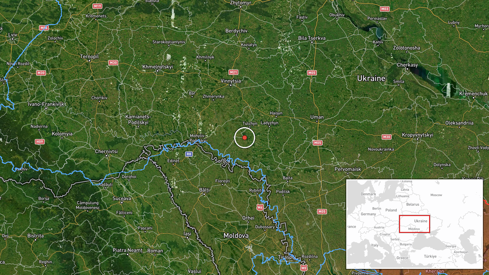
Ukraine's Air Force Telegram channel, @kpszsu, reported on 16 October 2026 at 16:21 UTC that strike drones were moving through Vinnytsia Oblast near Dashiv, Vapnyarka and Tyvriv, on a western heading. The original Ukrainian uses the plural for the drones, while the event summary records a single Russian Shahed-type drone passing Vapnyarka; that difference is unresolved in the record. The post reports no impact, damage or casualties, and it does not name a launch point. Attribution to Russia and the Shahed-type label are part of the event framing rather than details spelled out in the original line.
Context and assessment
Vinnytsia Oblast lies on routes that drones heading toward western Ukraine have often crossed, so tracks through the region usually point to destinations beyond it rather than to a single local target. The related events show a dense run of activity on the same day. Between 01:11 and 05:23 UTC, five separate jet-powered Geran-3 drone transits were logged in the oblast, with reports moving toward Tomashpil, Bratslav and Nemyriv, and one passing southern parts of the region heading west. Taken together, these entries suggest a sustained flight path through Vinnytsia rather than an isolated incursion. The 16:21 UTC report at Vapnyarka fits that pattern, placing a later track along a similar axis. Operationally, this sequence is consistent with long-range drones being routed across central Ukraine and with air monitoring following them through successive settlements. The jet-powered Geran-3 label, if accurate for this track, would describe a faster variant than the older propeller Shahed type, but the record does not confirm which variant this drone was. Because the report describes transit only, its significance depends on where the drone went next, which the source does not state.
Sources and confidence
The report comes from a single Telegram channel, @kpszsu, which is widely treated as the official air-monitoring channel of Ukraine's Air Force, and no second outlet is listed in the record. Confidence is 8.0 out of 10, a fairly high score for an official single-source alert, but not higher because the report has no independent corroboration, no impact confirmation, and an unresolved count discrepancy between the plural wording and the summary. Confidence would rise if independent monitoring, radar data or local authority statements confirmed the drone's presence, or if the count were clarified. It would fall if the track were corrected or retracted.
Location
Vapnyarka is a small town in Vinnytsia Oblast in west-central Ukraine. The coordinates were resolved to the settlement itself, with high location confidence and settlement-level precision. The source names three nearby settlements, Dashiv, Vapnyarka and Tyvriv, which suggests the report was tied to an area rather than a precise point. The surrounding terrain is largely open and agricultural, typical of the region's lowlands.
Related events nearby
- Ukrainian air monitoring: 1 Russian jet-powered Shahed (Geran-3) drone from Vinnytsia Oblast toward Tomashpil.2026-10-16 01:11 UTC · Drone Transit · Tomashpil, Ukraine
- Ukrainian air monitoring: 2+ Russian jet-powered Shahed (Geran-3) drones passing southern Vinnytsia Oblast, he2026-10-16 01:41 UTC · Drone Transit · southern Vinnytsia Oblast, Ukraine
- Ukrainian air monitoring: 1 Russian jet-powered Shahed (Geran-3) drone from Vinnytsia Oblast toward Bratslav.2026-10-16 02:50 UTC · Drone Transit · Bratslav, Ukraine
- Ukrainian air monitoring: 2+ Russian jet-powered Shahed (Geran-3) drones from Vinnytsia Oblast toward Bratslav2026-10-16 01:46 UTC · Drone Transit · Bratslav, Ukraine
- Ukrainian air monitoring: 3+ Russian Shahed-type drones passing southeastern Vinnytsia Oblast, heading west.2026-10-16 16:48 UTC · Drone Transit · southeastern Vinnytsia Oblast, Ukraine
▶ View this event on the live map

Intel Mapper aggregates open-source reports from monitored Telegram and X channels, geolocates them, cross-checks duplicates across sources and assigns a confidence score. Entries are updated as new confirmations arrive. Read how we verify events.