Jet-powered Shahed drones reported over southern Vinnytsia Oblast, tracked heading west
What happened
Ukrainian air monitoring reported at about 01:41 UTC on 16 October 2026 that jet-powered Shahed (Geran-3) drones were tracked over the southern part of Vinnytsia Oblast, moving on a westward course. The only source is a Telegram post from the channel @kpszsu, which carries Ukrainian air monitoring alerts. The original Ukrainian wording is brief: jet-type UAVs in the south of Vinnytsia region, heading west. The report gives no drone count, no specific settlement, no impact, and no named target. Its framing describes a transit through the area rather than a strike on it.
Context and assessment
This report belongs to a short series of similar alerts in the same region over about sixteen hours. On 15 October, monitoring posts placed single or multiple Geran-3 drones near Tulchyn at 09:29 UTC and near Tomashpil at 11:49 UTC, with a further single drone toward Tomashpil at 15:41 and another toward Kryzhopil at 16:15. A follow-up alert at 01:11 UTC on 16 October described one drone from Vinnytsia Oblast toward Tomashpil. The recurring names of towns in the south of the oblast suggest a corridor along which drones are being routed, rather than a set of separate targets. Vinnytsia lies on the path between the southern and eastern front areas and western Ukraine, so flights crossing it are not unusual. The jet-powered Geran-3 variant is generally described as faster than the propeller-driven Geran-2, which may make these transits harder to intercept. Operationally, the pattern may point to long-range flights traveling west or to waypoint navigation, though the data cannot show whether any drone was aimed at a specific site.
Sources and confidence
All information comes from one Telegram channel, @kpszsu, and no independent outlet, official statement, or second channel appears in the event data. The confidence score of 8.0 reflects that the report is a direct, timed monitoring alert naming the drone type and heading, and that it fits a consistent series of earlier alerts in the same area. It stays below the top range because the single-source basis cannot be checked against another feed. Confidence would rise with corroboration from another monitoring channel, an official air force statement, or reporting from regional authorities. It would fall if the channel corrected or withdrew the alert, or if later reports placed the drones outside the oblast.
Location
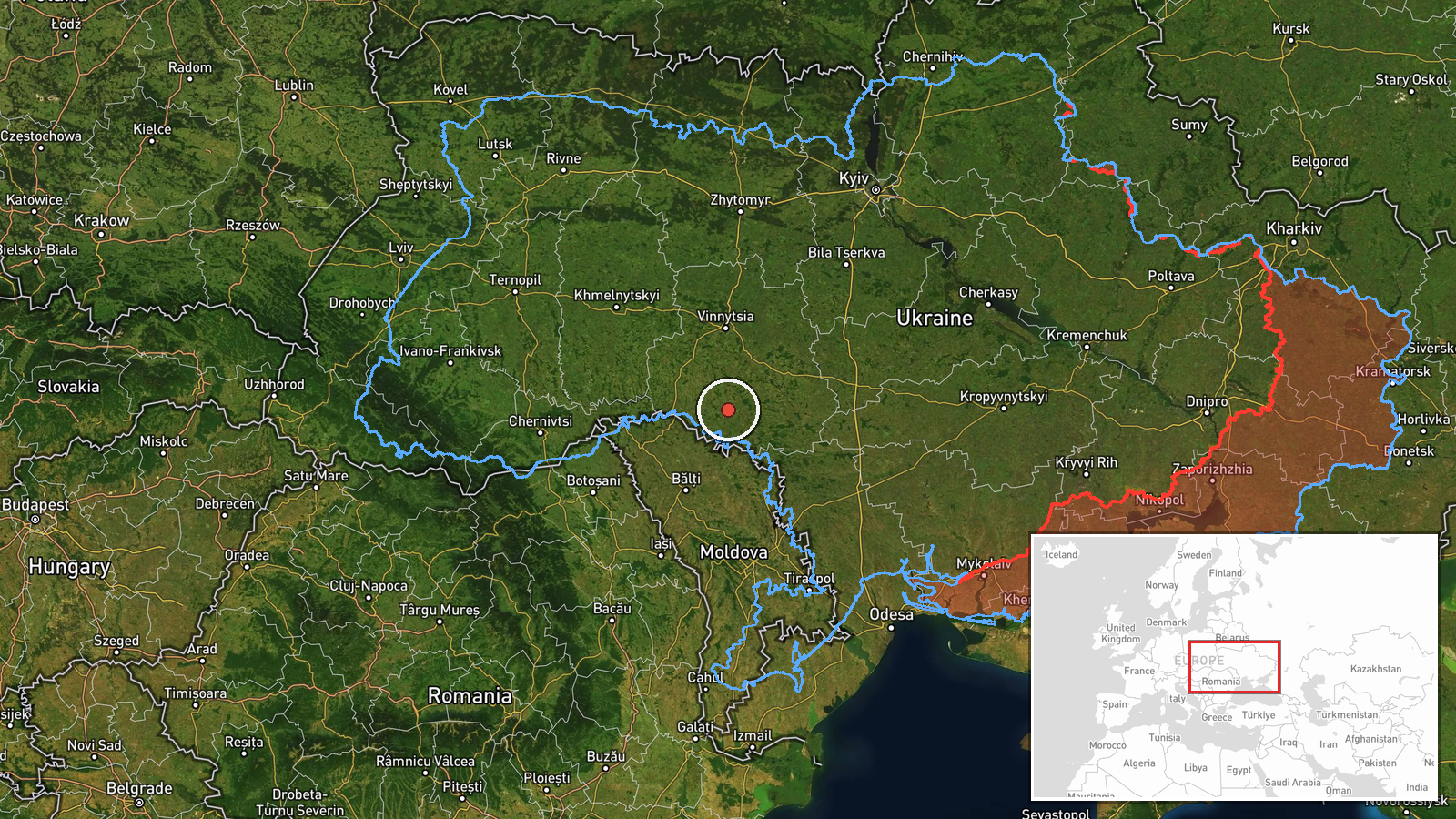
The event is placed at region level rather than at a settlement. The coordinates, 48.5 north and 28.5 east, are an approximate central point for the southern part of Vinnytsia Oblast, so the location confidence is rated low. Nearby towns named in related alerts, including Tomashpil, Kryzhopil and Tulchyn, are the best local reference points but are not the stated location of this report. The area is mainly rolling farmland on the Podolian upland, drained by the Southern Bug and its tributaries, with scattered forest patches and river valleys.
Related events nearby
- Ukrainian air monitoring: 1 Russian jet-powered Shahed (Geran-3) drone from Vinnytsia Oblast toward Tomashpil.2026-10-16 01:11 UTC · Drone Transit · Tomashpil, Ukraine
- Ukrainian air monitoring: 1 Russian jet-powered Shahed (Geran-3) drone heading toward Tomashpil.2026-10-15 15:41 UTC · Drone Transit · Tomashpil, Ukraine
- Ukrainian air monitoring: 2+ Russian jet-powered Shahed (Geran-3) drones heading toward Tomashpil.2026-10-15 11:49 UTC · Drone Transit · Tomashpil, Ukraine
- Ukrainian air monitoring: 1 Russian jet-powered Shahed (Geran-3) drone heading toward Kryzhopil.2026-10-15 16:15 UTC · Drone Transit · Kryzhopil, Ukraine
- Ukrainian air monitoring: 1 Russian jet-powered Shahed (Geran-3) drone from Vinnytsia Oblast toward Tulchyn.2026-10-15 09:29 UTC · Drone Transit · Tulchyn, Ukraine
▶ View this event on the live map

Intel Mapper aggregates open-source reports from monitored Telegram and X channels, geolocates them, cross-checks duplicates across sources and assigns a confidence score. Entries are updated as new confirmations arrive. Read how we verify events.