Russian Shahed drone tracked toward Kryzhopil in Vinnytsia Oblast
What happened
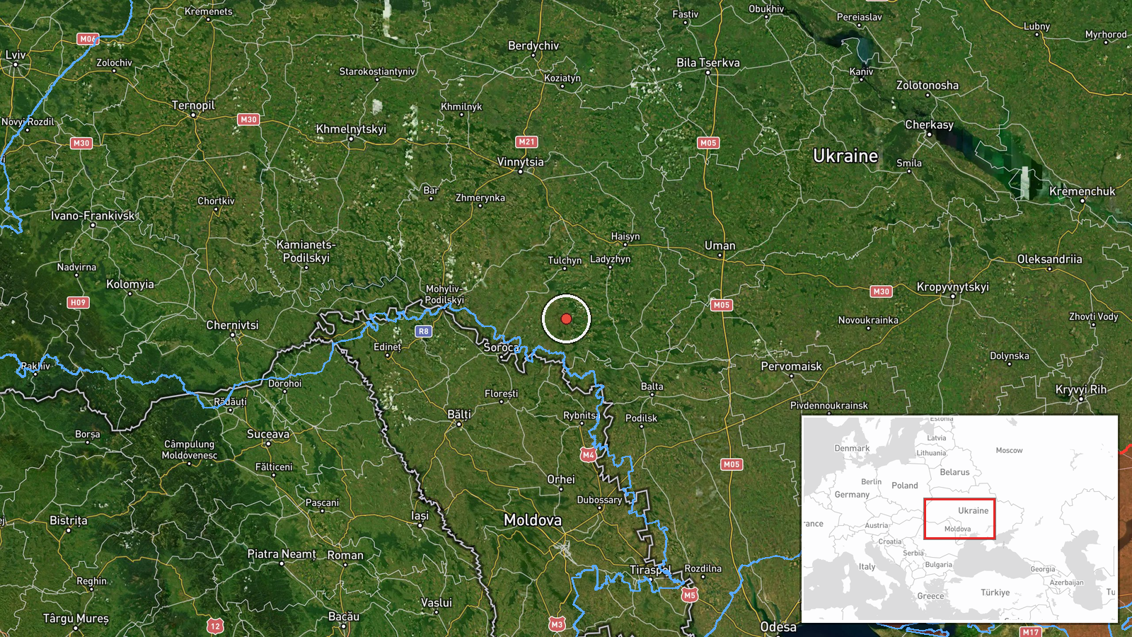
Ukrainian air monitoring reported one Russian jet-powered Shahed (Geran-3) drone heading toward Kryzhopil in Vinnytsia Oblast on October 15 at 16:15 UTC. The report was posted by the Kyiv Post Survival Guide (@kpszsu) on Telegram. Kryzhopil is a settlement in central Vinnytsia Oblast. The drone transit was tracked as it moved through the region, consistent with Ukrainian air defense monitoring protocols.
Context and assessment
This sighting occurred during a broader pattern of Russian Shahed drone activity across Vinnytsia Oblast on October 15. Earlier that day, Ukrainian monitoring detected multiple Shahed drones transiting toward Tomashpil (at 11:49 and 15:41 UTC), Tulchyn (09:29 UTC), Ladyzhyn (09:05 UTC), and the Vinnytsia-Cherkasy border region (09:13 UTC). The concentration of tracked drones in this sector suggests either a coordinated strike operation or sustained reconnaissance activity across central Ukraine. Vinnytsia Oblast, while distant from front lines, remains within range of Russian cruise and loitering munitions and has been subject to repeated attacks on infrastructure and civilian areas throughout the conflict.
Sources and confidence
Single source from Telegram (@kpszsu), the Kyiv Post Survival Guide channel, which reports Ukrainian air monitoring data. No cross-confirmation from other channels is noted. Confidence of 8.0 reflects the established reliability of official Ukrainian air tracking channels but is tempered by single-source reporting. Confirmation from independent radar data or Ukrainian Air Force statements would strengthen confidence; video or damage reports would clarify intent.
Location
Kryzhopil is a settlement in Vinnytsia Oblast, central Ukraine, located approximately 48.38°N, 28.87°E. It sits in the agricultural heartland of the region, roughly 70 km southwest of Vinnytsia city and within the broader zone tracked for Russian drone activity on October 15. The precise settlement-level geolocation is high confidence.
Related events nearby
- Ukrainian air monitoring: 1 Russian jet-powered Shahed (Geran-3) drone heading toward Tomashpil.2026-10-15 15:41 UTC · Drone Transit · Tomashpil, Ukraine
- Ukrainian air monitoring: 2+ Russian jet-powered Shahed (Geran-3) drones heading toward Tomashpil.2026-10-15 11:49 UTC · Drone Transit · Tomashpil, Ukraine
- Ukrainian air monitoring: 1 Russian jet-powered Shahed (Geran-3) drone from Vinnytsia Oblast toward Tulchyn.2026-10-15 09:29 UTC · Drone Transit · Tulchyn, Ukraine
- Ukrainian air monitoring: 1 Russian jet-powered Shahed (Geran-3) drone over Ladyzhyn.2026-10-15 09:05 UTC · Drone Transit · Ladyzhyn, Ukraine
- Ukrainian air monitoring reports 1 Russian jet-powered Shahed (Geran-3) drone transiting at the Vinnytsia-Cher2026-10-15 09:13 UTC · Drone Transit · Vinnytsia-Cherkasy Oblast Border, Ukraine
▶ View this event on the live map

Intel Mapper aggregates open-source reports from monitored Telegram and X channels, geolocates them, cross-checks duplicates across sources and assigns a confidence score. Entries are updated as new confirmations arrive. Read how we verify events.