Russian jet-powered drone tracked toward Tomashpil in Vinnytsia Oblast
What happened
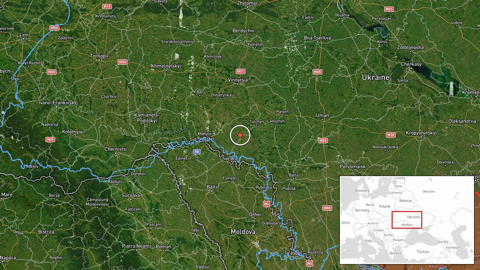
Ukrainian air monitoring reported one Russian jet-powered Shahed (Geran-3) drone heading toward Tomashpil in Vinnytsia Oblast on 15 October at 15:41 UTC. The report was issued by the Ukrainian air force command (@kpszsu on Telegram). This sighting occurred hours after Ukrainian monitors detected at least two similar drones targeting the same settlement earlier that morning, as part of a broader pattern of Russian drone operations across the region.
Context and assessment
Tomashpil, a town in central Vinnytsia Oblast roughly 200 kilometres west of Russian-held territory, has been repeatedly targeted by Russian jet-powered drones throughout 15 October. The pattern of multiple Geran-3 sorties toward the same settlement suggests a coordinated strike sequence. Vinnytsia Oblast, a civilian-inhabited region distant from frontline combat, has become a frequent target for Russian long-range drone strikes. The concentration of reports across Tomashpil, Tulchyn, Sharhorod, Tyvriv, and Ladyzhyn on a single day indicates a sustained campaign against rear-area infrastructure or population centres, potentially aimed at degrading civilian morale or striking industrial targets.
Sources and confidence
Single source: Telegram channel @kpszsu (Ukrainian air force command). No independent cross-confirmation is evident in provided data. Confidence score of 8.0 reflects that the source is official Ukrainian military monitoring, considered reliable for air defence tracking, but represents one reporting channel. Confirmation from additional Ukrainian sources or evidence of interception would strengthen confidence.
Location
Tomashpil is a settlement in Vinnytsia Oblast, central Ukraine, at coordinates 48.537°N, 28.513°E. The town lies approximately 200 kilometres behind Ukrainian-held territory relative to the Donbas front and sits in a predominantly agricultural region. No major military installations are publicly documented at the settlement, suggesting civilian infrastructure as a likely target focus.
Related events nearby
- Ukrainian air monitoring: 2+ Russian jet-powered Shahed (Geran-3) drones heading toward Tomashpil.2026-10-15 11:49 UTC · Drone Transit · Tomashpil, Ukraine
- Ukrainian air monitoring: 1 Russian jet-powered Shahed (Geran-3) drone from Vinnytsia Oblast toward Tulchyn.2026-10-15 09:29 UTC · Drone Transit · Tulchyn, Ukraine
- Ukrainian air monitoring: 1 Russian jet-powered Shahed (Geran-3) drone heading toward Kryzhopil.2026-10-15 16:15 UTC · Drone Transit · Kryzhopil, Ukraine
- Ukrainian air monitoring: 1 Russian jet-powered Shahed (Geran-3) drone passing Dzhuryn, heading toward Sharhor2026-10-15 16:39 UTC · Drone Transit · Sharhorod, Ukraine
- Ukrainian air monitoring: 2+ Russian jet-powered Shahed (Geran-3) drones heading toward Sharhorod.2026-10-15 11:54 UTC · Drone Transit · Sharhorod, Ukraine
▶ View this event on the live map

Intel Mapper aggregates open-source reports from monitored Telegram and X channels, geolocates them, cross-checks duplicates across sources and assigns a confidence score. Entries are updated as new confirmations arrive. Read how we verify events.