Shahed-type drones reported moving west through southeastern Vinnytsia Oblast
What happened
The Telegram channel @kpszsu, the official account of Ukraine's Air Force, reported at 16:48 UTC on 16 October 2026 that at least three Russian Shahed-type drones were passing through southeastern Vinnytsia Oblast on a westward heading. The post is part of a wider bulletin listing groups of strike drones across southern Kharkiv, northern Dnipropetrovsk, eastern Kirovohrad, central Cherkasy, northern Mykolaiv and Odesa regions, and several parts of Vinnytsia Oblast, all described as moving on a western course. The original Ukrainian wording refers to "групи ударних БпЛА" (groups of strike UAVs) and names no impact point, target, or damage. The report records movement only. The summary's "3+" is a minimum count, not an exact figure.
Context and assessment
Vinnytsia Oblast lies in west-central Ukraine, and drones crossing it on a westward heading are generally moving away from the eastern and southern front zones toward the western part of the country. The same oblast appears repeatedly in the related entries from earlier on 16 October. Between 01:46 and 02:50 UTC, one or more jet-powered Geran-3 drones were reported moving from Vinnytsia Oblast toward Bratslav. At 04:03 a Geran-3 was reported passing north of Haysyn heading north, and at 05:23 one was tracked toward Nemyriv. At 15:16 a Shahed-type strike drone was reported near Dashiv heading west. This spread of reports across the oblast through the day suggests a sustained transit corridor rather than a single isolated incursion. The mix of jet-powered Geran-3 variants and other Shahed-type drones, along with reports across several neighboring oblasts, fits a wide-area raid in which drones are routed through the region. The westward headings could indicate movement toward western targets, or they could reflect routing or decoy patterns. The data alone cannot establish intent or the final destination of these drones.
Sources and confidence
The report rests on a single source, the Telegram channel @kpszsu, which belongs to Ukraine's Air Force and is the usual official feed for this kind of air-monitoring notice. No second channel, outlet, or official statement in the data independently confirms this specific report. The confidence score of 8.0 is relatively high because the source is official, the heading and count are stated clearly, and the related entries are consistent with it. The score is held below the maximum because there is only one source and the entry is uncorrected. Confidence would rise with independent monitoring data or confirmation from regional military administrations. It would fall if the channel corrects the drone count, the heading, or the location.
Location
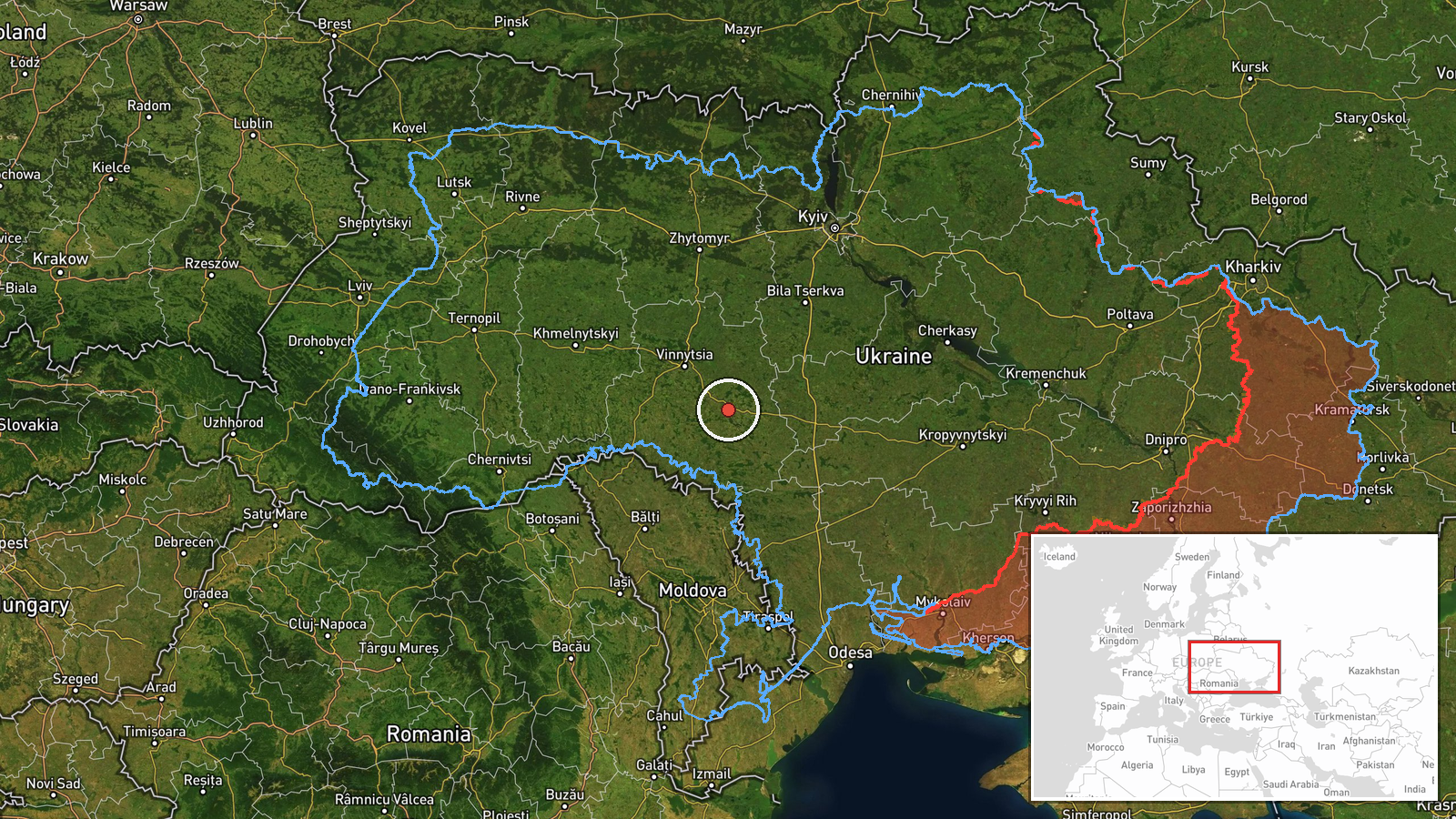
The coordinates (48.84459, 29.06018) are a region-level approximation placed in southeastern Vinnytsia Oblast, not a specific settlement or facility, and location confidence is recorded as low. Vinnytsia Oblast is in west-central Ukraine, and the Southern Bug river runs through its southern part, near Bratslav. Related entries name Bratslav, Nemyriv, Dashiv and Haysyn, which are spread across the oblast. The point should be read as a general area, not as an exact flight path.
Related events nearby
- Ukrainian air monitoring: 1 Russian jet-powered Shahed (Geran-3) drone from Vinnytsia Oblast toward Bratslav.2026-10-16 02:50 UTC · Drone Transit · Bratslav, Ukraine
- Ukrainian air monitoring: 2+ Russian jet-powered Shahed (Geran-3) drones from Vinnytsia Oblast toward Bratslav2026-10-16 01:46 UTC · Drone Transit · Bratslav, Ukraine
- Ukrainian air monitoring: 1 Russian jet-powered Shahed (Geran-3) drone from Vinnytsia Oblast toward Nemyriv.2026-10-16 05:23 UTC · Drone Transit · Nemyriv, Ukraine
- Ukrainian air monitoring: one Russian Shahed-type strike drone tracked near Dashiv, Vinnytsia Oblast, heading 2026-10-16 15:16 UTC · Drone Transit · Dashiv, Ukraine
- Ukrainian air monitoring: 1 Russian jet-powered Shahed (Geran-3) drone passing north of Haysyn, heading north.2026-10-16 04:03 UTC · Drone Transit · north of Haysyn, Ukraine
▶ View this event on the live map

Intel Mapper aggregates open-source reports from monitored Telegram and X channels, geolocates them, cross-checks duplicates across sources and assigns a confidence score. Entries are updated as new confirmations arrive. Read how we verify events.