Single Shahed-type strike drone tracked near Dashiv, Vinnytsia Oblast, heading west
What happened
Ukrainian air monitoring reported on 16 October 2026 at 15:16 UTC that one Russian Shahed-type strike drone was tracked near Dashiv, Vinnytsia Oblast, on a western heading. The original Ukrainian-language post, attributed to a Telegram channel tagged @kpszsu, describes the object as a strike UAV (ударний БпЛА) with the course given as west (курс західний). The wording refers only to a track and direction. It does not mention impact, damage, casualties, or interception, so the message is best read as a brief monitoring notice rather than a report of an attack on a specific target. The post identifies the drone by category rather than by model, so the Shahed classification and the attribution to Russia rest on the general pattern of such drones used in Ukraine rather than on details in the message itself.
Context and assessment
This track is one of several drone reports from Vinnytsia Oblast on the same day. Earlier, at 01:27 UTC, two or more jet-powered Shahed (Geran-3) drones were reported moving from the oblast toward Lypovets, and a further single drone was reported heading toward Lypovets at 01:43. Later in the day, a jet-powered Geran-3 was reported passing Monastyryshche toward Orativ at 09:12, a Shahed-type drone was reported passing Orativ heading west at 14:31, and a Geran-3 was reported north of Haysyn heading north at 04:03. Taken together, the reports show drones crossing the central and northern parts of the oblast from several directions over a single day. The Dashiv track fits that pattern, with the western heading matching the Orativ report but in a different direction from the Haysyn track. Operationally, a lone drone moving west through the oblast may be in transit toward targets farther west, relocating, acting as a decoy, or has lost its original route. The data does not establish a target at Dashiv, and the track alone should not be read as an indication of intent against the settlement.
Sources and confidence
The report rests on a single Telegram channel, and the dataset contains no cross-confirmation from other monitoring channels, regional authorities, or secondary outlets. The confidence score of 8.0 reflects the apparent official-style origin of the monitoring message and the high location confidence, but it is held below the top of the scale because there is only one source and no independent detail about the track. Confidence would rise with corroboration from other air monitoring feeds, regional military administration statements, or track data showing the same heading. It would fall if later reporting contradicts the direction, reclassifies the object as a different aircraft, or shows the track was not in this area.
Location
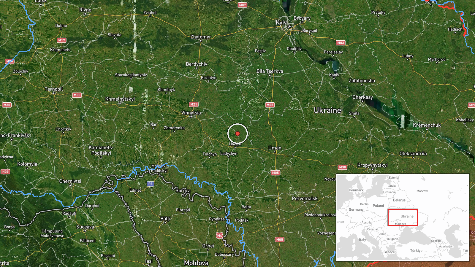
The location is recorded at settlement level, with coordinates of about 49.0035 N and 29.4397 E placed at the Dashiv settlement point rather than at any facility. Location confidence is rated high because the place name appears explicitly in the source message. Dashiv lies in Vinnytsia Oblast in central-west Ukraine, an area of farmland, scattered woodland, and small river valleys. The settlement point should be treated as an approximate reference for the reported track, not as the exact path or position of the drone.
Related events nearby
- Ukrainian air monitoring: 1 Russian jet-powered Shahed (Geran-3) drone passing north of Haysyn, heading north.2026-10-16 04:03 UTC · Drone Transit · north of Haysyn, Ukraine
- Ukrainian air monitoring: 1 Russian Shahed-type drone passing Orativ, heading west.2026-10-16 14:31 UTC · Drone Transit · Orativ, Ukraine
- Ukrainian air monitoring: 1 Russian jet-powered Shahed (Geran-3) drone passing Monastyryshche, heading toward 2026-10-16 09:12 UTC · Drone Transit · Orativ, Ukraine
- Ukrainian air monitoring: 3+ Russian Shahed-type drones passing southeastern Vinnytsia Oblast, heading west.2026-10-16 16:48 UTC · Drone Transit · southeastern Vinnytsia Oblast, Ukraine
- Ukrainian air monitoring: 1 Russian Shahed-type drone heading toward Lypovets.2026-10-16 01:43 UTC · Drone Transit · Lypovets, Ukraine
▶ View this event on the live map

Intel Mapper aggregates open-source reports from monitored Telegram and X channels, geolocates them, cross-checks duplicates across sources and assigns a confidence score. Entries are updated as new confirmations arrive. Read how we verify events.