Single Russian Shahed-type drone reported heading toward Smila, Cherkasy Oblast
What happened
Ukraine's air monitoring service reported on Telegram that one Russian Shahed-type drone was heading toward Smila, a city in Cherkasy Oblast in central Ukraine. The original Ukrainian post, published by the @kpszsu channel, reads as a regional alert stating that a UAV was moving in the direction of Smila, Zvenyhorodka and Khrystynivka. The event is timestamped 16 October 2026 at 18:15 UTC. The report describes no impact, damage, or casualties, and it does not say whether the drone was later shot down or lost. The post refers only to a UAV; the Shahed-type label comes from the event summary rather than the quoted wording.
Context and assessment
Smila matters in this pattern less as a named military objective than as one of several settlements along a drone corridor across Cherkasy and neighboring Kirovohrad Oblasts. Earlier on the same day, air monitoring logged a jet-powered Shahed-type drone heading toward Cherkasy at 01:49 UTC, and a separate report at 04:57 UTC described two or more jet-powered Geran-3 drones passing northern Kirovohrad Oblast and heading west. Larger waves were logged at 06:42, when 149 drones were launched from Oryol, occupied Donetsk and Crimea, and during a daytime attack from 07:00 to 19:00 involving 315 attack drones, 78 of them jet-powered, along with Gerbera decoys and S-8000 Banderol munitions. Against that backdrop, a single drone tracked toward Smila is most plausibly a transit track rather than evidence of a targeted strike on the city. Its rail and industrial links could make it a point of interest, but the report names no facility. Operationally, the sequence suggests drones entering central Ukraine are being followed across successive settlements, and individual alerts often reflect position along a route rather than a confirmed destination.
Sources and confidence
All information comes from a single Telegram channel, @kpszsu, which operates as the official Ukrainian air monitoring account. No independent outlet, wire service, or second channel had confirmed the track at the time of writing, so cross-confirmation is absent. The confidence score of 8.0 reflects the official origin of the channel and the specific, time-stamped nature of the alert, offset by the single-source basis and the lack of follow-up. It would rise if a later official update confirmed the flight path or a downing near Smila, or if independent monitoring data matched the track. It would fall if the drone was reported lost or redirected, or if the channel corrected its wording.
Location
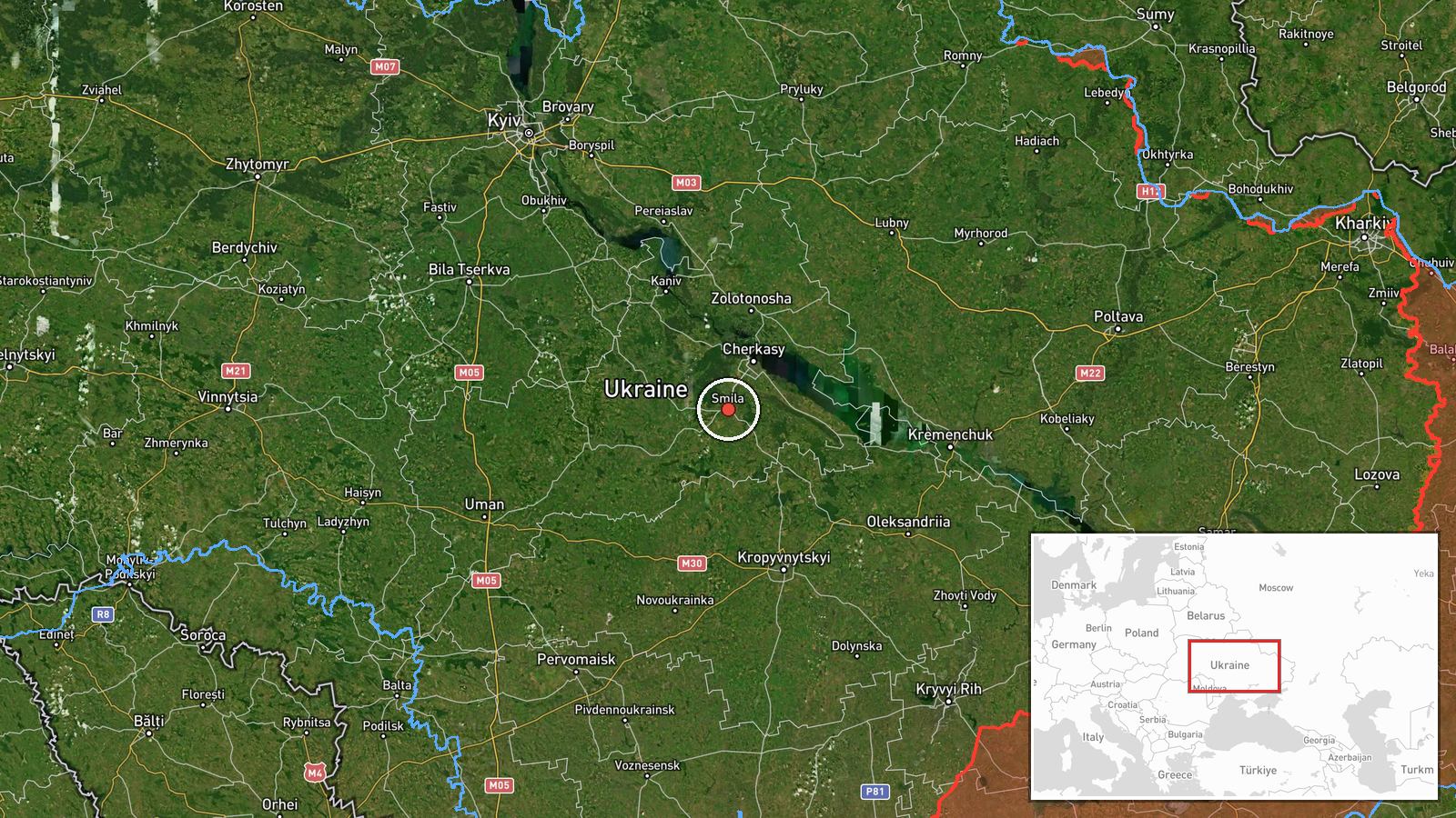
Coordinates place the event at Smila city centre, at settlement precision with high location confidence, since the report names the city directly. Smila lies in Cherkasy Oblast in central Ukraine, on the farmland and forest-steppe plain of the Dnipro basin. The point is an approximation for the settlement, not a specific facility. Zvenyhorodka and Khrystynivka, also named in the original post, are nearby settlements in the same oblast and are not mapped as separate event points.
Related events nearby
- Ukrainian air monitoring: 1 Russian jet-powered Shahed (Geran-3) drone heading toward Cherkasy.2026-10-16 01:49 UTC · Drone Transit · Cherkasy, Ukraine
- Russia launched 315 attack drones (78 jet-powered), plus Gerbera decoys and 15 S-8000 Banderol munitions, agai2026-10-16 16:45 UTC · UAS Strike · Ukraine (nationwide, no specific target named)
- A woman assaulted a military recruitment officer who had come to take her boyfriend for mobilization.2026-10-16 13:58 UTC · Security · Ukraine (location not reported)
- Russia launched 149 Shahed-type, Gerbera and decoy drones from Oryol, occupied Donetsk and Crimea. 114 downed 2026-10-16 06:42 UTC · UAS Strike · Ukraine
- Ukrainian air monitoring: 2+ Russian jet-powered Shahed (Geran-3) drones passing northern Kirovohrad Oblast, h2026-10-16 04:57 UTC · Drone Transit · northern Kirovohrad Oblast, Ukraine
▶ View this event on the live map

Intel Mapper aggregates open-source reports from monitored Telegram and X channels, geolocates them, cross-checks duplicates across sources and assigns a confidence score. Entries are updated as new confirmations arrive. Read how we verify events.