Up to 10 Shahed-type drones reported heading toward southern Odesa Oblast
What happened
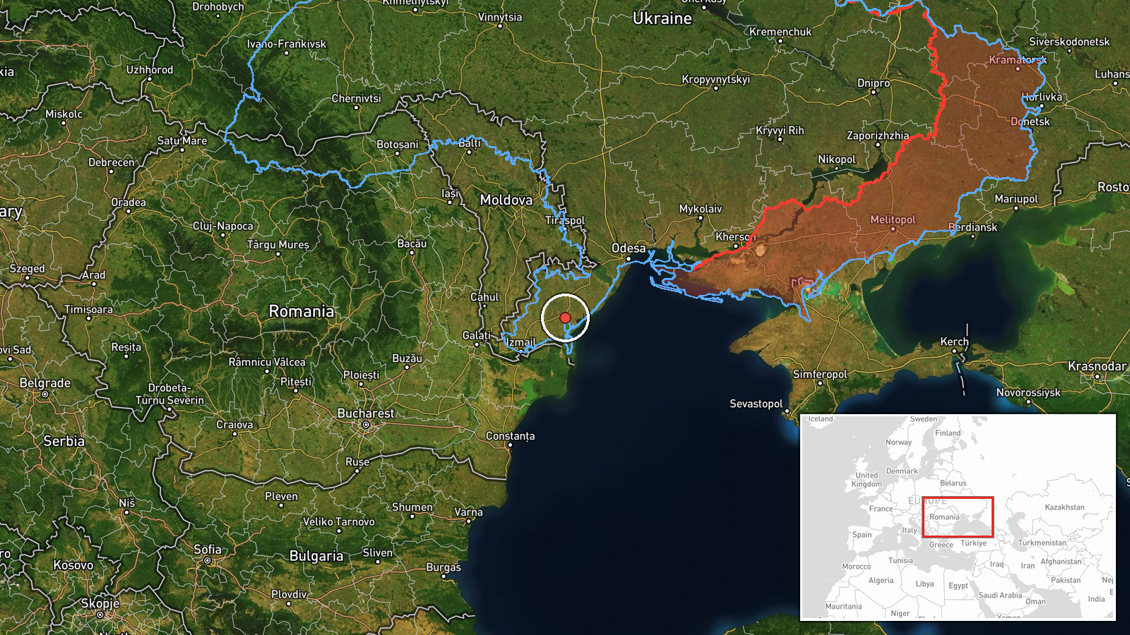
Ukraine's Air Force Telegram channel, @kpszsu, reported on 16 October 2026 at about 21:23 UTC that up to 10 Russian Shahed-type drones were heading toward southern Tatarbunary in Odesa Oblast. The original Ukrainian post described the drones as moving toward the south of the oblast and named Tatarbunary and Vylkove together, wording that leaves the exact target area open. The report is a transit notice from air monitoring. It does not confirm impact and states no casualties, damage, or interception results. The event is attributed to Russia and classified as a drone transit. Because it rests on a single channel and was geolocated only to a regional level, the map pin should be read as an approximate area rather than a confirmed site.
Context and assessment
The report sits within a day of repeated drone activity across Odesa Oblast. Earlier entries show a single jet-powered Geran-3 drone moving from the Black Sea toward southern Odesa Oblast at 01:05 UTC, a group of two or more heading from the oblast toward Mayaky at 01:18, two or more passing western Odesa Oblast northward at 02:41 and 03:20, and a further drone over the oblast at 07:50. This pattern of several small waves over many hours, entering from the sea and moving across the region, is consistent with sustained pressure on the Odesa coast and the Danube corridor, which carries much of Ukraine's grain and port traffic. Operationally, transit reports of this kind usually show routing rather than a confirmed aim point. The southward wording in this report may reflect a track that later turned north, as several earlier entries did, or a shift in targeting that the data cannot establish. Read together, the sequence suggests continued use of the southwestern approach toward Ukrainian-held coastal and Danube areas, but it does not by itself identify a specific intended target.
Sources and confidence
All information comes from one source, the official Ukrainian Air Force monitoring channel on Telegram (@kpszsu), which is the only listed source. No other channel, wire service, or regional authority in the data corroborates the report. The confidence score of 8.0 reflects the channel's official role and its consistency with same-day related reports, offset by the single-source basis, the regional-level geolocation, and the ambiguous mention of two settlements. Confidence would rise with corroboration from Odesa Oblast military authorities, reports of impact or interception in the area, or independent track data. It would fall if a later update revised the direction of travel or if the drones were not confirmed in the stated area.
Location
The coordinates, roughly 45.77 N and 29.61 E, are placed on southern Tatarbunary. The pin was derived from the settlement name in the report, and location confidence is rated low with region-level precision, so the true point could lie elsewhere in the southern district, including near Vylkove. The setting is the flat Budjak lowland between the Dniester and the Danube, an agricultural area with lakes and estuary features to the south and east, close to the Danube delta and the Romanian border.
Related events nearby
- Ukrainian air monitoring: 2+ Russian jet-powered Shahed (Geran-3) drones passing western Odesa Oblast, heading2026-10-16 03:20 UTC · Drone Transit · western Odesa Oblast, Ukraine
- Ukrainian air monitoring: 2+ Russian jet-powered Shahed (Geran-3) drones passing western Odesa Oblast, heading2026-10-16 02:41 UTC · Drone Transit · western Odesa Oblast, Ukraine
- Ukrainian air monitoring: 1 Russian jet-powered Shahed (Geran-3) drone from Black Sea toward southern Odesa Ob2026-10-16 01:05 UTC · Drone Transit · southern Odesa Oblast, Ukraine
- Ukrainian air monitoring: 2+ Russian jet-powered Shahed (Geran-3) drones from Odesa Oblast toward Mayaky.2026-10-16 01:18 UTC · Drone Transit · Mayaky, Ukraine
- Ukrainian air monitoring: 1 Russian jet-powered Shahed (Geran-3) drone over Odesa Oblast.2026-10-16 07:50 UTC · Drone Transit · Odesa Oblast, Ukraine
▶ View this event on the live map

Intel Mapper aggregates open-source reports from monitored Telegram and X channels, geolocates them, cross-checks duplicates across sources and assigns a confidence score. Entries are updated as new confirmations arrive. Read how we verify events.