Single Russian Shahed-type drone reported heading toward Tomashpil, Vinnytsia Oblast
What happened
Ukraine's air monitoring channel on Telegram, @kpszsu, reported on 16 October 2026 at 21:40 UTC that one Russian Shahed-type drone was heading toward Tomashpil in Vinnytsia Oblast. The original Ukrainian-language post was a brief alert stating that a UAV was moving in the direction of Tomashpil and Nemyriv. The wording gives no information about altitude, speed, or whether the drone was jet-powered, and it does not describe any impact or damage. The report is a movement warning rather than a confirmed strike. The event is recorded as a drone transit with Russia as the attributed actor, reflecting the channel's standard attribution of such aerial tracks.
Context and assessment
Tomashpil lies in Vinnytsia Oblast in central-western Ukraine, a region that has repeatedly appeared on the transit routes of long-range drones moving deeper into western Ukraine. The related reports from the same day form a noticeable pattern. Between 01:11 and 02:50 UTC, monitoring messages described one or more jet-powered Shahed-type drones, labeled Geran-3 in the source data, moving from Vinnytsia Oblast toward Tomashpil and Bratslav. A later report placed a single Shahed-type drone passing Vapnyarka and heading west at 16:21. Taken together, these reports suggest a multi-hour sequence of drones crossing the oblast on a broadly southwest-to-west trajectory rather than isolated incidents. Operationally, this may indicate that drones are being routed through corridors that avoid heavily defended areas, or that they are part of longer flights toward targets farther west. Such inferences are speculative, because the data does not identify targets or intended destinations. The recurrence of the same settlements across several alerts also suggests that monitoring focused on these localities as waypoints along the route.
Sources and confidence
The event rests on one Telegram channel, @kpszsu, with no second source in the data, so cross-confirmation is absent. The confidence score of 8.0 reflects a specific, settlement-level aerial alert from a monitoring feed that is consistent with the related same-day reports. It is not higher because the post is a movement warning without independent verification of position or outcome. Corroboration from regional authorities, independent monitoring, or a follow-up impact report would raise confidence, while contradictory updates or a correction would lower it.
Location
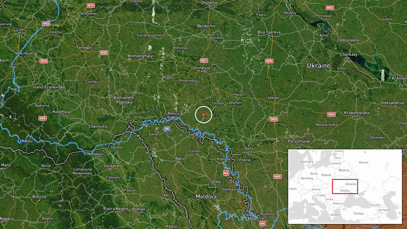
The coordinates correspond to Tomashpil, a settlement, and are recorded at settlement-level precision with high location confidence. The alert named the settlement directly, so the point sits there rather than at a broader oblast center. The area is largely agricultural, with rolling terrain and river valleys in the Southern Bug basin. Bratslav and Nemyriv, both named in the wider reporting, lie to the north-east. These are approximate directional references only, and the drone's position at the time of the post is not specified.
Related events nearby
- Ukrainian air monitoring: 1 Russian jet-powered Shahed (Geran-3) drone from Vinnytsia Oblast toward Tomashpil.2026-10-16 01:11 UTC · Drone Transit · Tomashpil, Ukraine
- Ukrainian air monitoring: 2+ Russian jet-powered Shahed (Geran-3) drones passing southern Vinnytsia Oblast, he2026-10-16 01:41 UTC · Drone Transit · southern Vinnytsia Oblast, Ukraine
- Ukrainian air monitoring: 1 Russian Shahed-type drone passing Vapnyarka, heading west.2026-10-16 16:21 UTC · Drone Transit · Vapnyarka, Ukraine
- Ukrainian air monitoring: 1 Russian jet-powered Shahed (Geran-3) drone from Vinnytsia Oblast toward Bratslav.2026-10-16 02:50 UTC · Drone Transit · Bratslav, Ukraine
- Ukrainian air monitoring: 2+ Russian jet-powered Shahed (Geran-3) drones from Vinnytsia Oblast toward Bratslav2026-10-16 01:46 UTC · Drone Transit · Bratslav, Ukraine
▶ View this event on the live map

Intel Mapper aggregates open-source reports from monitored Telegram and X channels, geolocates them, cross-checks duplicates across sources and assigns a confidence score. Entries are updated as new confirmations arrive. Read how we verify events.