Single Shahed-type drone reported heading toward Zaporizhzhia from the south, per Ukrainian air monitoring
What happened
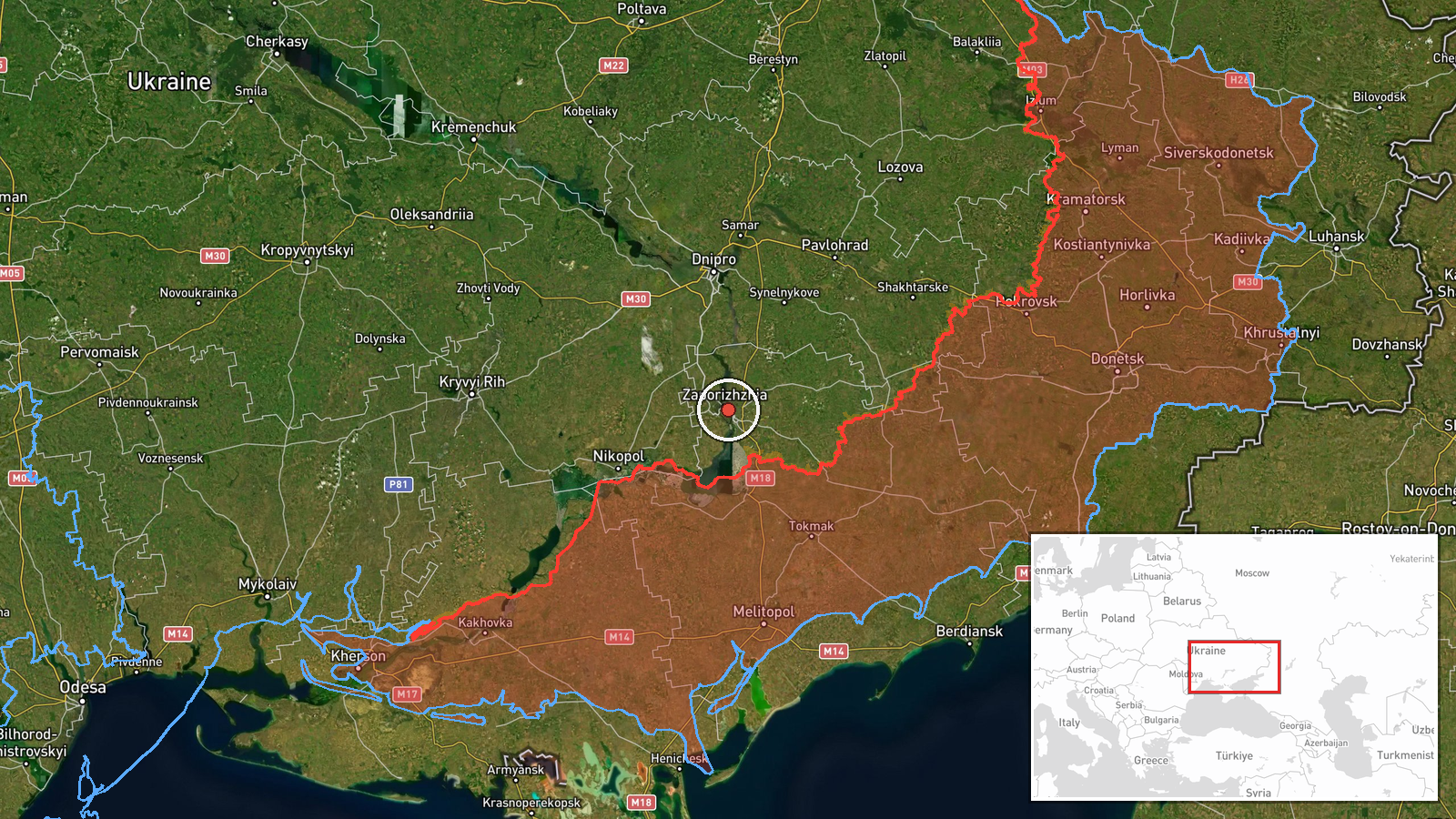
Ukraine's air monitoring channel on Telegram (@kpszsu) reported one Russian Shahed-type drone heading toward Zaporizhzhia on 16 October 2026, with the post logged at 22:53 UTC. The original Ukrainian wording, "БпЛА на Запоріжжя з півдня" (a UAV toward Zaporizhzhia from the south), describes a single unmanned aerial vehicle approaching from the southern direction and does not state a weapon payload, impact, or damage. The report is a transit warning rather than a confirmed strike. The event is recorded at settlement-level precision in Zaporizhzhia, Ukraine. No independent outlet is listed as corroborating the report at the time of logging.
Context and assessment
Zaporizhzhia city sits on the Dnipro River and serves as the administrative center of an oblast that has seen sustained Russian long-range and tactical activity since 2022. Its industrial sites, rail links, and logistics nodes make it a recurring target for drone and missile traffic moving across the front. The related events on the same date show a dense pattern in the region. Earlier that day, a jet-powered Shahed variant (Geran-3) was logged heading toward Zaporizhzhia, and a guided glide bomb was reported heading toward Zaporizhzhya Oblast. Ground combat was also reported in the Huliaipole and Orikhiv directions, and separate drone and glide-bomb transits were logged toward Dnipropetrovsk Oblast. Taken together, these entries suggest coordinated pressure across several oblasts rather than an isolated drone. Single-drone warnings of this kind often precede or accompany larger salvos, but they may also reflect routine reconnaissance or decoy flights. The entry on its own does not establish intent or target.
Sources and confidence
The report comes from a single Telegram channel, @kpszsu, which is linked to Ukraine's air-monitoring reporting. Cross-confirmation is absent at logging, so the event carries a confidence score of 8.0 out of 10 and a source count of one. The score reflects a credible, specific official-style warning and a high-confidence location, offset by the lack of independent corroboration and the transit-only nature of the report. Confidence would rise if regional military administration statements, air-defense reports, or local media confirmed the drone's approach or interception. It would fall if later updates showed the track was misidentified or if the channel retracted or revised the post.
Location
The point is placed at settlement level on Zaporizhzhia city, at approximately 47.84 N, 35.14 E, with high location confidence. The report names the city directly, so the placement is not inferred from an approximate area. Zaporizhzhia lies on the left bank of the Dnipro, near the Kakhovka reservoir's former footprint to the south. The surrounding steppe is largely flat and open, and the river and the large Kakhovka reservoir basin are notable landmarks in the wider region.
Related events nearby
- Ukrainian air monitoring: 1 Russian jet-powered Shahed (Geran-3) drone heading toward Zaporizhzhia.2026-10-16 06:39 UTC · Drone Transit · Zaporizhzhia, Ukraine
- Ukrainian air monitoring: 1 Russian guided glide bomb (KAB) heading toward Zaporizhzhya Oblast.2026-10-16 08:34 UTC · Airstrike · Zaporizhzhya Oblast, Ukraine
- Ukrainian General Staff reports 20 Russian assaults on Huliaipole direction toward Rizdvianka, Dolynka, Hirkyi2026-10-16 05:07 UTC · Combat · Rizdvianka, Zaporizhzhia Oblast, Ukraine
- Ukrainian air monitoring: 1 Russian Shahed-type drone from Kherson Oblast toward Dnipropetrovsk Oblast.2026-10-16 14:31 UTC · Drone Transit · Dnipropetrovsk Oblast, Ukraine
- Ukrainian air monitoring: 1 Russian guided glide bomb (KAB) heading toward Dnipropetrovsk Oblast.2026-10-16 07:00 UTC · Airstrike · Dnipropetrovsk Oblast, Ukraine
▶ View this event on the live map

Intel Mapper aggregates open-source reports from monitored Telegram and X channels, geolocates them, cross-checks duplicates across sources and assigns a confidence score. Entries are updated as new confirmations arrive. Read how we verify events.