Single Shahed-type drone reported passing Arkhanhelske in Kherson Oblast, heading north
What happened
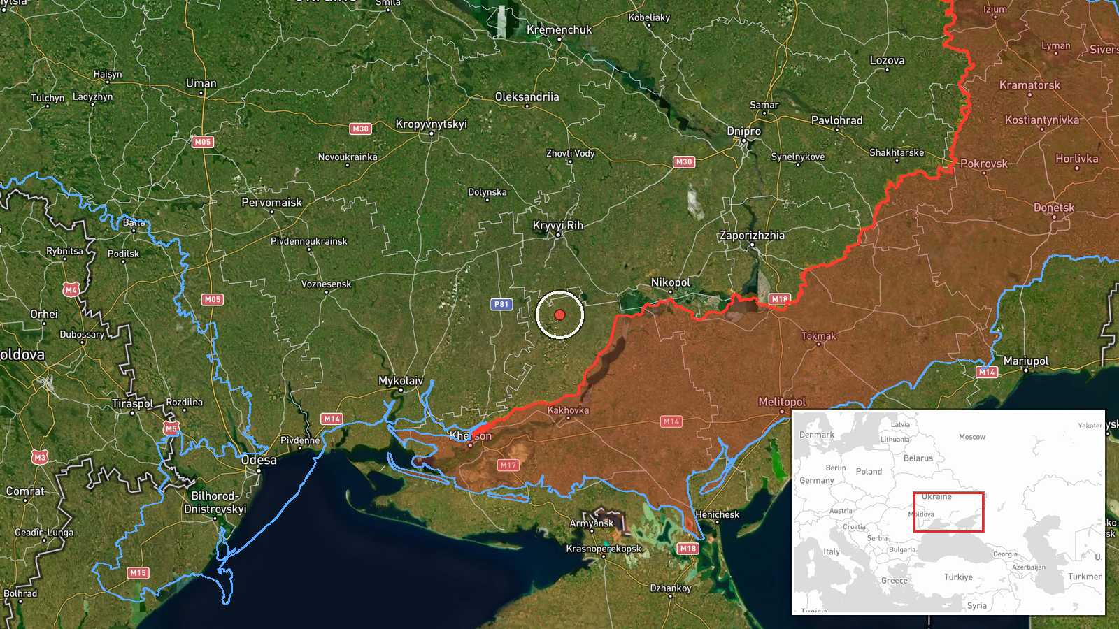
Ukrainian air monitoring channel @kpszsu reported on Telegram at 01:34 UTC on 17 October 2026 that one Russian Shahed-type drone was passing Arkhanhelske, a settlement in the Beryslav district of Kherson Oblast, on a northerly course. The original Ukrainian-language post described the object as a missile ("Ракета"), a term that differs from the drone classification in the summary, so the object type is reported with some inconsistency in the wording. The report does not describe any impact, casualties, or damage at Arkhanhelske. The event is recorded as a drone transit rather than a strike, and it has been logged as a single-source report.
Context and assessment
Arkhanhelske lies on the Dnipro's southern side near the Kherson front, an area that has seen repeated long-range drone traffic since 2022. Shahed-type drones are low-cost, slow-moving loitering weapons often launched in groups to saturate air defenses, and single transits like this one are frequently part of broader raid patterns. The related events in this data set show a sequence within roughly ninety minutes: a Banderol loitering munition southeast of Kryvyi Rih on 16 October at 15:41 UTC, a Shahed-type drone heading toward Velyka Oleksandrivka at 01:43 UTC, and then several objects tracked toward Kryvyi Rih between 01:35 and 01:47 UTC, including a reported ballistic missile at 01:36 UTC. The clustering of northbound tracks through the Beryslav and Kryvyi Rih corridor may indicate a coordinated attack package or a launch wave routed toward the Dnipropetrovsk region. Such an inference remains tentative, because the data does not establish launch sites, numbers, or target assignments for the other objects.
Sources and confidence
The report comes from a single Telegram channel, @kpszsu, which is an official-style Ukrainian air monitoring feed. No independent channel in the data set reports the same Arkhanhelske transit, so cross-confirmation is absent. The confidence score of 8.0 reflects a credible monitoring source with a clear location and time, tempered by the single-source status and the inconsistent object label in the original text. Confidence would rise with corroboration from a second monitoring feed, regional military administration statements, or tracking data matching the same course. It would fall if later reporting reclassified the object or contradicted the northbound heading.
Location
The location is coded at settlement precision for Arkhanhelske, Beryslav district, Kherson Oblast, at approximately 47.43 N, 33.41 E, and the location confidence is rated high. The coordinates likely reflect the settlement centroid rather than an exact point on the track, since the source names only the village. The area is flat steppe bordering the Dnipro River and its irrigation channels, with agricultural land and scattered settlements. The Kakhovka reservoir area and the Dnipro floodplain lie to the east and south, and the river's floodplain shapes both the terrain and the routing of low-altitude drones.
Related events nearby
- Ukrainian air monitoring: 1 Russian Shahed-type drone passing Beryslav district, heading toward Velyka Oleksan2026-10-17 01:43 UTC · Drone Transit · Velyka Oleksandrivka, Ukraine
- Ukrainian air monitoring reports a Russian Banderol loitering munition southeast of Kryvyi Rih, heading north.2026-10-16 15:41 UTC · Cruise Missile · Southeast of Kryvyi Rih, Ukraine
- Ukrainian air monitoring: 1 Russian Shahed-type drone heading toward Kryvyi Rih.2026-10-17 01:47 UTC · Drone Transit · Kryvyi Rih, Ukraine
- Ukrainian air monitoring: 1 Russian ballistic missile heading toward Kryvyi Rih.2026-10-17 01:36 UTC · Ballistic Missile · Kryvyi Rih, Ukraine
- Ukrainian air monitoring: 1 Russian Shahed-type drone from Kherson Oblast toward Kryvyi Rih.2026-10-17 01:35 UTC · Drone Transit · Kryvyi Rih, Ukraine
▶ View this event on the live map

Intel Mapper aggregates open-source reports from monitored Telegram and X channels, geolocates them, cross-checks duplicates across sources and assigns a confidence score. Entries are updated as new confirmations arrive. Read how we verify events.