Ukrainian monitors report one Russian drone heading toward Kryvyi Rih from Kherson Oblast
What happened
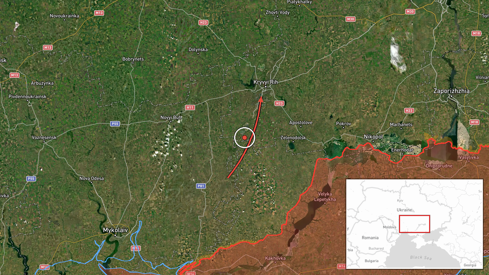
Ukrainian air monitoring, relayed through the Telegram channel @kpszsu, reported that one Russian Shahed-type drone was moving from Kherson Oblast toward Kryvyi Rih, with the alert logged at 01:35 UTC on 17 October 2026. The channel's original Ukrainian wording, translated, reads 'Missiles from the Kherson region, course toward Kryvyi Rih.' That text uses the plural for missiles and does not name a drone, so the drone identification in the summary is an editorial reading rather than a direct quote. The alert describes movement toward the city only and reports no strike, impact, or casualties. It sits within a cluster of overnight air alerts over Kryvyi Rih, logged in the hours before and after.
Context and assessment
Kryvyi Rih is a large industrial city in Dnipropetrovsk Oblast, known for iron ore mining and steel production, and its infrastructure has made it a recurring subject of air alerts in the broader southern Ukraine theatre. Its position north of the Kherson front line places it within reach of long-range drones launched from or routed across the south. The related events show a dense pattern on the same night: a Shahed-type drone flagged at 20:46 on 16 October, another from Dnipropetrovsk Oblast at 01:23, a ballistic missile warning at 01:36, a further drone alert at 01:47, and a 01:49 update noting a drone over the city with no impact reported. Taken together, the sequence suggests repeated, possibly multi-axis probing or sustained transit activity rather than a single isolated launch. Operationally, such patterns are often read as attempts to saturate air defences, to test alert response, or to strike targets along the route, though the reporting here does not establish which. Short-interval alerts without confirmed impacts are common in this kind of monitoring feed, and they should be read as indications of threat movement, not of damage.
Sources and confidence
The only source is the Telegram channel @kpszsu, which relays Ukrainian air monitoring messages. No independent outlet or second channel is listed as confirming this specific alert, so cross-confirmation is absent. The confidence score of 8.0 is relatively high for a single-source entry, likely reflecting the channel's official-style role and its consistency with the surrounding alert sequence for the same city. Confidence would rise with corroboration from Ukrainian air force statements, regional military administration reports, or independent tracking of the drone's route. It would fall if the channel later revised the object type from missiles to drones or if the alert were not matched by any subsequent official update.
Location
The event is geolocated to Kryvyi Rih at settlement precision, with high location confidence, because the alert names the city as the target direction rather than a specific facility. The coordinates, roughly 47.91 N and 33.39 E, place the marker at the city's general centre. Kryvyi Rih is an elongated city stretching along the Inhulets River valley, with mining pits, industrial zones, and steel works on its outskirts. The Kherson Oblast origin is not a precise launch point but a broad direction of travel.
Related events nearby
- Ukrainian air monitoring reports a Russian Shahed-type UAV over Kryvyi Rih; no strike or impact reported.2026-10-17 01:49 UTC · Drone Transit · Kryvyi Rih, Dnipropetrovsk Oblast, Ukraine
- Ukrainian air monitoring: 1 Russian Shahed-type drone heading toward Kryvyi Rih.2026-10-17 01:47 UTC · Drone Transit · Kryvyi Rih, Ukraine
- Ukrainian air monitoring: 1 Russian ballistic missile heading toward Kryvyi Rih.2026-10-17 01:36 UTC · Ballistic Missile · Kryvyi Rih, Ukraine
- Ukrainian air monitoring: 1 Russian Shahed-type drone from Dnipropetrovsk Oblast toward Kryvyi Rih.2026-10-17 01:23 UTC · Drone Transit · Kryvyi Rih, Ukraine
- Ukrainian air monitoring: 1 Russian Shahed-type drone heading toward Kryvyi Rih.2026-10-16 20:46 UTC · Drone Transit · Kryvyi Rih, Ukraine
▶ View this event on the live map

Intel Mapper aggregates open-source reports from monitored Telegram and X channels, geolocates them, cross-checks duplicates across sources and assigns a confidence score. Entries are updated as new confirmations arrive. Read how we verify events.