Single Russian Shahed-type drone reported on course for Kryvyi Rih from the south
What happened
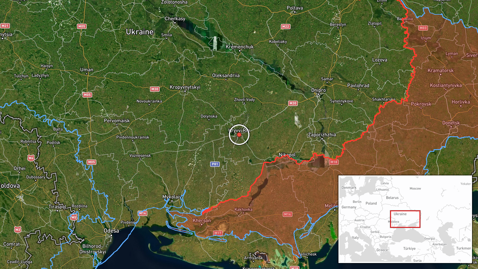
Ukrainian air monitoring on the Telegram channel @kpszsu reported at 20:46 UTC on 16 October 2026 that one Russian Shahed-type drone was heading toward Kryvyi Rih. The original Ukrainian wording, 'БпЛА курсом на Кривий Ріг з півдня,' translates roughly as an unmanned aerial vehicle on course for Kryvyi Rih from the south. The post does not give altitude, speed, or any impact. It is a warning about a track, not a confirmed strike, and it does not say whether the drone was intercepted, diverted, or continued past the city. The event is mapped at settlement level to Kryvyi Rih, a large industrial city in Dnipropetrovsk oblast, so the pin reflects the named city rather than a specific target inside it.
Context and assessment
The alert sits within a sequence of drone tracks reported earlier the same day across central Ukraine. At 01:23 a jet-powered Geran-3 was reported passing south of Kropyvnytskyi heading west, and at 04:45 two or more Geran-3 drones were reported south of Kremenchuk heading west. At 14:40 a Shahed-type drone passed Oleksandriya heading west. At 15:41 a Russian Banderol loitering munition was reported southeast of Kryvyi Rih heading north, although the event type in the feed is listed as cruise missile, a discrepancy worth noting. At 19:44 a Shahed-type drone was reported heading toward Kropyvnytskyi, and the Kryvyi Rih track follows roughly an hour later. Taken together, the headings suggest a corridor of activity moving through the Dnipro basin toward the north and west, with Kryvyi Rih lying on its southern approach. Kryvyi Rih matters because of its steel, iron ore, and mining base, and because its location on the central-southern front approach makes it a recurring point of interest. Operationally, a cluster of single-drone transit notices in one belt may indicate a wave of separate launches, a routing pattern, or simply dense air-defence tracking. The data alone cannot distinguish these explanations, so the sequence should be read as a pattern of reported movement rather than evidence of intent against a particular facility.
Sources and confidence
The event rests on one channel, the Telegram account @kpszsu, which publishes Ukrainian air monitoring updates. No independent outlet or second channel in the data confirms the track, so it is classed as single-source. The confidence score of 8.0 is relatively high for a single source, reflecting the consistency of the channel's track reporting and the fact that it is an established monitoring feed, but it is not higher because the post gives no outcome and no independent verification. Confidence would rise with corroboration from regional military administration statements, Air Force reporting, a reported interception or impact, or other tracking accounts. It would fall if later updates revised the track, reported no sighting, or contradicted the heading.
Location
The location is recorded at settlement precision with high confidence, placed at approximately 47.91 N, 33.39 E, which corresponds to the city of Kryvyi Rih rather than a named facility. The city is elongated along a narrow river valley in central Ukraine, with a dense industrial core and surrounding residential districts. Kropyvnytskyi and Kremenchuk, both referenced in the related events, lie to the northwest and north-east along the Dnipro corridor. The city is therefore a reasonable reference point for a drone transit notice, though the exact track position within the city is not known.
Related events nearby
- Ukrainian air monitoring reports a Russian Banderol loitering munition southeast of Kryvyi Rih, heading north.2026-10-16 15:41 UTC · Cruise Missile · Southeast of Kryvyi Rih, Ukraine
- Ukrainian air monitoring: 1 Russian Shahed-type drone passing Oleksandriya, heading west.2026-10-16 14:40 UTC · Drone Transit · Oleksandriya, Ukraine
- Ukrainian air monitoring: 1 Russian jet-powered Shahed (Geran-3) drone passing south of Kropyvnytskyi, heading2026-10-16 01:23 UTC · Drone Transit · south of Kropyvnytskyi, Ukraine
- Ukrainian air monitoring: 2+ Russian jet-powered Shahed (Geran-3) drones passing south of Kremenchuk, heading 2026-10-16 04:45 UTC · Drone Transit · south of Kremenchuk, Ukraine
- Ukrainian air monitoring: 1 Russian Shahed-type drone heading toward Kropyvnytskyi.2026-10-16 19:44 UTC · Drone Transit · Kropyvnytskyi, Ukraine
▶ View this event on the live map

Intel Mapper aggregates open-source reports from monitored Telegram and X channels, geolocates them, cross-checks duplicates across sources and assigns a confidence score. Entries are updated as new confirmations arrive. Read how we verify events.