Ukrainian air monitoring reports Russian Banderol loitering munition southeast of Kryvyi Rih
What happened
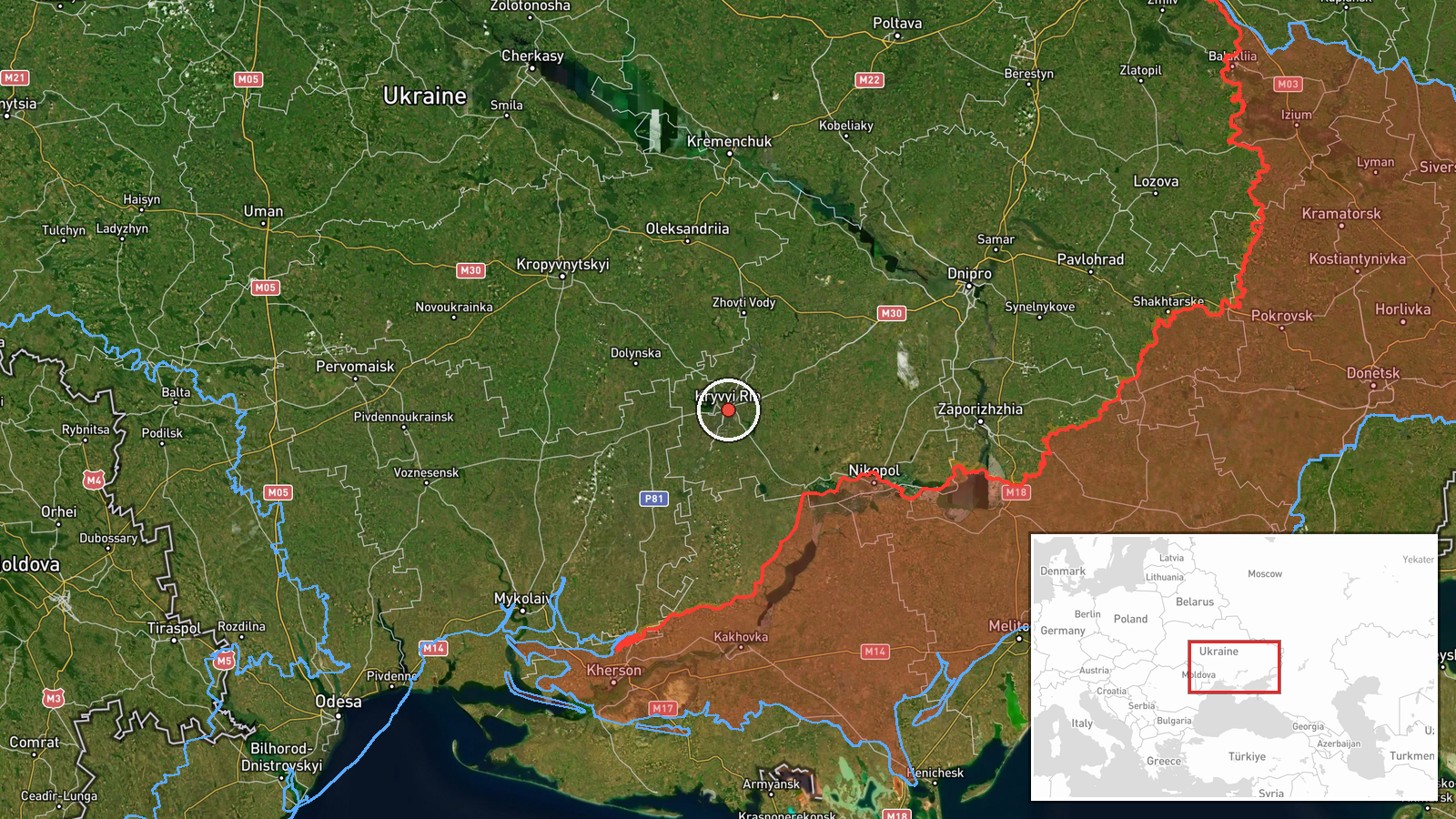
Ukrainian air monitoring reported at 15:41 UTC on 16 October 2026 that a Russian loitering munition identified as a Banderol was flying on a northerly heading southeast of Kryvyi Rih in Dnipropetrovsk region. The single report was posted to the Telegram channel @kpszsu. Its original wording describes a 'баражуючий боєприпас', or loitering munition, rather than a missile, while the event record labels the attack type as cruise missile. The record does not resolve this mismatch. The report describes no impact, damage, casualties, or interception. It gives only a general position and direction of travel, so the object's path and endpoint are not established by the source.
Context and assessment
Kryvyi Rih is a large industrial city in central Ukraine, known for iron ore mining and steel production, and it is a rail and road hub, which gives it logistical weight. The same day's related events show a sustained pattern of Russian Shahed-type and jet-powered Geran-3 drone transits across central Ukraine. One drone passed south of Kropyvnytskyi at 01:23 UTC, two or more passed south of Kremenchuk at 04:45, three or more were directed toward Kropyvnytskyi at 09:31, and further groups were reported near Oleksandriya and the Kamianske district in the afternoon. These staggered reports point to a long-duration flow of drones along a broad corridor rather than a single raid. Against that background, a loitering munition heading north near Kryvyi Rih could reflect an effort to test air defenses in a different area, or it could be a separate tasking running alongside the drone traffic. The available data cannot confirm intent, the intended target, or whether the object was intercepted. The cruise missile label conflicts with the loitering munition description and should be treated with caution.
Sources and confidence
The event rests on one Telegram channel, @kpszsu, which is widely associated with Ukrainian Air Force air monitoring. No second channel, radar feed, or official follow-up in the record independently confirms the report. The confidence score of 8.0 reflects a specific, time-stamped posting from a channel with an established monitoring role, offset by single-source status and the unresolved mismatch between the loitering munition wording and the cruise missile label. Confidence would rise with a second monitoring source, an official statement, or reports of impact or wreckage. It would fall if the object were identified as a different system or if the channel corrected its description.
Location
The location is a regional reference, southeast of Kryvyi Rih, rather than a confirmed settlement or facility. The coordinates given, 47.906 N and 33.394 E, fall in the general area of the city, so they should be read as an approximate placement and not a precise track point. Kryvyi Rih is a long city stretched along the Ingulets River valley, surrounded by steppe, mining districts, and industrial zones. The open steppe terrain offers little natural cover for low-flying objects.
Related events nearby
- Ukrainian air monitoring: 1 Russian Shahed-type drone passing Oleksandriya, heading west.2026-10-16 14:40 UTC · Drone Transit · Oleksandriya, Ukraine
- Ukrainian air monitoring: 1 Russian jet-powered Shahed (Geran-3) drone passing south of Kropyvnytskyi, heading2026-10-16 01:23 UTC · Drone Transit · south of Kropyvnytskyi, Ukraine
- Ukrainian air monitoring: 2+ Russian jet-powered Shahed (Geran-3) drones passing south of Kremenchuk, heading 2026-10-16 04:45 UTC · Drone Transit · south of Kremenchuk, Ukraine
- Ukrainian air monitoring: 3+ Russian jet-powered Shahed (Geran-3) drones heading toward Kropyvnytskyi.2026-10-16 09:31 UTC · Drone Transit · Kropyvnytskyi, Ukraine
- Ukrainian air monitoring: 2+ Russian jet-powered Shahed (Geran-3) drones heading toward Kamianske district.2026-10-16 14:34 UTC · Drone Transit · Kamianske district, Ukraine
▶ View this event on the live map

Intel Mapper aggregates open-source reports from monitored Telegram and X channels, geolocates them, cross-checks duplicates across sources and assigns a confidence score. Entries are updated as new confirmations arrive. Read how we verify events.