Ukrainian air monitoring reports 3+ jet-powered Shahed drones heading toward Kropyvnytskyi
What happened
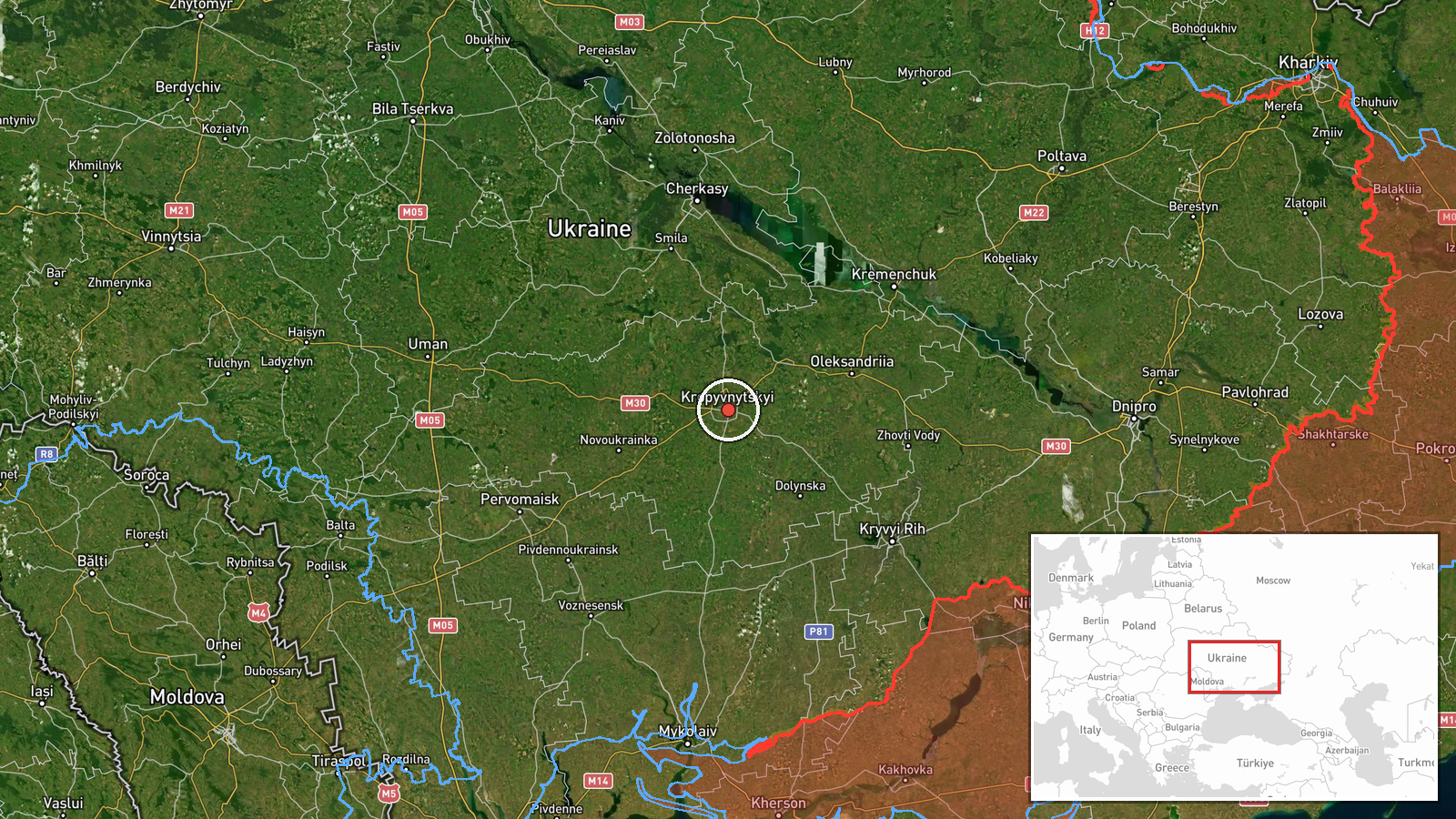
Ukrainian air monitoring reported at 09:31 UTC on 16 October 2026 that three or more Russian jet-powered Shahed (Geran-3) drones were heading toward Kropyvnytskyi from the south. The report was posted on Telegram by the channel @kpszsu and is the only source logged for the event, so it rests on a single channel. The original Ukrainian wording describes groups of jet-powered UAVs moving toward the city from the south, and the record gives the count as 3+ rather than a confirmed figure. The location is recorded at settlement level for Kropyvnytskyi in central Ukraine. The event is classed as a drone transit, meaning the report describes aircraft approaching or passing through an area rather than a confirmed impact. No strike outcome, casualties, or damage is recorded for this item.
Context and assessment
Kropyvnytskyi, the administrative centre of Kirovohrad Oblast, lies on the main north-south and east-west transport corridors of central Ukraine, which makes it a recurring point of interest for aerial routing. The related events show a sustained pattern on the same morning. Between 01:21 and 01:23 UTC, single and multiple Geran-3 drones were reported passing north and south of the city, all heading west. At 04:45 and 04:57, further groups were logged south of Kremenchuk and across northern Kirovohrad Oblast, again moving west. The report at 09:31 differs in direction, placing drones approaching from the south toward the city itself. At 06:42, a much larger package of 149 Shahed-type, Gerbera and decoy drones was reported launched from Oryol, occupied Donetsk and Crimea, with 114 downed or suppressed and 27 hits at 24 locations. Operationally, a sequence of transits along a corridor can be consistent with route probing, decoy activity, or drones being steered around air defence concentrations, but the data alone does not establish which. The timing relative to the larger launch suggests the city sits within a wider wave rather than an isolated target.
Sources and confidence
The item rests on one Telegram channel, @kpszsu, which publishes Ukrainian air monitoring updates and is widely used for real-time aerial alerts. No independent second report is logged, so cross-confirmation is absent. The confidence score of 8.0 reflects the channel's routine use for this type of alert, the high location precision, and consistency with several other transit reports in the same hours. It is not higher because the count is given as 3+ and no impact or interception outcome has been published. Confidence would rise with confirmation from an official air force statement, regional military administration, or a matching report from another monitoring source. It would fall if the track were revised, the drones were attributed to a different area, or no follow-up appeared.
Location
The location is recorded at settlement level for Kropyvnytskyi, with coordinates 48.51 N, 32.27 E and high location confidence. The point marks the city rather than a specific facility or street. Kropyvnytskyi sits in the flat steppe of central Ukraine, on the Inhul River, with Kremenchuk to the east and other Kirovohrad Oblast settlements to the north and south. The surrounding terrain offers little natural cover from low-flying aircraft, and the area is served by major roads and rail lines.
Related events nearby
- Ukrainian air monitoring: 1 Russian jet-powered Shahed (Geran-3) drone passing south of Kropyvnytskyi, heading2026-10-16 01:23 UTC · Drone Transit · south of Kropyvnytskyi, Ukraine
- Ukrainian air monitoring: 1 Russian jet-powered Shahed (Geran-3) drone passing north of Kropyvnytskyi, heading2026-10-16 01:21 UTC · Drone Transit · north of Kropyvnytskyi, Ukraine
- Russia launched 149 Shahed-type, Gerbera and decoy drones from Oryol, occupied Donetsk and Crimea. 114 downed 2026-10-16 06:42 UTC · UAS Strike · Ukraine
- Ukrainian air monitoring: 2+ Russian jet-powered Shahed (Geran-3) drones passing northern Kirovohrad Oblast, h2026-10-16 04:57 UTC · Drone Transit · northern Kirovohrad Oblast, Ukraine
- Ukrainian air monitoring: 2+ Russian jet-powered Shahed (Geran-3) drones passing south of Kremenchuk, heading 2026-10-16 04:45 UTC · Drone Transit · south of Kremenchuk, Ukraine
▶ View this event on the live map

Intel Mapper aggregates open-source reports from monitored Telegram and X channels, geolocates them, cross-checks duplicates across sources and assigns a confidence score. Entries are updated as new confirmations arrive. Read how we verify events.