Russian Shahed-type drone reported moving west past Oleksandriya, Kirovohrad oblast
What happened
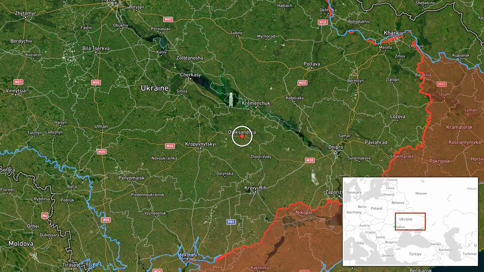
Ukrainian air monitoring reported at 14:40 UTC on 16 October 2026 that one Russian Shahed-type drone was passing the Oleksandriya area of Kirovohrad oblast and heading west. The original Ukrainian-language post, published on the Telegram channel @kpszsu, describes strike UAVs (ударні БпЛА) moving on a western course in the area of several settlements, naming Pavlysh, Oleksandriya, Livsove and Holovanivske. The post uses the plural, while the event summary records a single drone, so the exact count is unclear. The source describes movement only. It reports no impact, casualties, or damage, and the event is logged as a transit rather than a strike on a specific target.
Context and assessment
This report is one of several drone-transit alerts issued on 16 October 2026 that concern the same general corridor of central Ukraine. Earlier that day, a report placed two or more jet-powered Shahed (Geran-3) drones south of Kremenchuk, also heading west. Between 01:08 and 11:09 UTC, further alerts described groups of one to three or more drones heading toward Kremenchuk, a city on the Dnipro with a major hydroelectric dam and industrial sites. The sequence suggests that drones were being tracked over a sustained period across a route that runs from the Dnipro area toward the west, with Oleksandriya lying along that track. Operationally, a westward track through this region may indicate routing toward targets farther west, a decoy or saturation pattern, or simply transit through airspace on a longer flight path. The data alone cannot establish which of these applies, and no link to a specific intended target is documented here.
Sources and confidence
The event rests on a single Telegram channel, @kpszsu, which is widely associated with Ukraine's Air Force and is generally treated as an official monitoring source. No independent outlet or second channel has been logged as confirming this specific report. The confidence score of 8.0 reflects the official-looking origin and its consistency with nearby related reports, but it is held below the maximum because the event is single-sourced and the drone count is inconsistent between the summary and the original text. Confidence would rise with independent confirmation, radar or flight-tracking corroboration, or an official statement from the Air Force. It would fall if the report were corrected or if the track were attributed to a different airframe.
Location
The location is a settlement-level match on Oleksandriya, a town in western-central Kirovohrad oblast, at approximately 48.675 N, 33.118 E. Location confidence is rated high. The original post names several nearby settlements, including Pavlysh, Livsove and Holovanivske, which indicates the track passed through a cluster of communities rather than a single fixed site. The surrounding terrain is largely flat steppe and farmland, with river valleys and open fields that offer few natural barriers to low-flying drones.
Related events nearby
- Ukrainian air monitoring: 2+ Russian jet-powered Shahed (Geran-3) drones passing south of Kremenchuk, heading 2026-10-16 04:45 UTC · Drone Transit · south of Kremenchuk, Ukraine
- Ukrainian air monitoring: 1 Russian Shahed-type drone heading toward Kremenchuk.2026-10-16 11:09 UTC · Drone Transit · Kremenchuk, Ukraine
- Ukrainian air monitoring: 3+ Russian Shahed-type drones heading toward Kremenchuk.2026-10-16 10:52 UTC · Drone Transit · Kremenchuk, Ukraine
- Ukrainian air monitoring: 3+ Russian Shahed-type drones heading toward Kremenchuk.2026-10-16 10:18 UTC · Drone Transit · Kremenchuk, Ukraine
- Ukrainian air monitoring: 2+ Russian jet-powered Shahed (Geran-3) drones heading toward Kremenchuk.2026-10-16 01:08 UTC · Drone Transit · Kremenchuk, Ukraine
▶ View this event on the live map

Intel Mapper aggregates open-source reports from monitored Telegram and X channels, geolocates them, cross-checks duplicates across sources and assigns a confidence score. Entries are updated as new confirmations arrive. Read how we verify events.