Ukrainian air monitoring reports one Shahed-type drone heading toward Kryvyi Rih
What happened
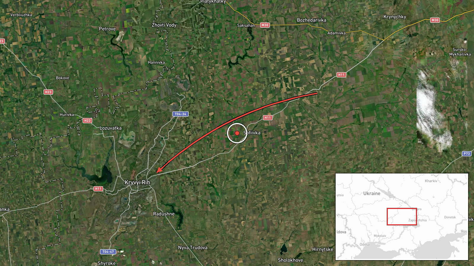
Ukrainian air monitoring reported one Russian Shahed-type drone moving from Dnipropetrovsk Oblast on a course toward Kryvyi Rih, a city in central Ukraine. The alert was posted on Telegram at 01:23 UTC on 17 October 2026. The original Ukrainian-language message describes an unmanned aerial vehicle (БпЛА) in the Dnipropetrovsk area on a heading to Kryvyi Rih. It does not state a strike, impact, or damage. The summary attributes the drone to Russia and classifies the event as a drone transit, meaning a track observed in flight rather than a confirmed attack on a target. The available data reports no casualties, impacts, or interceptions. The report comes from a single channel, and the drone's flight path after the message is not documented.
Context and assessment
Kryvyi Rih is a large industrial city whose iron ore mining and steel production make it a recurring subject of long-range strike planning, and its rail and power infrastructure add to its value as a target. The related events show a dense pattern of drone activity across the same corridor on 16 October. A Shahed-type drone passed Oleksandriya heading west at 14:40. A Banderol loitering munition was tracked southeast of Kryvyi Rih heading north at 15:41. A Shahed-type drone was reported heading toward Kropyvnytskyi at 19:44, and another was reported heading toward Kryvyi Rih at 20:46. Earlier that day, two or more jet-powered Geran-3 drones passed south of Kremenchuk heading west. Taken together, these tracks suggest several systems moving through central Ukraine in a short window. Operationally, this may indicate routing toward targets farther west, reconnaissance, or decoy activity. Shahed-type drones are often flown in larger waves to saturate air defenses, so a single track like this one may be part of a broader movement. The single report alone cannot establish the intended target.
Sources and confidence
All information comes from one Telegram channel, @kpszsu, with no independent cross-confirmation in the data. The confidence score of 8.0 reflects the channel's role in routine air monitoring, the specific heading and location detail, and consistency with several related tracks reported the same day. It is held below the maximum because there is no second source, no imagery, and no official confirmation of the track. Confidence would rise with corroboration from a second independent channel, a Ukrainian Air Force statement, or local official reports of sound or impacts. It would fall if later reports revised the heading, identified a different aircraft type, or contradicted the track. The event is not marked as corrected.
Location
Coordinates are at settlement precision, placed at the approximate centre of Kryvyi Rih, with high location confidence. The origin is recorded only as Dnipropetrovsk Oblast from the message, not as a specific launch site. Kryvyi Rih sits in central Ukraine's steppe zone and stretches along a long north-south axis beside the Inhulets River valley. Its mining pits, steel works, and rail lines are notable landmarks in the surrounding area.
Related events nearby
- Ukrainian air monitoring reports a Russian Shahed-type UAV over Kryvyi Rih; no strike or impact reported.2026-10-17 01:49 UTC · Drone Transit · Kryvyi Rih, Dnipropetrovsk Oblast, Ukraine
- Ukrainian air monitoring: 1 Russian Shahed-type drone heading toward Kryvyi Rih.2026-10-17 01:47 UTC · Drone Transit · Kryvyi Rih, Ukraine
- Ukrainian air monitoring: 1 Russian ballistic missile heading toward Kryvyi Rih.2026-10-17 01:36 UTC · Ballistic Missile · Kryvyi Rih, Ukraine
- Ukrainian air monitoring: 1 Russian Shahed-type drone from Kherson Oblast toward Kryvyi Rih.2026-10-17 01:35 UTC · Drone Transit · Kryvyi Rih, Ukraine
- Ukrainian air monitoring: 1 Russian Shahed-type drone heading toward Kryvyi Rih.2026-10-16 20:46 UTC · Drone Transit · Kryvyi Rih, Ukraine
▶ View this event on the live map

Intel Mapper aggregates open-source reports from monitored Telegram and X channels, geolocates them, cross-checks duplicates across sources and assigns a confidence score. Entries are updated as new confirmations arrive. Read how we verify events.