Shahed-type drone reported over Kryvyi Rih; no strike or impact reported by monitoring channel
What happened
A Ukrainian air monitoring post on the Telegram channel @kpszsu reported a Russian Shahed-type unmanned aerial vehicle over Kryvyi Rih, in Dnipropetrovsk Oblast, at approximately 01:49 UTC on 17 October 2026. The original post is brief, consisting of a drone-symbol emoji and the Ukrainian phrase noting a UAV over the city. The report does not describe any explosion, strike, or damage, and no impact is recorded in the event data. The attribution to Russia and the drone type come from the monitoring channel's standard alert format rather than from independent confirmation of the aircraft's origin or characteristics.
Context and assessment
Kryvyi Rih is a large industrial city in central Ukraine, home to iron ore mining and steelmaking infrastructure, and it lies within easy range of drones launched from Russian-held territory to the south. The event is one of a sequence of alerts over roughly five hours on 16 and 17 October. Earlier entries cover a drone reported at 20:46 UTC on 16 October, followed by drones at 01:23 and 01:35 UTC, the latter described as coming from Kherson Oblast, and a ballistic missile flagged at 01:36 UTC. The drone at 01:47 UTC then precedes the event reported at 01:49 UTC. Taken together, the pattern suggests repeated, overlapping launches aimed at the same city rather than an isolated flight. Operationally, a cluster of this kind may indicate a sustained attack wave, a decoy pattern intended to saturate air defenses, or simply continuing approaches by drones already in flight. The alerts alone cannot distinguish between these possibilities, and the sequence does not by itself establish an intended target within the city.
Sources and confidence
The event rests on a single Telegram channel, @kpszsu, which is the Ukrainian air force monitoring account. The channel's report is terse and consistent with its routine alert format, and the related events come from the same source, so they do not constitute independent confirmation. No second outlet has been identified reporting this specific drone. The confidence score of 8.0 reflects a credible official-type channel with a clear timestamp and location, offset by the absence of cross-confirmation and the lack of any corroborating impact or wreckage report. Confidence would rise with a second independent observation, such as a regional military administration statement or local media geolocated footage. It would fall if later official updates contradicted the alert or if the drone's track were reported as leaving the area without approach to the city.
Location
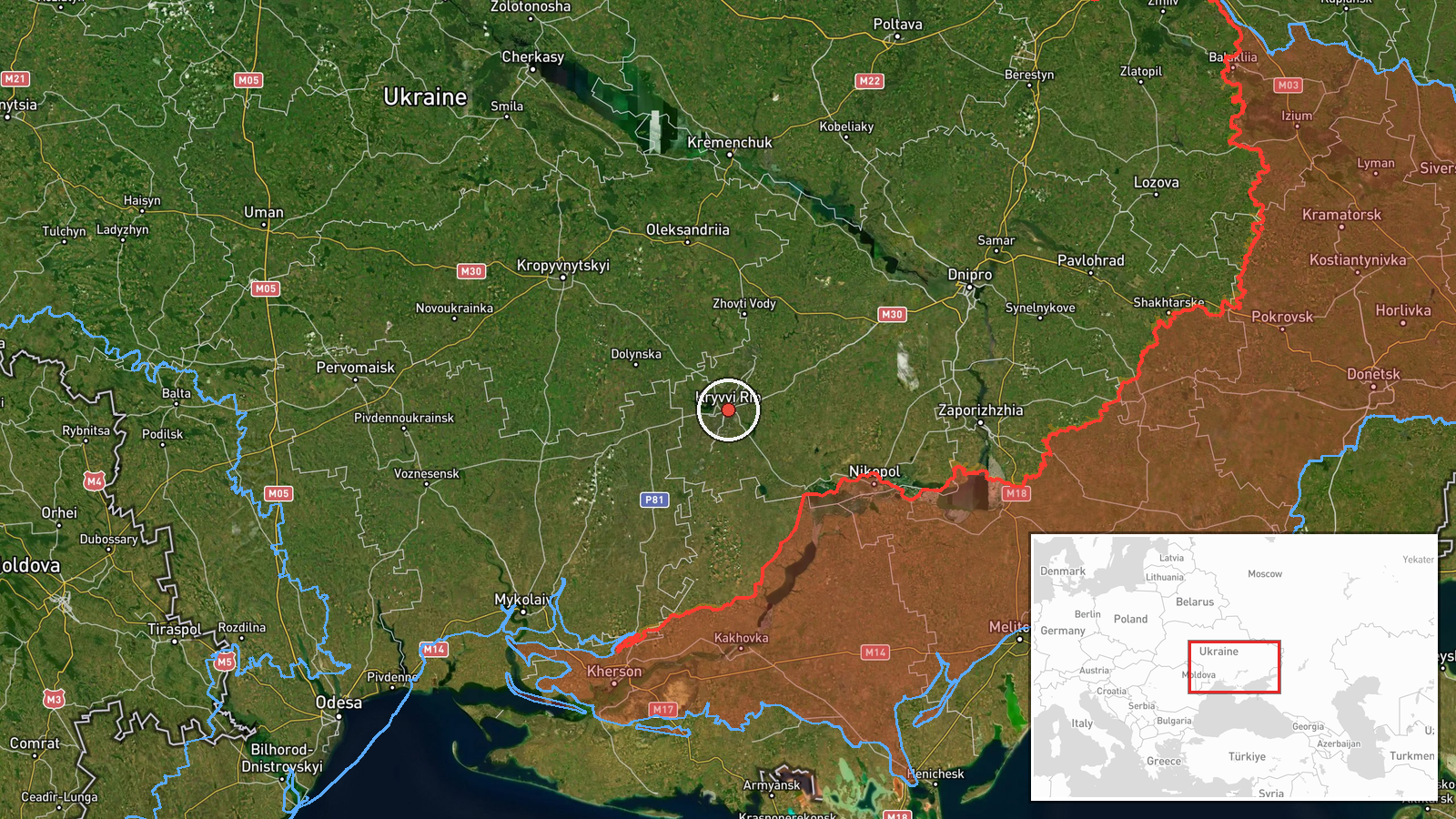
The location is recorded at settlement level, placing the event at the city of Kryvyi Rih at approximately 47.91 N, 33.39 E. The alert refers to the city as a whole rather than a specific facility, so the coordinates mark the settlement center and do not indicate a target. Kryvyi Rih stretches along the Ingulets River valley and is notably long and narrow, extending for many kilometers north to south. Its industrial zones and mining operations lie on the edges of the urban core, while the surrounding steppe terrain is largely open and flat, which affects how drones are detected and tracked.
Related events nearby
- Ukrainian air monitoring: 1 Russian Shahed-type drone heading toward Kryvyi Rih.2026-10-17 01:47 UTC · Drone Transit · Kryvyi Rih, Ukraine
- Ukrainian air monitoring: 1 Russian ballistic missile heading toward Kryvyi Rih.2026-10-17 01:36 UTC · Ballistic Missile · Kryvyi Rih, Ukraine
- Ukrainian air monitoring: 1 Russian Shahed-type drone from Kherson Oblast toward Kryvyi Rih.2026-10-17 01:35 UTC · Drone Transit · Kryvyi Rih, Ukraine
- Ukrainian air monitoring: 1 Russian Shahed-type drone from Dnipropetrovsk Oblast toward Kryvyi Rih.2026-10-17 01:23 UTC · Drone Transit · Kryvyi Rih, Ukraine
- Ukrainian air monitoring: 1 Russian Shahed-type drone heading toward Kryvyi Rih.2026-10-16 20:46 UTC · Drone Transit · Kryvyi Rih, Ukraine
▶ View this event on the live map

Intel Mapper aggregates open-source reports from monitored Telegram and X channels, geolocates them, cross-checks duplicates across sources and assigns a confidence score. Entries are updated as new confirmations arrive. Read how we verify events.