Monitors report one Shahed-type drone on course for Stavyshche, Kyiv Oblast
What happened
Ukrainian air monitoring channel @kpszsu reported on 17 October 2026 at 03:36 UTC that one Russian Shahed-type drone was heading toward Stavyshche, a settlement in Kyiv Oblast. The original Ukrainian-language post, 'БпЛА курсом на Ставище,' is a terse course notice rather than a report of impact, and it does not state the drone's exact variant, altitude, or whether it was intercepted. The message attributes the drone to Russia based on the threat category rather than on wreckage or independent identification. No casualties, damage, or air defense engagement are described in the source. The event is classified as a drone transit, meaning a tracked airborne threat moving through airspace over a named location, and it should be read as a warning of movement rather than a confirmed strike.
Context and assessment
Stavyshche sits in Kyiv Oblast south of the capital region, within a belt of settlements that Ukrainian monitors often name when tracking long-range drones across central Ukraine. The five related events in the record, all dated 16 October 2026, show single Shahed-type drones logged twice at Bila Tserkva, twice at Orativ, and once at Hrebinky, with one entry identifying a jet-powered Geran-3 variant. Several entries use the words 'passing' or 'heading west,' suggesting some tracks were crossing the region rather than aimed at a single point. Taken together, the pattern points to a steady flow of individual drones routed through central and western Ukraine over one day, with Bila Tserkva recurring as a reference point. Operationally, such a pattern may indicate routing to multiple targets, or the use of decoys and saturation tactics, though the record cannot establish intent. The Stavyshche entry is the only one dated 17 October, so it may represent a continuation of overnight activity. Course notices of this kind are typically issued to warn local populations and air defense units, and they are not in themselves evidence of a hit.
Sources and confidence
Only one channel, the Telegram account @kpszsu, is logged as a source, and no independent outlet has reported this track. The lack of cross-confirmation is the main reason the score is 8.0. The channel is an official Ukrainian air monitoring feed, which gives its course notices a sound baseline, but the post is brief and offers no further detail. Confidence would rise with a second monitoring source, a regional administration statement, or reports of interception or impact. It would fall if the track were revised or attributed to another aircraft.
Location
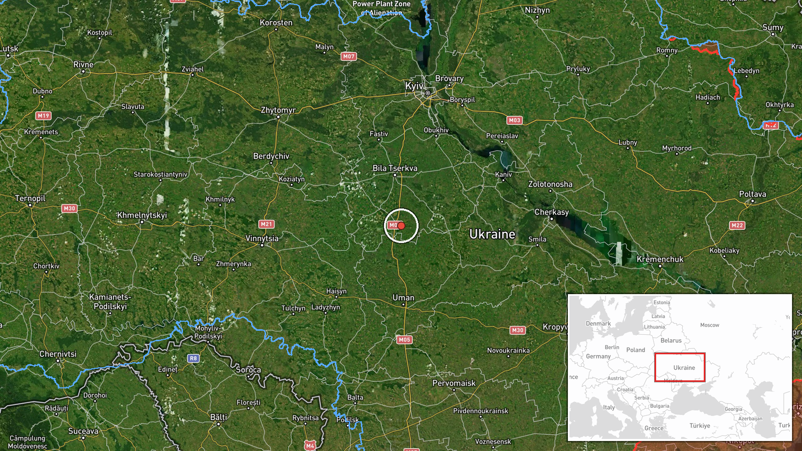
The coordinates correspond to Stavyshche at settlement precision, and location confidence is recorded as high. The pin marks the settlement rather than a specific facility, since the source names only the town as the course target. Stavyshche lies in Kyiv Oblast in central Ukraine, on relatively flat forest-steppe terrain, reportedly near the Ros river basin. Bila Tserkva, referenced in several related events, lies roughly 45 km to the north.
Related events nearby
- Ukrainian air monitoring: 1 Russian Shahed-type drone from Cherkasy Oblast toward Bila Tserkva.2026-10-16 11:02 UTC · Drone Transit · Bila Tserkva, Ukraine
- Ukrainian air monitoring: 1 Russian jet-powered Shahed (Geran-3) drone heading toward Bila Tserkva.2026-10-16 06:44 UTC · Drone Transit · Bila Tserkva, Ukraine
- Ukrainian air monitoring: 1 Russian Shahed-type drone passing Orativ, heading west.2026-10-16 14:31 UTC · Drone Transit · Orativ, Ukraine
- Ukrainian air monitoring: 1 Russian jet-powered Shahed (Geran-3) drone passing Monastyryshche, heading toward 2026-10-16 09:12 UTC · Drone Transit · Orativ, Ukraine
- Ukrainian air monitoring: 1 Russian Shahed-type drone passing Hrebinky, heading west.2026-10-16 14:33 UTC · Drone Transit · Hrebinky, Ukraine
▶ View this event on the live map

Intel Mapper aggregates open-source reports from monitored Telegram and X channels, geolocates them, cross-checks duplicates across sources and assigns a confidence score. Entries are updated as new confirmations arrive. Read how we verify events.