Single Shahed-type drone reported from Cherkasy Oblast toward Bila Tserkva, Kyiv Oblast
What happened
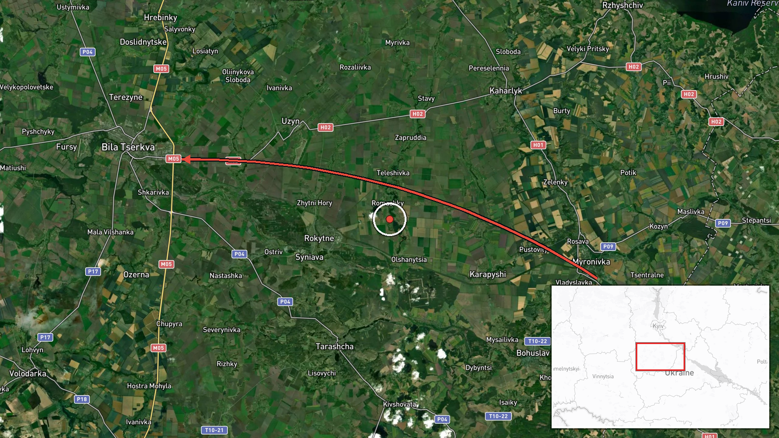
On 16 October 2026 at about 11:02 UTC, Ukrainian air monitoring reported a Russian Shahed-type drone moving from Cherkasy Oblast toward Bila Tserkva in Kyiv Oblast. The only source is the Telegram channel @kpszsu, which carries the official Ukrainian air-alert feed. Its original post uses the plural phrase 'ударні БпЛА' (strike drones) and says they were moving west into Vinnytsia Oblast and toward Bila Tserkva. The structured summary records a single drone, so the count is uncertain. No damage, casualties, or impact were reported in the material available. The event is classified as a drone transit, meaning a track through the area rather than a confirmed strike on a target.
Context and assessment
This track is one of several in a short window. Related entries show the same Geran-3 jet-powered drone type, described as Shahed-type, crossing or approaching Bila Tserkva repeatedly: from Cherkasy Oblast toward the city on 15 October at 14:01 UTC, over the city at 17:01, and again heading toward it at 06:44 on 16 October. Other tracks crossed southern Kyiv Oblast heading west at 03:41 and approached Vasylkiv at 17:31 on 15 October. Taken together, the pattern suggests multiple drones using the Kyiv-to-Cherkasy corridor, with Bila Tserkva lying on a recurring route. Bila Tserkva is a sizeable regional city with rail and road links, which may explain its frequent appearance in tracks without implying a specific target. Repeated transits of this kind may reflect routing toward western Ukraine, reconnaissance, or attempts to saturate air defences along the approach. These readings are inferences from timing and geography, and the open data does not establish intent.
Sources and confidence
All information comes from one Telegram channel, @kpszsu, so the report has not been cross-confirmed by a second independent source. The confidence score of 8.0 reflects the official nature of the channel and its consistent use in the related reports, but it is held below the top of the scale because the feed is single-sourced and its drone count differs between the original wording and the summary. Confidence would rise with corroboration from other Ukrainian air-force posts, regional military administrations, or independent trackers that show the same track. It would fall if later updates revised the count, changed the direction of travel, or contradicted the reported destination.
Location
The event is placed at the settlement level, with the point set at the city of Bila Tserkva, roughly 80 km south of Kyiv, and location confidence is rated high. The source names the city directly, so the placement reflects a named settlement, not a specific facility. The city sits on the Ros River, and the Kyiv–Odesa highway (M-05) passes through the surrounding area. The terrain is largely flat agricultural land and river valley, which gives low-flying drones few natural obstacles.
Related events nearby
- Ukrainian air monitoring: 1 Russian jet-powered Shahed (Geran-3) drone heading toward Bila Tserkva.2026-10-16 06:44 UTC · Drone Transit · Bila Tserkva, Ukraine
- Ukrainian air monitoring: 1 Russian jet-powered Shahed (Geran-3) drone over Bila Tserkva.2026-10-15 17:01 UTC · Drone Transit · Bila Tserkva, Ukraine
- Ukrainian air monitoring: 1 Russian jet-powered Shahed (Geran-3) drone from Cherkasy Oblast toward Bila Tserkv2026-10-15 14:01 UTC · Drone Transit · Bila Tserkva, Ukraine
- Ukrainian air monitoring: 2+ Russian jet-powered Shahed (Geran-3) drones passing southern Kyiv Oblast, heading2026-10-16 03:41 UTC · Drone Transit · southern Kyiv Oblast, Ukraine
- Ukrainian air monitoring: 1 Russian jet-powered Shahed (Geran-3) drone from northern Kyiv Oblast toward Vasylk2026-10-15 17:31 UTC · Drone Transit · Vasylkiv, Ukraine
▶ View this event on the live map

Intel Mapper aggregates open-source reports from monitored Telegram and X channels, geolocates them, cross-checks duplicates across sources and assigns a confidence score. Entries are updated as new confirmations arrive. Read how we verify events.