Jet-powered Shahed drones reported over northern and southern Kyiv Oblast, heading west
What happened
Ukraine's Air Force monitoring channel on Telegram, @kpszsu, reported at 03:41 UTC on 16 October 2026 that jet-powered Shahed drones, identified in the post as Geran-3 type, were tracked over the northern and southern parts of Kyiv Oblast on a westward course. The original Ukrainian wording is brief: reactive UAVs in the north and south of the region, heading west. The post gives no altitude, drone count, or impact details. It is one of several short air-monitoring updates posted in the same early-morning window, which place individual drones at different points across the oblast and neighbouring areas. Because the report describes movement rather than strikes, it records transit only. No damage, casualties, or interception is stated in the source material. The event carries a region-level location rather than a specific settlement.
Context and assessment
Kyiv Oblast surrounds Kyiv city, the national capital, which sits administratively apart from the oblast but shares its airspace and its approach routes. Earlier entries in the same stream show a steady sequence of Geran-3 drones moving through the area over roughly two and a half hours. At 01:08 one drone was tracked over western Chernihiv Oblast heading toward Kyiv Oblast. At 01:58 one passed Boryspil, east of the capital, heading toward Kyiv. At 02:16 two or more were reported over Kyiv city itself. At 03:27 one was tracked over western Cherkasy Oblast heading toward Kyiv Oblast, with a second drone reported from the north. At 03:43 a single drone was logged over Kyiv Oblast. Taken together, this points to a dispersed stream of individual or small groups entering from the north and east, rather than one concentrated wave. Operationally, such a pattern may reflect an effort to sustain pressure on air defence, to gather reconnaissance, or to test routes, though the data does not establish the intended target. The westward heading reported here may suggest drones leaving the capital area or moving through to western oblasts. Jet-powered variants are generally described in open reporting as faster than earlier piston-engined Shaheds, which shortens warning time for interceptors. These readings remain tentative and rest on a single channel's summaries.
Sources and confidence
All entries in this event rest on one channel, the official-linked Ukrainian Air Force monitoring account on Telegram, which lists itself as the sole source. Related events from the same feed follow a consistent format, but they come from the same reporting pipeline and do not constitute independent confirmation. The confidence score of 8.0 reflects a credible, officially associated channel with a regular update cadence, offset by the absence of any second source. Confidence would rise with corroboration from a regional military administration, radar or flight-tracking data, a formal Air Force statement, or reports of impacts. It would fall if the channel issued a correction, retracted the post, or was contradicted by later position updates.
Location
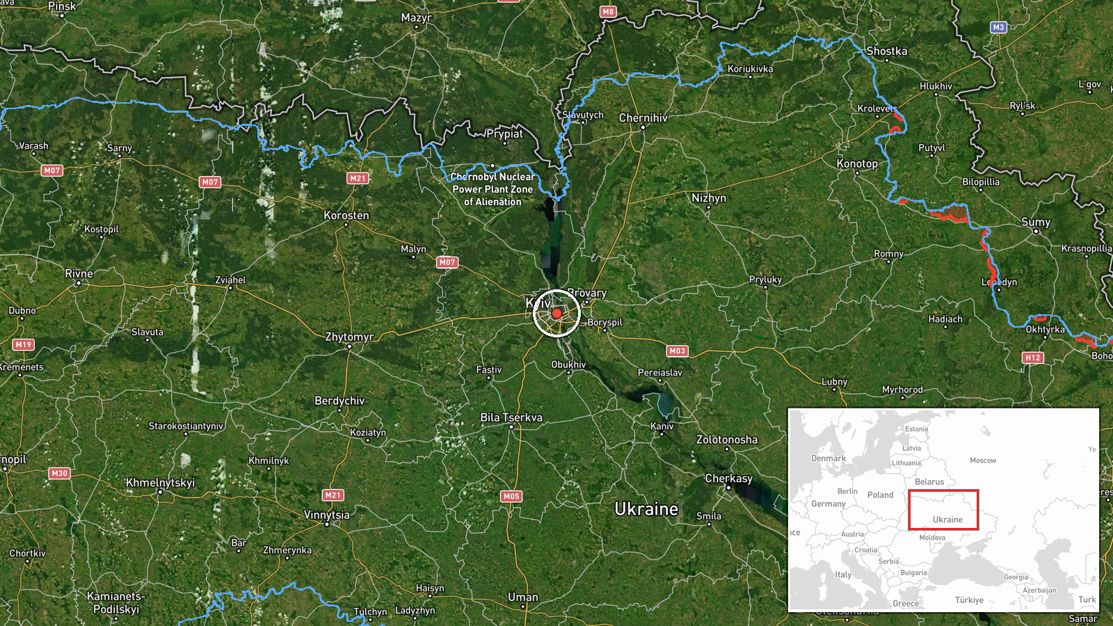
The coordinates 50.45, 30.52 fall in central Kyiv city rather than a precise point in Kyiv Oblast, and the geo precision is set at region level, so the pin is an approximate placement for the oblast as a whole. Kyiv Oblast encircles the capital in north-central Ukraine, a landscape of gently rolling terrain, farmland, forest belts, and river valleys. The Dnipro River runs along the eastern edge of the city, and Boryspil International Airport lies to the east. The northern parts of the oblast border Chernihiv and the Belarus frontier region, which is relevant to the approach routes noted in the related reports.
Related events nearby
- Ukrainian air monitoring: 1 Russian jet-powered Shahed (Geran-3) drone heading toward Kyiv Oblast.2026-10-16 04:01 UTC · Drone Transit · Kyiv Oblast, Ukraine
- Ukrainian air monitoring: 1 Russian jet-powered Shahed (Geran-3) drone over Kyiv Oblast.2026-10-16 03:43 UTC · Drone Transit · Kyiv Oblast, Ukraine
- Ukrainian air monitoring: one Russian jet-powered Shahed (Geran-3) drone over western Cherkasy Oblast, heading2026-10-16 03:27 UTC · Drone Transit · Kyiv Oblast, Ukraine
- Ukrainian air monitoring: 2+ Russian jet-powered Shahed (Geran-3) drones over Kyiv.2026-10-16 02:16 UTC · Drone Transit · Kyiv, Ukraine
- Ukrainian air monitoring: 1 Russian jet-powered Shahed (Geran-3) drone passing Boryspil, heading toward Kyiv.2026-10-16 01:58 UTC · Drone Transit · Kyiv, Ukraine
▶ View this event on the live map

Intel Mapper aggregates open-source reports from monitored Telegram and X channels, geolocates them, cross-checks duplicates across sources and assigns a confidence score. Entries are updated as new confirmations arrive. Read how we verify events.