Single jet-powered Shahed drone tracked over Cherkasy Oblast heading toward Kyiv Oblast, per Ukrainian monitoring
What happened
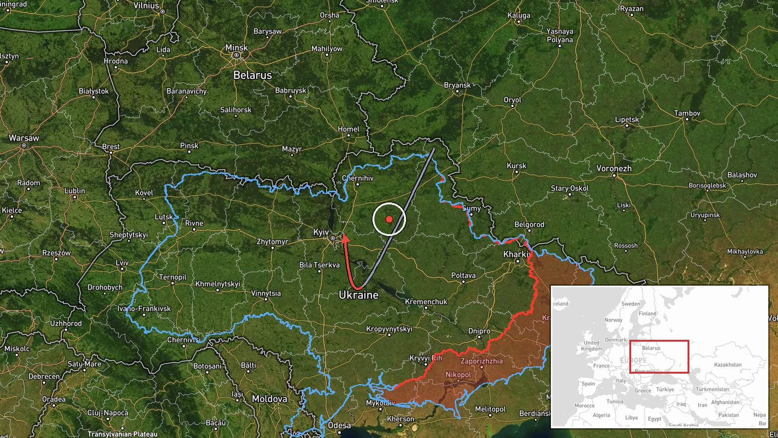
Ukrainian air monitoring reported on Telegram channel @kpszsu that one Russian jet-powered Shahed (Geran-3) drone was over western Cherkasy Oblast, on a course toward Kyiv Oblast, at about 03:27 UTC on 16 October 2026. The same post described a second jet-powered drone in northern Kirovohrad Oblast heading toward Cherkasy Oblast. The source used the Ukrainian shorthand 'Реактивний БпЛА' (jet-powered UAV) and 'курс на' (course toward), which describe heading rather than impact. The post does not report explosions, damage, or casualties, and the event is recorded as a drone transit rather than a strike.
Context and assessment
The location sits within a corridor that has been active throughout the preceding hours. Related entries show Geran-3 drones tracked from Cherkasy Oblast toward Kyiv Oblast at 17:32 on 15 October, with groups of two or more reported heading toward Kyiv at 18:10 and over Kyiv at 02:16 on 16 October. A single drone was also tracked over western Chernihiv Oblast at 01:08 and passing Boryspil near Kyiv at 01:58. Taken together, this pattern suggests a sustained stream of jet-powered drones routed from the north and center of Ukraine toward the capital region, with individual aircraft entering monitored airspace at intervals. Because the entries are tracking reports, they indicate routing and approach rather than targets struck. Operationally, a drone on a Kyiv Oblast heading that also follows earlier groups may indicate continued probing or saturation of air defense across several oblasts at once. The data alone cannot confirm the intended target, so any reading of purpose should be treated as provisional.
Sources and confidence
The report comes from a single Telegram channel, @kpszsu, which is listed as the only source. The related entries share the same type of ongoing air monitoring reporting, which gives the set internal consistency but not independent cross-confirmation of this specific drone. The confidence score of 8.0 reflects a clear, specific, and time-stamped official-style air alert with consistent wording across related entries, offset by the lack of a second outlet. Confidence would rise if other monitoring channels, regional military administrations, or flight-tracking observations matched the track, and would fall if later updates contradicted the heading or if the drone was reported downed or lost.
Location
The event is pinned to Kyiv Oblast at a region-level precision rather than a specific settlement, so the coordinates reflect the oblast centroid near the city of Kyiv at roughly 50.45 N, 30.52 E. The origin is recorded as western Cherkasy Oblast, and the approximate track runs northwest-to-north through central Ukraine. Kyiv Oblast surrounds the capital and includes the Dnipro River basin to the east, where Boryspil airport lies to the east of the city. The terrain is largely flat agricultural land with wide river floodplains, which generally offers few natural obstacles to low-flying drones.
Related events nearby
- Ukrainian air monitoring: 1 Russian jet-powered Shahed (Geran-3) drone heading toward Kyiv Oblast.2026-10-16 04:01 UTC · Drone Transit · Kyiv Oblast, Ukraine
- Ukrainian air monitoring: 1 Russian jet-powered Shahed (Geran-3) drone over Kyiv Oblast.2026-10-16 03:43 UTC · Drone Transit · Kyiv Oblast, Ukraine
- Ukrainian air monitoring: jet-powered Shahed (Geran-3) drones tracked over northern and southern Kyiv Oblast, 2026-10-16 03:41 UTC · Drone Transit · Kyiv Oblast, Ukraine
- Ukrainian air monitoring: 2+ Russian jet-powered Shahed (Geran-3) drones over Kyiv.2026-10-16 02:16 UTC · Drone Transit · Kyiv, Ukraine
- Ukrainian air monitoring: 1 Russian jet-powered Shahed (Geran-3) drone passing Boryspil, heading toward Kyiv.2026-10-16 01:58 UTC · Drone Transit · Kyiv, Ukraine
▶ View this event on the live map

Intel Mapper aggregates open-source reports from monitored Telegram and X channels, geolocates them, cross-checks duplicates across sources and assigns a confidence score. Entries are updated as new confirmations arrive. Read how we verify events.