Ukrainian air monitoring reports one Shahed-type drone heading toward Kozyatyn, Vinnytsia Oblast
What happened
Ukrainian air monitoring, relayed through the Telegram channel @kpszsu, reported a single unmanned aerial vehicle on course toward Kozyatyn in Vinnytsia Oblast. The original Ukrainian post reads "🛵 Вінниччина: БпЛА курсом на Козятин," which translates as "Vinnytsia region: UAV on course for Kozyatyn." The post uses the generic term БпЛА for an unmanned aerial vehicle. The Shahed-type classification appears in the event summary, not in the original wording. The report is timestamped 03:37 UTC on 17 October 2026. It describes a transit track rather than an impact, and no damage, casualties, or interception are mentioned.
Context and assessment
Kozyatyn matters mainly as a point on a recurring route rather than as a destination in itself. It lies in Vinnytsia Oblast, which has seen repeated overflight reports as drones move through central-western Ukraine. The related events show a sequence of single-drone tracks. At 04:02 UTC on 16 October, one Shahed-type drone was reported from Zhytomyr Oblast toward Berdychiv. Shortly after 14:30 that day, a jet-powered Shahed, described as a Geran-3, was reported over Vinnytsia, and a drone was logged from Zhytomyr Oblast toward Kozyatyn at 14:33. A further track was reported passing Andrushivka heading west at 14:40. Another drone was reported heading toward Ruzhyn at 03:25 UTC on 17 October, about twelve minutes before this report. The pattern suggests objects entering from the north and moving through the oblasts over several hours. Operationally, this is more consistent with transit routing than with a single targeted strike, though the feed does not reveal intended targets. Such tracks may reflect long-range attack routes, decoy launches, or reconnaissance. Intent should be treated as unknown.
Sources and confidence
All information comes from one Telegram channel, @kpszsu, which is the public channel associated with Ukraine's Air Force. No second outlet, official statement, or local report in the data confirms the track. The confidence score of 8.0 reflects the channel's institutional authority and the high location confidence, but it is capped by single-source reporting. Confidence would rise if other monitoring channels, regional officials, or later Air Force updates confirmed the drone's path or any impact. It would fall if the track were later revised, withdrawn, or found to refer to a different object.
Location
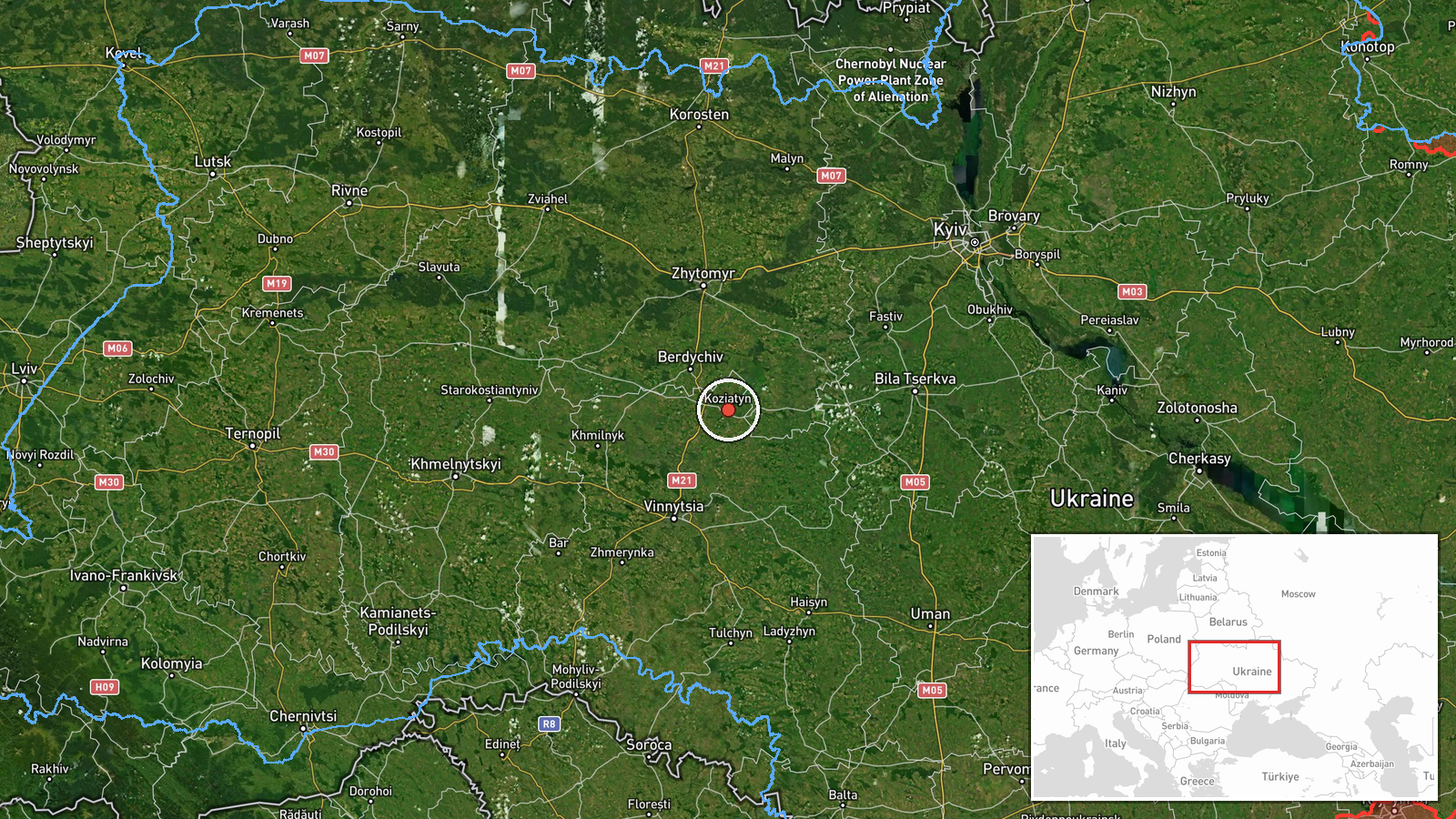
The location is recorded at settlement precision, with coordinates for the town of Kozyatyn, and location confidence is rated high. The point marks the town itself rather than a specific facility. Kozyatyn sits in Vinnytsia Oblast in central-western Ukraine, close to the northern boundary with Zhytomyr Oblast, which several related tracks passed through. The surrounding terrain is largely open and agricultural, typical of the region.
Related events nearby
- Ukrainian air monitoring: 1 Russian Shahed-type drone from Zhytomyr Oblast toward Kozyatyn.2026-10-16 14:33 UTC · Drone Transit · Kozyatyn, Ukraine
- Ukrainian air monitoring: 1 Russian Shahed-type drone passing Vinnytsia–Zhytomyr border area, heading west.2026-10-17 04:25 UTC · Drone Transit · Vinnytsia–Zhytomyr border area, Ukraine
- Ukrainian air monitoring: 1 Russian Shahed-type drone heading toward Ruzhyn.2026-10-17 03:25 UTC · Drone Transit · Ruzhyn, Ukraine
- Ukrainian air monitoring: 1 Russian Shahed-type drone passing Andrushivka, heading west.2026-10-16 14:40 UTC · Drone Transit · Andrushivka, Ukraine
- Ukrainian air monitoring: 1 Russian jet-powered Shahed (Geran-3) drone over Vinnytsya.2026-10-16 14:32 UTC · Drone Transit · Vinnytsya, Ukraine
▶ View this event on the live map

Intel Mapper aggregates open-source reports from monitored Telegram and X channels, geolocates them, cross-checks duplicates across sources and assigns a confidence score. Entries are updated as new confirmations arrive. Read how we verify events.