Single Shahed-type drone reported moving west across Vinnytsia–Zhytomyr border area
What happened
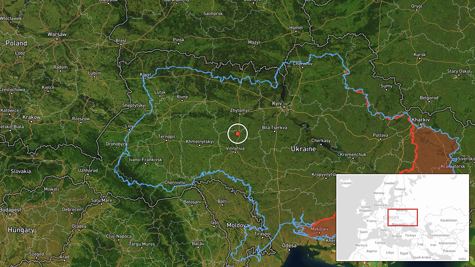
Ukrainian air monitoring reported on Telegram via the channel @kpszsu that one Russian Shahed-type drone was passing the border area between Vinnytsia and Zhytomyr oblasts on a westerly heading. The report, posted at 04:25 UTC on 17 October 2026, is a brief air-alert style notice. The original post, written in Ukrainian, describes a drone (БпЛА) at the boundary of the two regions with a western course. It does not mention impacts, casualties, or any strike. The location is given only as a broad border zone, so the exact position of the drone at the time of the report is not specified.
Context and assessment
This event is one of a short sequence of drone transit reports across central-western Ukraine over roughly 14 hours on 16 and 17 October. Earlier reports placed a single Shahed-type drone over Vinnytsia city at 14:32 UTC on 16 October, with a jet-powered Geran-3 variant noted in that post, and a second drone passing Andrushivka heading west at 14:40. Later that day, drones were reported heading toward Kozyatyn and Ruzhyn, the latter in the early hours of 17 October. Kozyatyn is a rail and road hub in Vinnytsia Oblast, and the cluster of reports suggests tracks that trend westward through the region, possibly along routes used to reach western Ukraine or to approach infrastructure in the central oblasts. Single-drone transits of this kind are often associated with reconnaissance, route probing, or harassment rather than a coordinated mass strike, though the data alone cannot confirm intent. The repetition of similar reports in a compact window indicates persistent activity in this corridor rather than an isolated sighting.
Sources and confidence
The event rests on a single Telegram channel, @kpszsu, which carries Ukrainian air-monitoring updates. No independent outlet or second channel in the dataset confirms this specific report, though it is consistent with the surrounding reports from the same channel and the same corridor. The confidence score of 8.0 reflects a single-source origin, which limits certainty, offset somewhat by the regular publication pattern of this type of update and by the corroborating nature of nearby reports. Confidence would rise with confirmation from a second monitoring source, from official regional air-force statements, or from any independent observation of the drone's track. It would fall if later reports contradicted the heading or if the track proved to be a different object.
Location
The location is recorded as an approximate border area between Vinnytsia and Zhytomyr oblasts, with coordinates of 49.74 N, 28.565 E, marked at region precision and low location confidence. This is a general point rather than a settlement or facility, because the source names only the boundary zone. The area is mostly agricultural and wooded terrain on the Dnipro-Dniester interfluve, with rivers including the Southern Bug and its tributaries to the west and south. Settlements such as Kozyatyn and Andrushivka lie within a short distance of the marked point.
Related events nearby
- Ukrainian air monitoring: 1 Russian Shahed-type drone heading toward Kozyatyn.2026-10-17 03:37 UTC · Drone Transit · Kozyatyn, Ukraine
- Ukrainian air monitoring: 1 Russian Shahed-type drone from Zhytomyr Oblast toward Kozyatyn.2026-10-16 14:33 UTC · Drone Transit · Kozyatyn, Ukraine
- Ukrainian air monitoring: 1 Russian Shahed-type drone passing Andrushivka, heading west.2026-10-16 14:40 UTC · Drone Transit · Andrushivka, Ukraine
- Ukrainian air monitoring: 1 Russian Shahed-type drone heading toward Ruzhyn.2026-10-17 03:25 UTC · Drone Transit · Ruzhyn, Ukraine
- Ukrainian air monitoring: 1 Russian jet-powered Shahed (Geran-3) drone over Vinnytsya.2026-10-16 14:32 UTC · Drone Transit · Vinnytsya, Ukraine
▶ View this event on the live map

Intel Mapper aggregates open-source reports from monitored Telegram and X channels, geolocates them, cross-checks duplicates across sources and assigns a confidence score. Entries are updated as new confirmations arrive. Read how we verify events.