Ukrainian Air Force reports one drone flying west over northern Kirovohrad Oblast
What happened
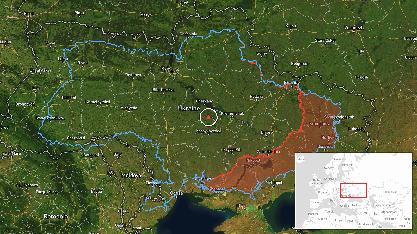
Ukraine's Air Force, through its official Telegram channel, reported one unmanned aerial vehicle (БпЛА) over the northern part of Kirovohrad Oblast at about 04:26 UTC on 17 October 2026, moving on a western heading. The original post is brief. It names no settlement, altitude, or exact track. The English summary labels the drone a Shahed-type, a classification the original wording does not make; the post identifies it only as an unmanned aerial vehicle. The report mentions no impact, casualties, or damage. The event is logged as a drone transit rather than a strike, and the location is recorded only at regional level, so the precise flight path is unknown.
Context and assessment
Northern Kirovohrad sits in central Ukraine, on the broad route that Russian long-range drones have used when moving from the east and south toward western regions. The record fits a recent pattern. Early on 16 October, the same area logged two or more jet-powered Shahed (Geran-3) drones heading west. Later that day, between 07:00 and 19:00, Russia reportedly launched 315 attack drones, 78 of them jet-powered, along with Gerbera decoys and 15 S-8000 Banderol munitions across Ukraine. A ballistic missile warning followed at 01:39 on 17 October and was cancelled at 02:22, with no launch site or target given. Taken together, the sequence suggests sustained long-range activity, with individual drones crossing central Ukraine as part of larger raids. A single drone on this track could be a decoy, a reconnaissance asset, a straggler, or part of a wider wave that was not yet visible in the reporting. The data alone cannot distinguish among these possibilities, and no damage has been linked to this track.
Sources and confidence
The event rests on one channel, the Telegram account @kpszsu, which is widely understood to be the Ukrainian Air Force's official feed. No independent outlet, radar-based tracker, or second monitoring channel is recorded for this track. The confidence score of 8.0 reflects a official military source whose wording matches earlier transits in the same corridor. It is held below the top of the scale by the single-source basis, the regional-only location, and the absence of any recorded track or follow-up. Confidence would rise with a second independent channel, flight-tracking or radar data, or a later regional alert confirming the same path. It would fall if the source corrected the report or if the drone's identity or track were later disputed.
Location
The location is assigned at regional precision. The coordinates, roughly 49.06 N and 32.26 E, are an area-level placement within northern Kirovohrad Oblast rather than a settlement or facility, so the drone's exact position is unknown. The area is generally flat forest-steppe terrain, with farmland, scattered woodland, and river valleys typical of the region. Its location on the regional edge makes it useful as a transit reference, but it cannot identify any specific site along the track.
Related events nearby
- Ukrainian Air Force announces all-clear: the threat of Russian ballistic missile use has been cancelled.2026-10-17 02:22 UTC · Siren · Ukraine
- Ukrainian Air Force warns of threat of Russian ballistic missile use; no specific target or launch site report2026-10-17 01:39 UTC · Ballistic Missile · Ukraine
- Russia launched 315 attack drones (78 jet-powered), plus Gerbera decoys and 15 S-8000 Banderol munitions, agai2026-10-16 16:45 UTC · UAS Strike · Ukraine (nationwide, no specific target named)
- A woman assaulted a military recruitment officer who had come to take her boyfriend for mobilization.2026-10-16 13:58 UTC · Security · Ukraine (location not reported)
- Russia launched 149 Shahed-type, Gerbera and decoy drones from Oryol, occupied Donetsk and Crimea. 114 downed 2026-10-16 06:42 UTC · UAS Strike · Ukraine
▶ View this event on the live map

Intel Mapper aggregates open-source reports from monitored Telegram and X channels, geolocates them, cross-checks duplicates across sources and assigns a confidence score. Entries are updated as new confirmations arrive. Read how we verify events.