Ukrainian monitors report one glide bomb heading toward Vilnyansk, Zaporizhzhia Oblast
What happened
Ukrainian air monitoring reported on Telegram (@kpszsu) that one Russian guided glide bomb, called a KAB in the post, was heading toward Vilnyansk in Zaporizhzhia Oblast. The alert was timestamped 08:35 UTC on 17 October 2026. The wording describes the munition as moving 'toward' the town, not as having hit it, and no impact, casualties, or damage are mentioned. It was one of several air-threat notices issued in the same window across Zaporizhzhia and Dnipropetrovsk areas. Because the report describes a munition in flight, it should be read as a warning of a possible strike rather than a confirmed detonation.
Context and assessment
Vilnyansk is a settlement in Zaporizhzhia Oblast whose position relative to the front can shift, so a glide bomb warning there is best read as a signal of activity across the wider northern Zaporizhzhia sector rather than a fixed target assessment. Guided glide bombs are typically unpowered or low-powered munitions released from aircraft at standoff distance, which lets attackers strike positions behind the front without entering the envelope of many air defences. They are most often associated with frontline towns, logistics nodes and urban areas. The report fits a pattern visible in the related events. Earlier that morning the page logged a KAB warning toward Komyshuvakha at 03:01 UTC, and later alerts followed toward Zaporizhzhia at 06:37 and toward Zaporizhzhia Oblast at 08:55. Shahed-type drone transits toward Zaporizhzhia city the previous evening and a drone group over Synelnykove district add to the picture. The cluster suggests repeated sorties across several localities in the same oblast rather than a single isolated strike. Operationally, this may indicate a sustained effort against settlements and infrastructure in the region, though monitoring alerts alone do not reveal intended targets, launch platforms or effects.
Sources and confidence
Only one channel, the Telegram account @kpszsu, carries this report in the data, so cross-confirmation is absent. The post is an official-style air-monitoring alert, which gives it a reasonable base for a score of 8.0, but the score is not higher because no second outlet, imagery or official statement corroborates it and the alert describes a moving munition rather than an outcome. The score would rise with independent confirmation from regional officials, a second monitoring feed, or reports of an impact at Vilnyansk. It would fall if later alerts indicate the munition was diverted or shot down without a verified track.
Location
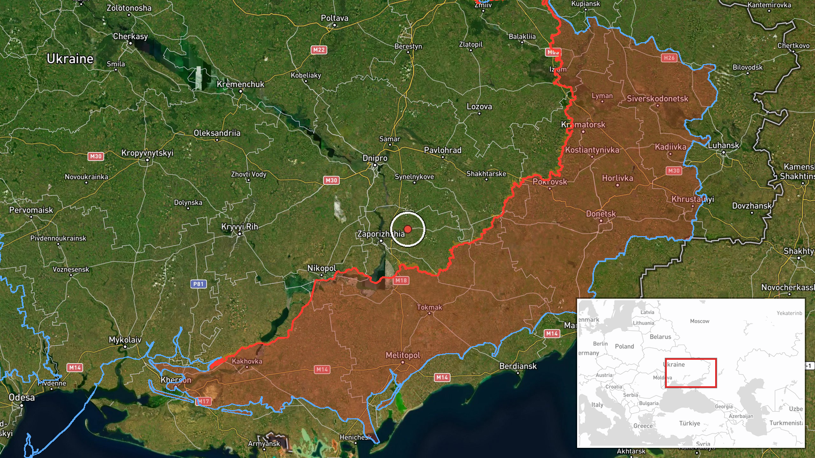
Coordinates are at settlement precision, placed on Vilnyansk itself, and the location confidence is rated high. Vilnyansk lies in Zaporizhzhia Oblast in southeastern Ukraine. The surrounding terrain is largely open steppe and farmland within the broader Dnipro basin, offering little natural cover. Its exact distance from the front line should be checked against current reporting, since it can change.
Related events nearby
- Ukrainian air monitoring: 1 Russian guided glide bomb (KAB) heading toward Zaporizhzhya Oblast.2026-10-17 08:55 UTC · Airstrike · Zaporizhzhya Oblast, Ukraine
- Ukrainian air monitoring: 1 Russian guided glide bomb (KAB) heading toward Zaporizhzhia.2026-10-17 06:37 UTC · Airstrike · Zaporizhzhia, Ukraine
- Ukrainian air monitoring: 1 Russian Shahed-type drone heading toward Zaporizhzhia.2026-10-16 22:53 UTC · Drone Transit · Zaporizhzhia, Ukraine
- Ukrainian air monitoring: 1 Russian guided glide bomb (KAB) heading toward Komyshuvakha.2026-10-17 03:01 UTC · Airstrike · Komyshuvakha, Ukraine
- Ukrainian air monitoring: a group of Russian Shahed-type drones in Synelnykove district, Dnipropetrovsk Oblast2026-10-17 06:35 UTC · Drone Transit · Synelnykove, Dnipropetrovsk Oblast, Ukraine
▶ View this event on the live map

Intel Mapper aggregates open-source reports from monitored Telegram and X channels, geolocates them, cross-checks duplicates across sources and assigns a confidence score. Entries are updated as new confirmations arrive. Read how we verify events.