Air monitors report one Russian strike drone over Kupiansk district, heading southwest
What happened
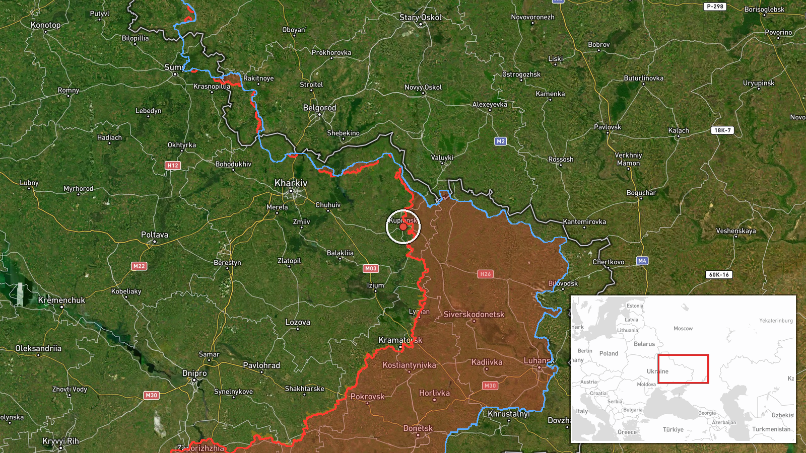
A Ukrainian air monitoring channel, the Telegram account @kpszsu, reported at 08:44 UTC on 17 October 2026 that one strike unmanned aerial vehicle, described in the original Ukrainian wording as an "ударний БпЛА" (strike drone), was passing through Kupiansk district of Kharkiv Oblast in a southwesterly direction. The post attributes the drone to Russia. The English summary calls it a Shahed-type drone, a label the original text does not use. The original gives no type designation, so the Shahed description reflects the desk's interpretation rather than the channel's wording. The report concerns a single airborne object and records no impact, casualties, or damage.
Context and assessment
Kupiansk sits on the Kupiansk axis, where the Ukrainian Defense Forces reportedly repelled a Russian attempt to advance on 16 October, shortly before this report. Nearby, the General Staff described 22 combat clashes on the South Slobozhansky axis near Starytsia, Mala Vovcha, Chuhunivka and Radkivka, and five Russian attacks on the Lyman axis were reported on 17 October. Air monitoring in the same window also logged a Russian guided glide bomb heading toward eastern Kharkiv Oblast at 01:29 and a ballistic missile launched from Kharkiv Oblast toward Zmiiv at 08:28. Taken together, the sequence shows sustained activity across several parts of the Kharkiv front in a short period. A single drone transiting a frontline district during active ground fighting could be reconnaissance, a relay or routing flight toward other targets, or a strike that was tracked but not yet resolved. The data does not show its intended target, and the southwesterly heading does not on its own confirm where it was going.
Sources and confidence
All information comes from one Telegram channel, @kpszsu, and the source count is one. The data contains no cross-confirmation from independent monitors, Ukrainian officials, or media. The confidence score of 8.0 reflects an official-style air monitoring channel, a clearly stated direction of travel, and a specific location. It is held below the maximum because the report rests on a single account and no later sightings or impact reports are attached. Confidence would rise with independent air monitoring or regional administration confirmation, or with a logged impact or interception. It would fall if other channels contradicted the track or if the object was later identified as something other than a drone.
Location
The location is recorded at settlement precision, but the coordinates, 49.71003 N and 37.61581 E, correspond to the broader Kupiansk district rather than a verified point. The pin should be read as approximate and not as the position of the drone when it was reported. Kupiansk lies in northeastern Kharkiv Oblast, near the Russian border and the front line. The town sits on the Oskil River, which runs through the area and is a notable landmark. Open farmland and river valleys characterise much of the surrounding district.
Related events nearby
- Ukrainian Defense Forces repelled one Russian attempt to advance near Kupiansk on the Kupiansk axis, as of 22:2026-10-16 19:02 UTC · Combat · Kupiansk, Kharkiv, Ukraine
- Ukrainian air monitoring: 1 Russian guided glide bomb (KAB) heading toward eastern Kharkiv Oblast.2026-10-17 01:29 UTC · Airstrike · eastern Kharkiv Oblast, Ukraine
- Ukrainian General Staff reports 22 combat clashes on the South Slobozhansky axis by 22:00 on 16 Oct near Stary2026-10-16 19:01 UTC · Combat · Chuhunivka, Kharkiv Oblast, Ukraine
- Ukrainian General Staff reports Ukrainian forces repelled five Russian attacks on the Lyman axis around Lyman,2026-10-17 05:09 UTC · Combat · Lyman, Donetsk Oblast, Ukraine
- Ukrainian air monitoring: 1 Russian ballistic missile from Kharkiv Oblast toward Zmiyiv.2026-10-17 08:28 UTC · Ballistic Missile · Zmiyiv, Ukraine
▶ View this event on the live map

Intel Mapper aggregates open-source reports from monitored Telegram and X channels, geolocates them, cross-checks duplicates across sources and assigns a confidence score. Entries are updated as new confirmations arrive. Read how we verify events.