Ukraine reports repelling one Russian advance attempt near Kupiansk, Kharkiv Oblast
What happened
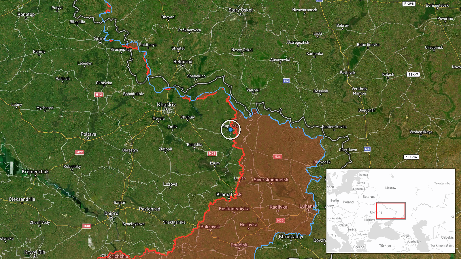
The Telegram channel of Ukraine's General Staff (@GeneralStaffZSU) reported that, as of 22:00 on 16 October 2026, Ukrainian Defense Forces on the Kupiansk axis repelled one Russian attempt to advance in the area of Kupiansk, a city in Kharkiv Oblast. The original Ukrainian wording says the defenders 'repelled one attempt by invaders to advance' in the Kupiansk district. The report gives no details on the size of the assault, the units involved, casualties, or how the engagement developed beyond the repulse. The entry is timestamped 19:02 UTC and is classed as a combat event, with Ukrainian forces as the reporting side. Because the account comes from one official channel, the claim is recorded as Ukraine's own assessment of the action.
Context and assessment
Kupiansk has been a recurring focus of fighting on the northeastern front, largely because of its position on the Oskil River and its road and rail links across the Kharkiv region. The same day's wider reporting shows that pressure was spread across several sectors rather than concentrated in one place. The Ukrainian General Staff described 22 combat clashes on the South Slobozhansky axis near Starytsia, Mala Vovcha, Chuhunivka and Radkivka by 22:00, and separate reporting recorded eight Russian attacks on the Lyman axis and two on the Sloviansk axis. Earlier that day, air monitoring tracked Russian jet-powered Shahed-type drones crossing eastern Kharkiv Oblast, which points to long-range strike activity running alongside ground probing. Taken together, the sequence suggests a broad, multi-axis tempo in which a single repulsed advance near Kupiansk is one part of a larger pattern. Operationally, repeated attempts in the Kupiansk area may indicate Russian interest in pressing toward the city or fixing Ukrainian units in place, but a single unexplained report cannot confirm intent or the scale of any push.
Sources and confidence
The event rests on one source, the official General Staff Telegram channel, and no independent outlet or second channel is listed as confirming it. That single-channel basis is why the confidence score sits at 8.0 rather than higher. The report is a routine operational update, and its wording is consistent with other General Staff reports from the same day, which adds some internal coherence but not independent verification. The score would rise if regional military administration statements, independent monitoring groups, or geolocated footage confirmed an engagement at or near Kupiansk. It would fall if later official reporting contradicted the account or if no corroborating material appeared.
Location
The pin is placed at the settlement level for Kupiansk, Kharkiv Oblast, at approximately 49.71 N, 37.62 E, because the source names the city without a more specific street or facility. Kupiansk lies in northeastern Ukraine on the Oskil River, a tributary that shapes the terrain and crossing points around the town. The area is generally open and river-influenced, and the town sits in a region that is relatively close to the Russian border. The pin therefore marks the urban area rather than a precise front-line position.
Related events nearby
- Ukrainian air monitoring: 2+ Russian jet-powered Shahed (Geran-3) drones passing eastern Kharkiv Oblast, headi2026-10-16 04:55 UTC · Drone Transit · eastern Kharkiv Oblast, Ukraine
- Ukrainian General Staff reports 22 combat clashes on the South Slobozhansky axis by 22:00 on 16 Oct near Stary2026-10-16 19:01 UTC · Combat · Chuhunivka, Kharkiv Oblast, Ukraine
- Ukrainian forces repelled eight Russian attacks on the Lyman axis and two on the Sloviansk axis, plus three at2026-10-16 05:05 UTC · Combat · Lyman, Donetsk Oblast, Ukraine
- Ukrainian units repelled 22 Russian attacks near Starytsia, Izbytske, Chuhunivka, Buzove and Radkivka in the S2026-10-16 05:04 UTC · Combat · Starytsia, Kharkiv Oblast, Ukraine
- Russian FPV drone struck Ukrainian soldiers while they were evacuating civilians. No casualty or location deta2026-10-15 21:51 UTC · FPV Drone · Near Yampil', Donetsk, Ukraine (front line, estima
▶ View this event on the live map

Intel Mapper aggregates open-source reports from monitored Telegram and X channels, geolocates them, cross-checks duplicates across sources and assigns a confidence score. Entries are updated as new confirmations arrive. Read how we verify events.