Ukraine says it repelled 13 Russian attacks across Lyman, Sloviansk and Kramatorsk axes
What happened
Ukraine's General Staff reported, via its Telegram channel, that Ukrainian forces repelled eight Russian attacks on the Lyman axis and two on the Sloviansk axis, along with three attempted advances on the Kramatorsk axis. The report, published at 05:05 UTC on 16 October 2026, names Novoyehorivka, Olhivka, Druzhelyubivka, Lyman and Stary Karavan on the Lyman axis, Orikhivka and Mykolaivka on the Sloviansk axis, and the area around Chervonyi and toward Yurkivka on the Kramatorsk axis. The original Ukrainian wording describes the attacks as occupier actions directed at these settlements. The statement does not give casualty figures, equipment losses, or details of ground changes, and no independent confirmation of the individual engagements has been published.
Context and assessment
Lyman is a rail and road junction in northern Donetsk Oblast, and its approaches connect to the Sloviansk and Kramatorsk agglomeration, which has been a central objective of Russian operations in the region for some time. The axes named in this report sit along that northern and eastern arc, so the pattern of attacks is consistent with sustained pressure rather than a single isolated push. Related reporting from the same day adds context. A Russian FPV drone reportedly struck Ukrainian soldiers evacuating civilians near Yampil, a shallow, tactical-level incident. DeepState recorded a Russian advance of roughly 6 square kilometres in the Minkivka sector without a settlement changing hands. The General Staff separately counted 27 Russian attacks on the Kostiantynivka direction, and Ukrainian air monitoring tracked a guided glide bomb toward Donetsk Oblast. A Ukrainian strike on a drone storage and launch site in the region was also reported earlier. Taken together, these items suggest a broad, multi-axis effort, though the number of reported attacks is a Ukrainian figure and cannot be checked against Russian accounts.
Sources and confidence
The only source for this event is the Telegram channel of the Ukrainian General Staff, which is an official military channel with a generally consistent reporting record but is also a party to the conflict. No second outlet, satellite imagery, or map update has been found to confirm the individual attacks, so the confidence score of 8.0 reflects a credible official origin offset by single-channel sourcing and the absence of independent detail. Confidence would rise if regional officials, independent monitors, or frontline mapping services such as DeepState corroborated the named settlements and the attack counts. It would fall if later reporting contradicted the timing or locations, or if the claims of repelled attacks were disputed by visual or open-source evidence.
Location
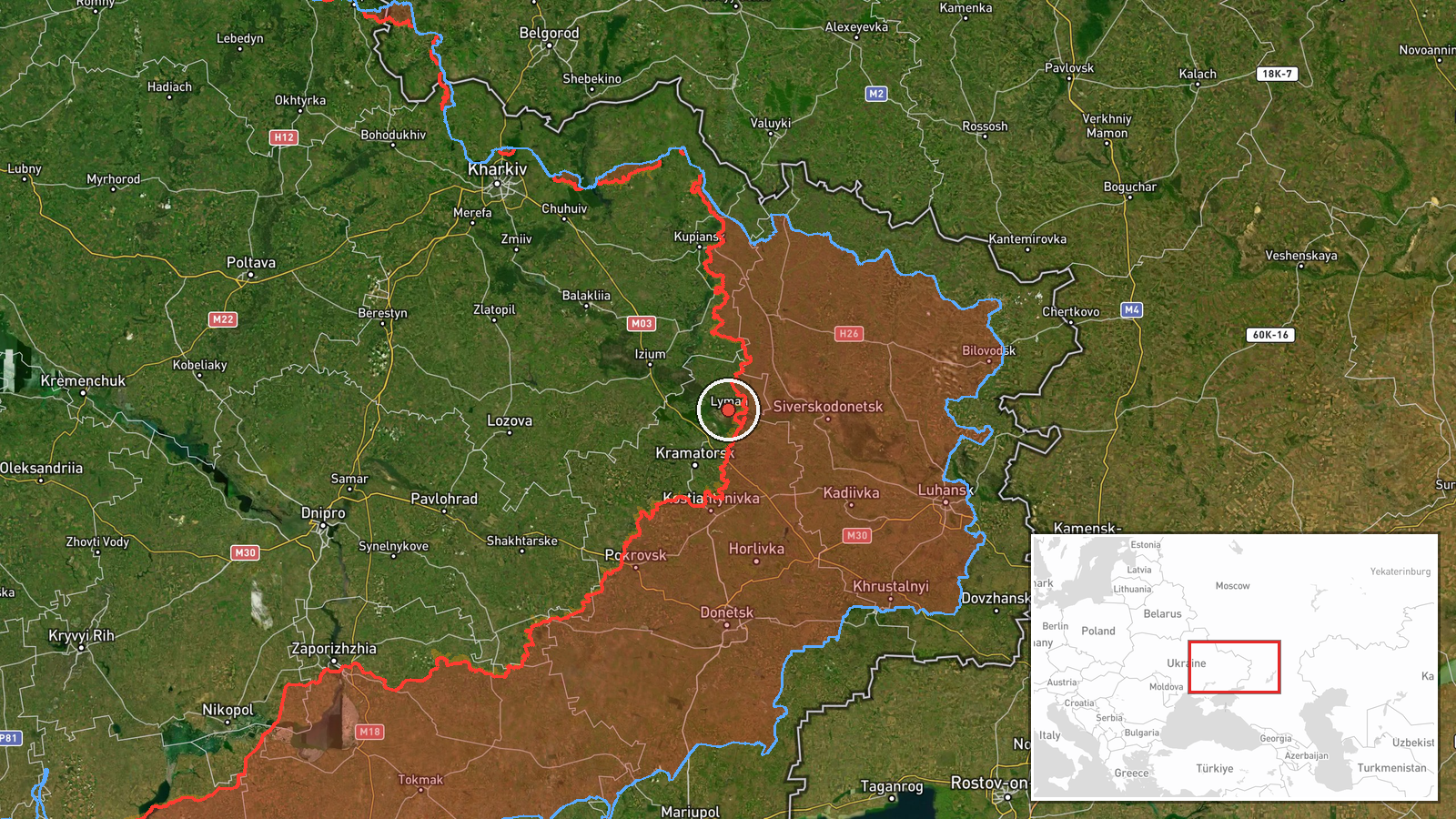
The coordinates correspond to Lyman, a settlement in Donetsk Oblast, so the location is set at settlement precision, which is appropriate for a multi-village report. Lyman lies on the Siverskyi Donets river in the northern part of the oblast, in hilly, partly wooded terrain with river floodplains. Its rail yards and surrounding roads make it a notable transport node. The other named villages sit within several kilometres of it, so the pin represents the broader axis rather than a single point.
Related events nearby
- Russian FPV drone struck Ukrainian soldiers while they were evacuating civilians. No casualty or location deta2026-10-15 21:51 UTC · FPV Drone · Near Yampil', Donetsk, Ukraine (front line, estima
- Russian forces advanced (~6 km²) in the Minkivka sector per DeepState frontline update. No settlement center c2026-10-16 00:20 UTC · Combat · Minkivka sector, Ukraine
- Ukrainian General Staff reports 27 Russian attacks on the Kostiantynivka direction, including assaults near Ko2026-10-16 05:06 UTC · Combat · Kostiantynivka, Donetsk Oblast, Ukraine
- Ukrainian air monitoring: 1 Russian guided glide bomb (KAB) heading toward Donetsk Oblast.2026-10-16 01:04 UTC · Airstrike · Donetsk Oblast, Ukraine
- Ukrainian forces struck a Russian storage, preparation, and launch site for attack drones in Donetsk region. E2026-10-15 13:03 UTC · UAS Strike · Donetsk Oblast, Ukraine
▶ View this event on the live map

Intel Mapper aggregates open-source reports from monitored Telegram and X channels, geolocates them, cross-checks duplicates across sources and assigns a confidence score. Entries are updated as new confirmations arrive. Read how we verify events.